3.1 Disclaimer
The TOPODRONE LR1 Control Module is a high-precision survey-grade measuring instrument. Handle it with care - this extends its service life. Product parameters, recommendations, limitations, field work and post-processing procedures are described in this manual and in the manuals for TOPOSETTER and TOPOMAPPER.
It is PROHIBITED to operate the module in any way not described in this manual.
It is PROHIBITED to expose the module to shocks and vibration, especially when it is turned on: do not drop, hit, scratch, toss, shake or knock it.
It is PROHIBITED to place the module in direct sunlight, in poorly ventilated places, or near a source of heat or cold.
It is PROHIBITED to immerse the module in water or expose it to prolonged rain, snow, sand and dust. The module is not protected against moisture and dust.
It is PROHIBITED to insert foreign objects into the module connectors, insert the memory card upside down or connect incompatible connectors.
It is PROHIBITED to insert or remove the microSD card while the module is operating - this can damage the card and cause data loss. To remove the card, turn off the power and wait until the device shuts down.
It is PROHIBITED to open the module housing.
If moisture gets on the module (rain, snow, fog), wipe it with a clean dry cloth and leave it in a dry room for an hour until completely dry. Only then put the equipment in the case. For long-term storage, you can put a silica gel bag in the case.
In PPK mode, post-processing requires base station GNSS data for the entire operating time of the module. Correct data requires a good GNSS signal both at the module and at the base station.
If the above requirements are violated, the manufacturer does not guarantee the module's operability.
3.2 Product Description
TOPODRONE LR1 Control Module is a survey-grade GNSS receiver fully integrated with the Sony ILX-LR1 camera. During the flight, the receiver records raw satellite measurements at 20 Hz to the microSD card together with the precise camera shutter release times. From this data and the base station measurement file for the same period, TOPOSETTER calculates high-precision coordinates of the camera centers.
The measurement file is recorded in the Unicore receiver format (*.bin). The file name corresponds to the recording start time: YYYY-MM-DD_HH-MM-SS.bin.
The built-in Linux-based computer transmits the video stream and camera parameters to the DJI Pilot 2 app and allows you to change settings and take pictures from the remote controller (see chapter 8).
3.3 GNSS and Memory Card Status
The module status is displayed in the DJI Pilot 2 app: a module status window with three lines is shown over the camera view:
- Photos remaining: N - how many more images fit on the memory card;
- GNSS ... - GNSS receiver status (for example, "GNSS Starting" - initialization in progress);
- SD mount OK - the memory card is recognized.
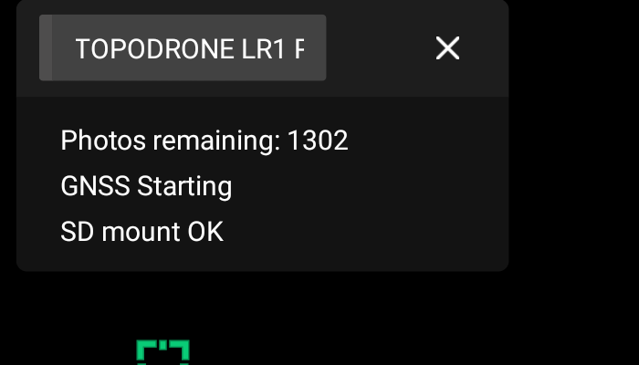
TOPODRONE LR1 Control Module status window in DJI Pilot 2.