Knowledge base
Blog
Services
  • Aerial Photography
    • UAV Monitoring & Inspections
    • UAV Photogrammetry
  • Laser Scanning
    • Aerial Laser Scanning
    • Quarry Surveying
    • Topographical Surveying
  • Training
    • UAV Pilot Course: Photogrammetry & ALS
Company
  • Staff
  • News
  • Reviews
  • Vacancy
  • Licenses
  • Documents
  • Partners
Information
  • Requisites
Brands
Contacts
    +41 21 588 02 11
    +41 21 588 02 11 09:00-18:00 whatsapp.svg
    Sales [email protected] email.png
    Support [email protected] email.png
    Telegram Channel @topodronesa tg.svg
    Telegram Chat @topodronesagroup tg.svg
    Telegram Bot @topodronecombot tg.svg
    Facebook @topodronesa ycz1c9257s6gh7g315r8q6tob3bnddba.png
    Youtube @topodronesa youtube.png
    LinkedIn @topodrone 9ratq3v3eavnhupo1akvxp0sbx4vopj5.png
    X @topodrone twitter.png
    Instagram @topodrone tpxkj71axu6dxt423lwj5idzwcej1njx.png
    Email
    [email protected] - Sales
    [email protected] - Support
    The address
    TOPODRONE SA, Rue de la Gare 13, 1820 Montreux, Switzerland
    Working hours
    10:00-18:00
    TOPODRONE
    SPH Engineering
    3Dsurvey
    Velodyne
    DJI
    GreenValley International
    Honeywell
    Fixar
    Blue Marble Geographics
    Sony
    Agisoft
    EMLID
    Pix4D
    Autel Robotics
    SHAREUAV
    • LiDAR
      LiDAR
      • Aerial Survey LiDAR
      • SLAM Survey LiDAR
      • LiDAR Accessories
    • Bathymetry
      Bathymetry
    • Photogrammetry
      Photogrammetry
      • Mapping Drones
      • Drone Mapping Cameras
      • VTOL Mapping Cameras
    • PPK Upgrade Kits
      PPK Upgrade Kits
      • PPK for Drones
      • PPK for any UAV
    • Spectrography
      Spectrography
      • Thermal
      • Multispectral
    • UAV
      UAV
      • DJI
      • Autel Robotics
      • FIXAR
      • Innotech drone
    • Payload
      Payload
      • Aerial Survey LiDAR
      • Bathymetric Scanner
      • Photogrammetric Cameras
      • Thermal Cameras
      • Multispectral Cameras
      • Beacon
    • Software
      Software
      • TOPODRONE
      • UgCS
      • Agisoft
      • 3Dsurvey
      • LiDAR360
      • DJI
      • PIX4D
    • GNSS Equipment
      GNSS Equipment
      • EMLID
      • DJI
    TOPODRONE – LiDAR & UAV Survey
    Log in
    0 Comparison
    0 Favorites
    0 Cart
    TOPODRONE – LiDAR & UAV Survey
    Log in
    0 Comparison
    0 Favorites
    0 Cart
    TOPODRONE – LiDAR & UAV Survey
    Telephones
    +41 21 588 02 11 09:00-18:00 whatsapp.svg
    Sales [email protected] email.png
    Support [email protected] email.png
    Telegram Channel @topodronesa tg.svg
    Telegram Chat @topodronesagroup tg.svg
    Telegram Bot @topodronecombot tg.svg
    Facebook @topodronesa ycz1c9257s6gh7g315r8q6tob3bnddba.png
    Youtube @topodronesa youtube.png
    LinkedIn @topodrone 9ratq3v3eavnhupo1akvxp0sbx4vopj5.png
    X @topodrone twitter.png
    Instagram @topodrone tpxkj71axu6dxt423lwj5idzwcej1njx.png
    Email
    [email protected] - Sales
    [email protected] - Support
    The address
    TOPODRONE SA, Rue de la Gare 13, 1820 Montreux, Switzerland
    Working hours
    10:00-18:00
    0
    0
    0
    • Cabinet
    • 0 Compare
    • 0 Favorite
    • 0 Cart
    • Brands
    • Sales
    • Services
      • Services
      • Aerial Photography
        • Aerial Photography
        • UAV Monitoring & Inspections
        • UAV Photogrammetry
      • Laser Scanning
        • Laser Scanning
        • Aerial Laser Scanning
        • Quarry Surveying
        • Topographical Surveying
      • Training
        • Training
        • UAV Pilot Course: Photogrammetry & ALS
    • Company
      • Company
      • Staff
      • News
      • Reviews
      • Vacancy
      • Licenses
      • Documents
      • Partners
    • Blog
    • Information
      • Information
      • Requisites
    • Contacts
    +41 21 588 02 11 09:00-18:00
    • Telephones
    • +41 21 588 02 11 09:00-18:00
      whatsapp.svg
    • Sales [email protected]
      email.png
    • Support [email protected]
      email.png
    • Telegram Channel @topodronesa
      tg.svg
    • Telegram Chat @topodronesagroup
      tg.svg
    • Telegram Bot @topodronecombot
      tg.svg
    • Facebook @topodronesa
      ycz1c9257s6gh7g315r8q6tob3bnddba.png
    • Youtube @topodronesa
      youtube.png
    • LinkedIn @topodrone
      9ratq3v3eavnhupo1akvxp0sbx4vopj5.png
    • X @topodrone
      twitter.png
    • Instagram @topodrone
      tpxkj71axu6dxt423lwj5idzwcej1njx.png
    • [email protected] - Sales
      [email protected] - Support
    • TOPODRONE SA, Rue de la Gare 13, 1820 Montreux, Switzerland
    • 10:00-18:00
    Main
    Products
    Software
    LiDAR360
    LiDAR360 Professional, Next Version Upgrade
    LiDAR360 Professional, Next Version Upgrade

    LiDAR360 Professional, Next Version Upgrade

    5
    Art. TDCH8606
    $1 920
    Available
    Specifications
    Warranty : 12 months
    $1 920
    Available
    • Description
    • Reviews
    • Specifications

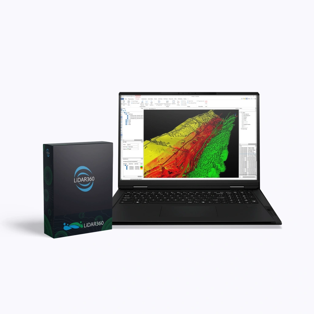
    LiDAR360 Professional is a powerful software suite by GreenValley International, designed for processing, visualising, and analysing point clouds captured using UAVs, terrestrial, and mobile laser scanners (LiDAR). The software serves as a universal solution for professionals in surveying, cartography, forestry, mining, and construction. When purchasing the LiDAR360 Professional package, users receive the programme’s core platform (Framework) along with a set of specialised modules.

    Upgrade Licence (Upgrade to the Next Major Version)

    A one-time upgrade of an existing licence to the next major version of the software.

    Terms:

    • Applicable to previous versions (e.g. V8 → V9).
    • Upgrading is incremental — skipping versions is not permitted (e.g. V6 → V7 → V8).
    • Major upgrade (transition to the next primary version).
    • Minor updates (patches and builds with fixes and improvements) — free for 1 year.
    • Technical support is extended for the full duration of the upgraded licence.

    Advantages

    • Intelligent data processing – built-in AI modules automatically classify and analyse point clouds.
    • High performance – support for multithreaded processing and distributed computing enables efficient handling of terabyte-scale datasets.
    • Versatility – compatible with data from any LiDAR platform: aerial, mobile, terrestrial, and photogrammetric.
    • Flexible modular structure – the option to purchase only the required tools.
    • Integration with GIS and CAD – export to widely used industry-standard formats for further processing.
    • Support for clustered and network deployments – server and distributed licences for team-based data processing.

    Functionality

    The LiDAR360 Professional software package includes a powerful set of tools for:

    • Visualising and filtering point clouds of any density.
    • Automatic object classification (ground, vegetation, buildings, etc.).
    • Creating digital terrain and surface models (DEM, DSM).
    • Extracting engineering, geological, and forestry parameters.
    • Constructing 3D urban models and analysing infrastructure.
    • Aligning and synchronising LiDAR data with imagery for enhanced analytical accuracy.

    What’s Included in LiDAR360 Professional

    Modules Main Functions
    Framework (Core Platform)
    • Point cloud processing and data quality control
    • AI classification (32+ object types)
    • Distributed computing and Model Builder
    • Support for 60+ data formats
    Terrain (Topography)
    • Automatic generation of DEM, DSM, orthomosaics, and contours
    • Contour and breakline editing
    • Flood analysis, SVF, and change detection
    Forestry
    • AI-driven tree segmentation for 7+ data types
    • 18+ tree attributes (height, diameter, volume, etc.)
    • 90+ stand-level metrics
    Powerline (Utility Networks)
    • Detection and classification of powerline assets
    • Vegetation clearance distance analysis
    • Identification of hazardous clearances
    Mine (Mining)
    • Slope and bench stability analysis
    • Stockpile and excavation volume calculations
    • Deformation monitoring of mine workings
    3D Building (Construction)
    • Automated LOD2.2 building modelling
    • Generation of 10,000+ models in 20 minutes
    • Calculation of 8+ building attributes

    Loading...
    5
    Common
    Warranty
    12 months
    Back to the list
    Connect with us
    +41 21 588 02 11
    +41 21 588 02 11 09:00-18:00 whatsapp.svg
    Sales [email protected] email.png
    Support [email protected] email.png
    Telegram Channel @topodronesa tg.svg
    Telegram Chat @topodronesagroup tg.svg
    Telegram Bot @topodronecombot tg.svg
    Facebook @topodronesa ycz1c9257s6gh7g315r8q6tob3bnddba.png
    Youtube @topodronesa youtube.png
    LinkedIn @topodrone 9ratq3v3eavnhupo1akvxp0sbx4vopj5.png
    X @topodrone twitter.png
    Instagram @topodrone tpxkj71axu6dxt423lwj5idzwcej1njx.png
    Email
    [email protected] - Sales
    [email protected] - Support
    The address
    TOPODRONE SA, Rue de la Gare 13, 1820 Montreux, Switzerland
    Working hours
    10:00-18:00
    [email protected] - Sales
    [email protected] - Support
    TOPODRONE SA, Rue de la Gare 13, 1820 Montreux, Switzerland
    Products
    Sales
    Brands
    Services
    Applications
    Company
    Staff
    News
    Reviews
    Vacancy
    Licenses
    Documents
    Partners
    Information
    Requisites
    Help
    Payment
    Delivery
    Warranty
    FAQ
    © 2026 TOPODRONE SA
    Privacy Policy
    Main page Product 0 Comparison Contacts Blog Applications