






Knowledge base
Blog
Services
  • Aerial Photography
    • UAV Monitoring & Inspections
    • UAV Photogrammetry
  • Laser Scanning
    • Aerial Laser Scanning
    • Quarry Surveying
    • Topographical Surveying
  • Training
    • UAV Pilot Course: Photogrammetry & ALS
Company
  • Staff
  • News
  • Reviews
  • Vacancy
  • Licenses
  • Documents
  • Partners
Information
  • Requisites
Brands
Contacts
    +41 21 588 02 11
    +41 21 588 02 11 09:00-18:00 whatsapp.svg
    Sales [email protected] email.png
    Support [email protected] email.png
    Telegram Channel @topodronesa tg.svg
    Telegram Chat @topodronesagroup tg.svg
    Telegram Bot @topodronecombot tg.svg
    Facebook @topodronesa ycz1c9257s6gh7g315r8q6tob3bnddba.png
    Youtube @topodronesa youtube.png
    LinkedIn @topodrone 9ratq3v3eavnhupo1akvxp0sbx4vopj5.png
    X @topodrone twitter.png
    Instagram @topodrone tpxkj71axu6dxt423lwj5idzwcej1njx.png
    Email
    [email protected] - Sales
    [email protected] - Support
    The address
    TOPODRONE SA, Chemin du Closel 5, 1020, RENENS, Switzerland
    Working hours
    10:00-18:00
    TOPODRONE
    SPH Engineering
    3Dsurvey
    Velodyne
    DJI
    GreenValley International
    Honeywell
    Fixar
    Blue Marble Geographics
    Sony
    Agisoft
    EMLID
    Pix4D
    Autel Robotics
    SHAREUAV
    • LiDAR
      LiDAR
      • Aerial Survey LiDAR
      • SLAM Survey LiDAR
      • LiDAR Accessories
    • Bathymetry
      Bathymetry
    • Photogrammetry
      Photogrammetry
      • Mapping Drones
      • Drone Mapping Cameras
      • VTOL Mapping Cameras
    • PPK Upgrade Kits
      PPK Upgrade Kits
      • PPK for Drones
      • PPK for any UAV
    • Spectrography
      Spectrography
      • Thermal
      • Multispectral
    • UAV
      UAV
      • DJI
      • Autel Robotics
      • FIXAR
      • Innotech drone
    • Payload
      Payload
      • Aerial Survey LiDAR
      • Bathymetric Scanner
      • Photogrammetric Cameras
      • Thermal Cameras
      • Multispectral Cameras
      • Beacon
    • Software
      Software
      • TOPODRONE
      • UgCS
      • Agisoft
      • 3Dsurvey
      • LiDAR360
      • DJI
      • PIX4D
    • GNSS Equipment
      GNSS Equipment
      • EMLID
      • DJI
    TOPODRONE – LiDAR & UAV Survey
    Log in
    0 Comparison
    0 Favorites
    0 Cart
    TOPODRONE – LiDAR & UAV Survey
    Log in
    0 Comparison
    0 Favorites
    0 Cart
    TOPODRONE – LiDAR & UAV Survey
    Telephones
    +41 21 588 02 11 09:00-18:00 whatsapp.svg
    Sales [email protected] email.png
    Support [email protected] email.png
    Telegram Channel @topodronesa tg.svg
    Telegram Chat @topodronesagroup tg.svg
    Telegram Bot @topodronecombot tg.svg
    Facebook @topodronesa ycz1c9257s6gh7g315r8q6tob3bnddba.png
    Youtube @topodronesa youtube.png
    LinkedIn @topodrone 9ratq3v3eavnhupo1akvxp0sbx4vopj5.png
    X @topodrone twitter.png
    Instagram @topodrone tpxkj71axu6dxt423lwj5idzwcej1njx.png
    Email
    [email protected] - Sales
    [email protected] - Support
    The address
    TOPODRONE SA, Chemin du Closel 5, 1020, RENENS, Switzerland
    Working hours
    10:00-18:00
    0
    0
    0
    • Cabinet
    • 0 Compare
    • 0 Favorite
    • 0 Cart
    • Brands
    • Sales
    • Services
      • Services
      • Aerial Photography
        • Aerial Photography
        • UAV Monitoring & Inspections
        • UAV Photogrammetry
      • Laser Scanning
        • Laser Scanning
        • Aerial Laser Scanning
        • Quarry Surveying
        • Topographical Surveying
      • Training
        • Training
        • UAV Pilot Course: Photogrammetry & ALS
    • Company
      • Company
      • Staff
      • News
      • Reviews
      • Vacancy
      • Licenses
      • Documents
      • Partners
    • Blog
    • Information
      • Information
      • Requisites
    • Contacts
    +41 21 588 02 11 09:00-18:00
    • Telephones
    • +41 21 588 02 11 09:00-18:00
      whatsapp.svg
    • Sales [email protected]
      email.png
    • Support [email protected]
      email.png
    • Telegram Channel @topodronesa
      tg.svg
    • Telegram Chat @topodronesagroup
      tg.svg
    • Telegram Bot @topodronecombot
      tg.svg
    • Facebook @topodronesa
      ycz1c9257s6gh7g315r8q6tob3bnddba.png
    • Youtube @topodronesa
      youtube.png
    • LinkedIn @topodrone
      9ratq3v3eavnhupo1akvxp0sbx4vopj5.png
    • X @topodrone
      twitter.png
    • Instagram @topodrone
      tpxkj71axu6dxt423lwj5idzwcej1njx.png
    • [email protected] - Sales
      [email protected] - Support
    • TOPODRONE SA, Chemin du Closel 5, 1020, RENENS, Switzerland
    • 10:00-18:00
    Main
    Products
    LiDAR
    SLAM Survey LiDAR
    SLAM1000
    SLAM1000
    SLAM1000
    SLAM1000
    SLAM1000
    SLAM1000
    SLAM1000
    SLAM1000
    SLAM1000
    SLAM1000
    SLAM1000
    SLAM1000
    SLAM1000

    SLAM1000

    5
    Art. TDCH1204
    $4 500
    Available
    Specifications
    Статьи : SLAM 1000 HANDHELD SCANNER: ENTRY-LEVEL MODEL FOR PROFESSIONAL MAPPING, PRACTICAL USE OF SLAM SCANNERS FOR TOPOGRAPHIC SURVEYING, SLAM 100 ON THE ROAD: SURVEYING WITHOUT INTERRUPTING TRAFFIC, SLAM 200E - THE UPGRADE FOR SLAM 100 HIGH-PRECISION MLS IN REAL-TIME MODE, MLS EFFICIENCY FOR GEODETIC TREE-BY-TREE SURVEYING WITH SLAM 200, SURVEYING A QUARRY WITH A SLAM 100 SCANNER: A PRACTICAL EXPERIENCE
    Country of origin : China
    Warranty : 12 months
    Weight : 0.65 kg (scanner) / 1.16 kg (including battery and base)
    Product Dimensions : 283.8 × 173.8 × 170 mm
    Operating Temperature Range : -20°C...+50°C, IP54
    Built-in IMU : Yes
    Built-in Cameras : Yes (panoramic)
    Max. Beam Length : 70 m
    Positioning Accuracy : 2 cm @ 100 m (RMSE)
    All Specifications
    Description
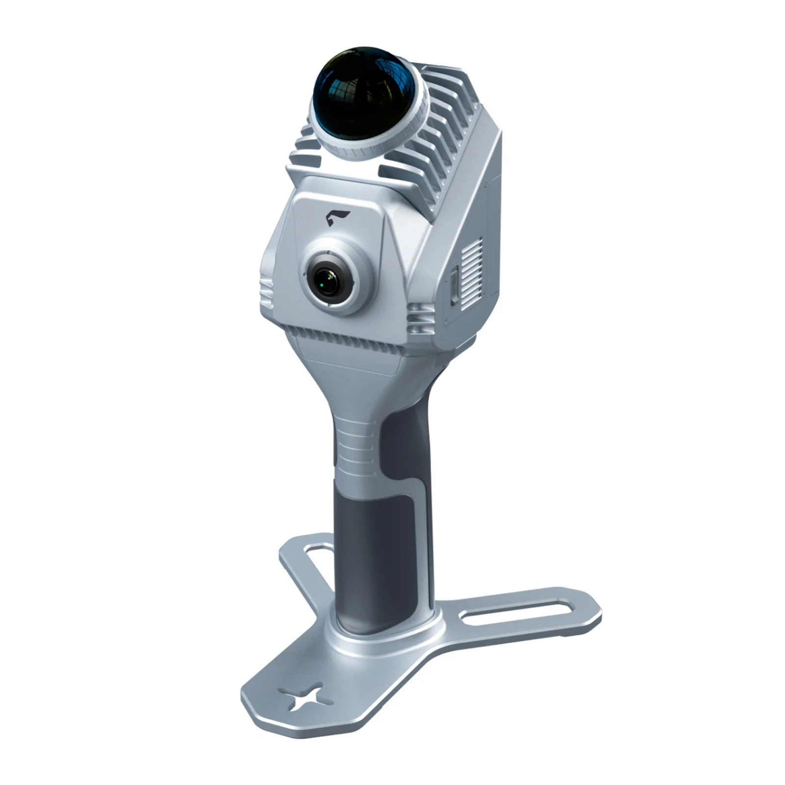
    High-precision entry-level handheld SLAM scanner with colourised point clouds, delivering up to 100 minutes of operation on a single battery.
    More details
    $4 500
    Available
    FEIMA ROBOTICS
    All items of FEIMA ROBOTICS
    All products of the category
    • Description
    • Reviews
    • Specifications
    • Documents

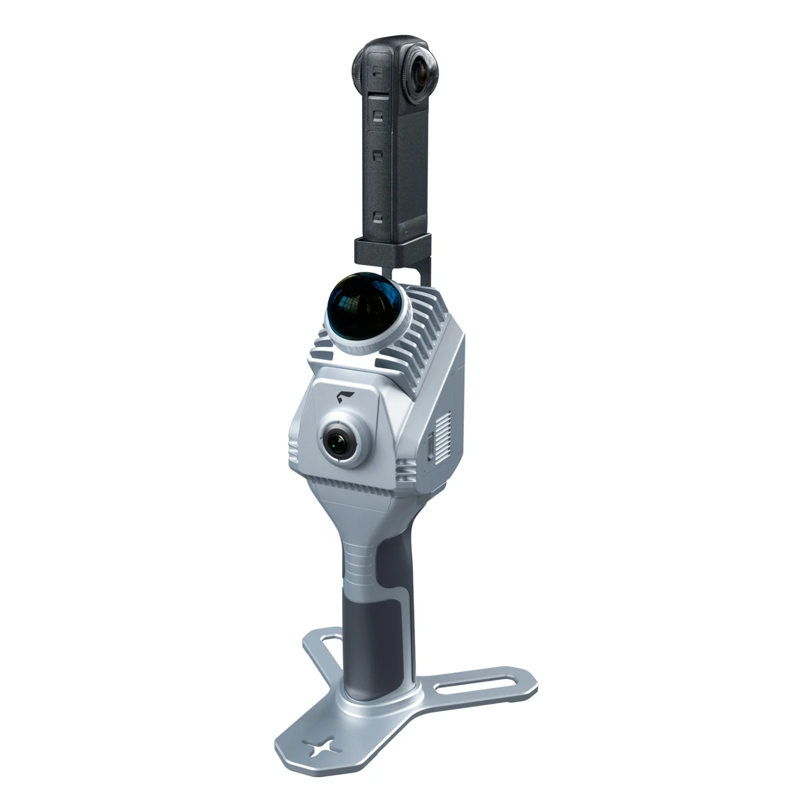
    Handheld 3D LiDAR Scanner SLAM1000

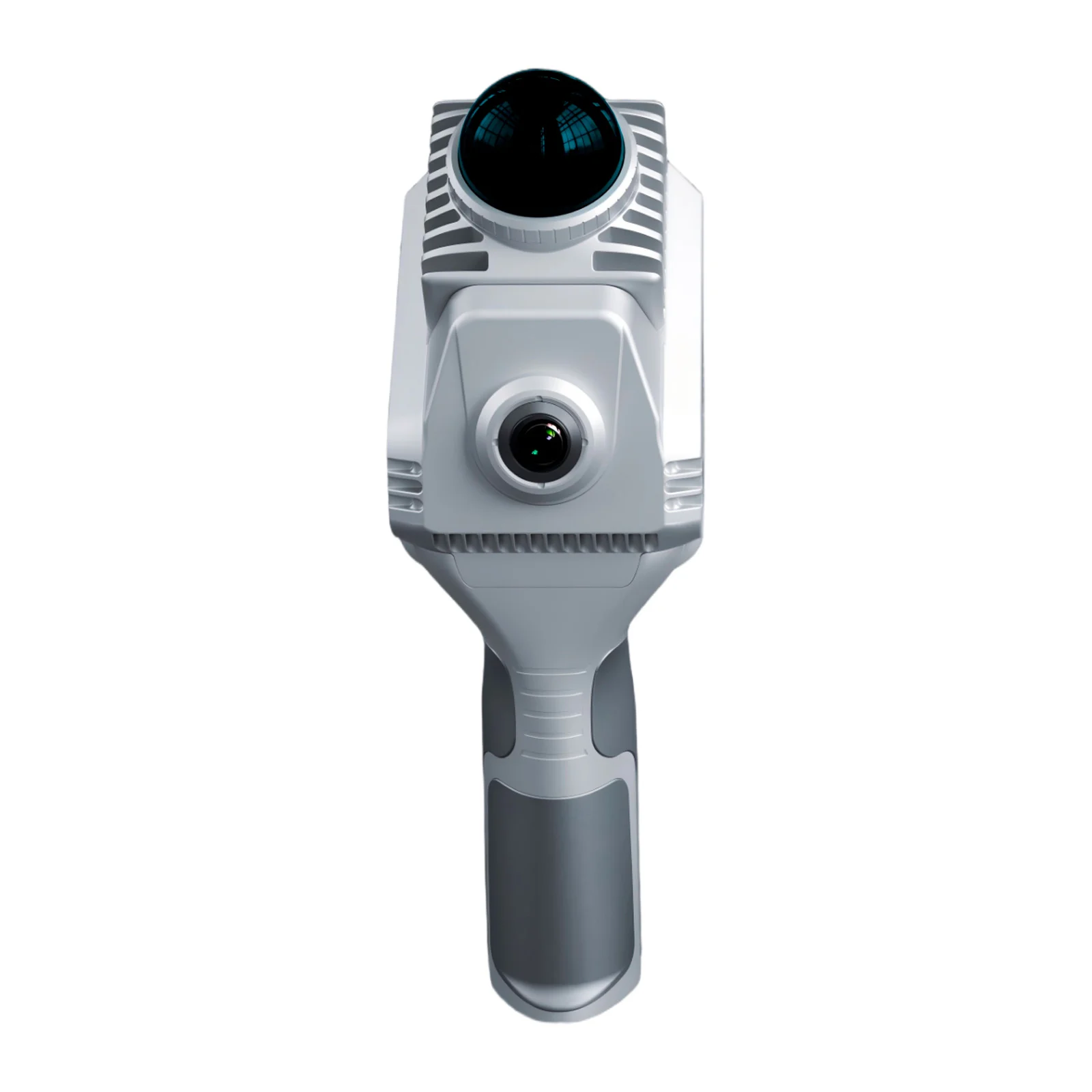
    The SLAM1000 handheld 3D LiDAR scanner delivers high-precision scanning with full-colour visualisation in a lightweight and cost-efficient form factor. Powered by proprietary SLAM algorithms and a 12 MP colour camera, it generates detailed colourised point clouds, making it ideal for applications where accuracy is critical.

    This entry-level solution combines professional-grade performance with ease of use at an accessible price point. The scanner is well suited to surveying and reality capture workflows, providing reliable results and streamlined data acquisition across a wide range of use cases. Up to 100 minutes of operation on a single battery.

    Key Features

    • High-precision point cloud. Equipped with a non-repetitive scanning LiDAR and a high-accuracy inertial measurement unit (IMU), the system uses industrial-grade SLAM algorithms to deliver precise results.
    • Colourised point cloud. A 12 MP panoramic camera produces high-definition colourised point clouds with realistic and detailed colour representation.
    • Real-time mapping. Supports real-time point cloud data acquisition and visualisation.
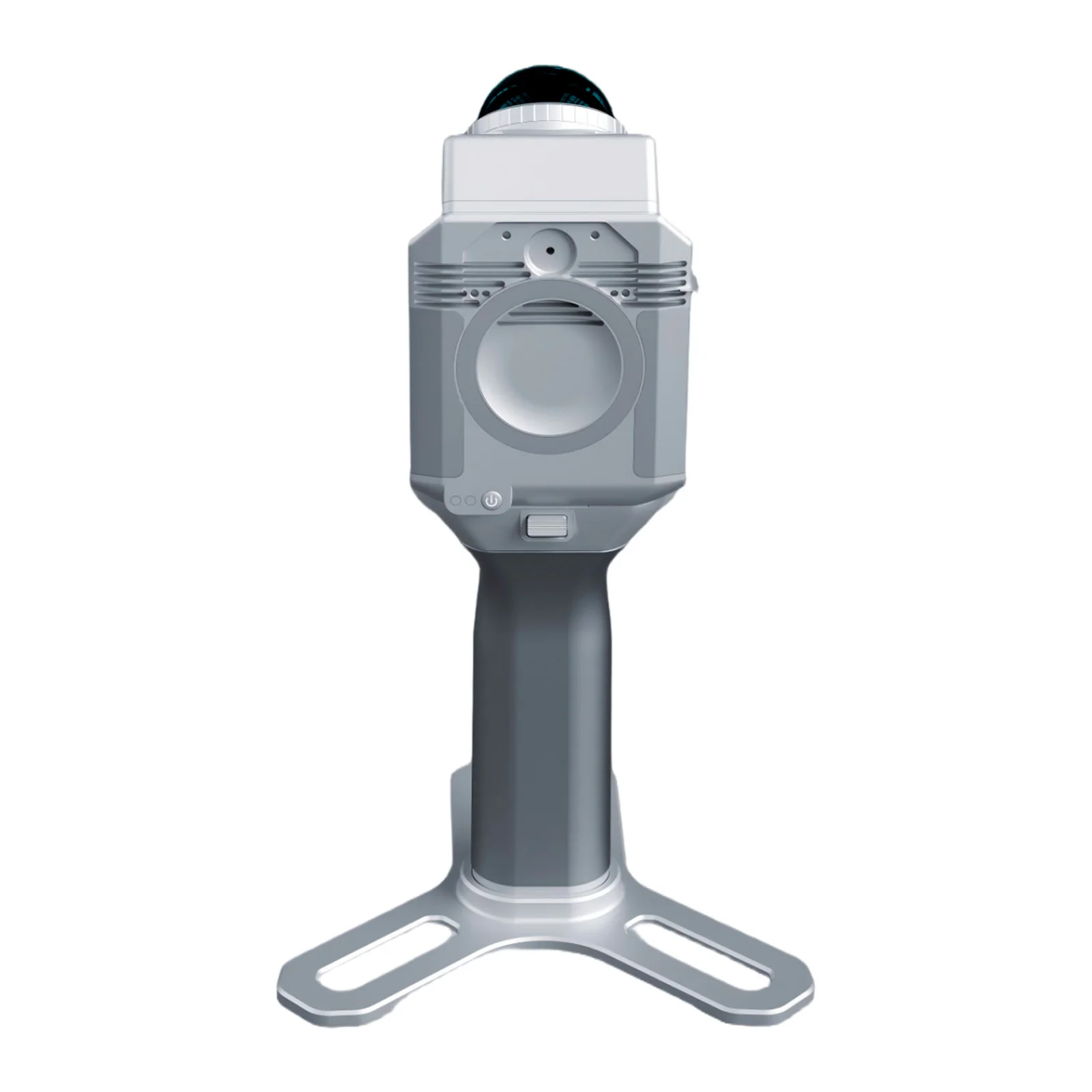
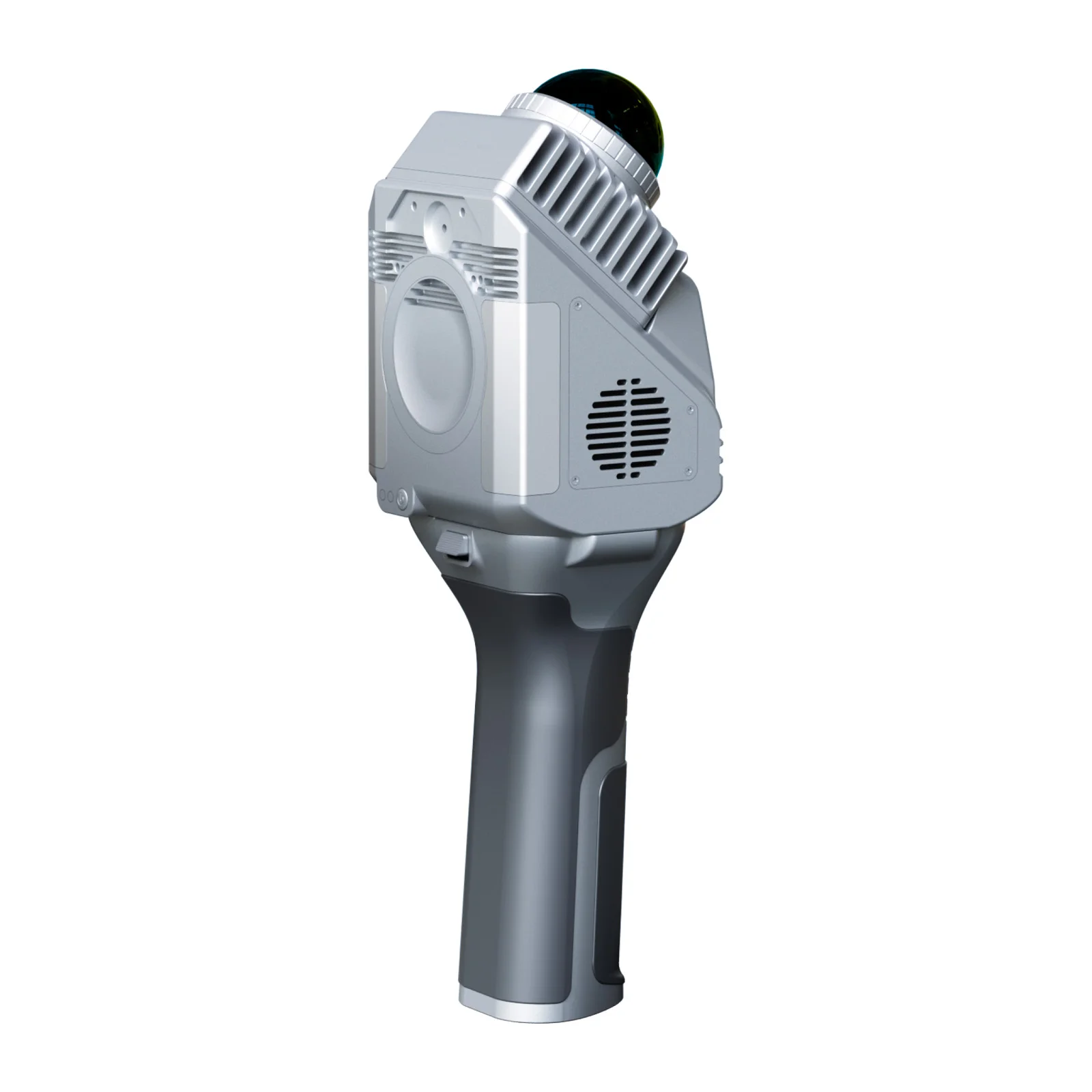
    • MagSafe. Integrated MagSafe magnetic ring on the rear panel enables convenient smartphone mounting.
    • External panoramic camera support. Compatible with external panoramic cameras and supports 3D Gaussian Splatting (3DGS) generation.
    • Lightweight and portable. Carry case dimensions: 189 × 232 × 115 mm (smaller than an A4 sheet), ensuring convenient transport.

    Sample Data

    Download and review sample datasets from the SLAM scanner here.

    Software

    SLAM GO POST Pro

    • PC software integrated into a UAV management environment;
    • Processing of handheld LiDAR scanner data;
    • Rendering and visualisation of point cloud datasets;
    • Point cloud colourisation, panoramic image generation, and 3DGS creation;
    • Resume scanning from the last stopping point (breakpoint continuation);
    • Fusion of aerial and terrestrial scanning data, and more.

    SLAM GO

    • Mobile application compatible with Android and iOS;
    • Quick measurements and generation of industry-specific reports;
    • Real-time mapping, data visualisation, and navigation;
    • CORS configuration and connectivity.

    Warranty

    12 months from the date of purchase.

    Loading...
    5
    Common
    Country of origin
    China
    Warranty
    12 months
    Weight
    0.65 kg (scanner) / 1.16 kg (including battery and base)
    Product Dimensions
    283.8 × 173.8 × 170 mm
    Operating Temperature Range
    -20°C...+50°C, IP54
    LiDAR
    Built-in IMU
    Yes
    Built-in Cameras
    Yes (panoramic)
    Max. Beam Length
    70 m
    Positioning Accuracy
    2 cm @ 100 m (RMSE)
    Field of View (FOV)
    360° (H), -7° ~ 52° (V)
    Scan Rate
    200,000 points/s (200 kpts/s)
    Laser Wavelength
    905 nm
    IMU Operating Frequency
    10 Hz
    Camera
    Camera Type
    Panoramic (360°)
    Sensor Quantity
    1
    Sensor Resolution
    12 MP, image resolution 2704 × 2208 px
    Lens
    Field of View (FOV)
    360° H, -7° ~ 52° V
    SLAM 1000
    1,8 MB

    Media

    SLAM1000
    SLAM1000
    SLAM1000
    SLAM1000
    SLAM1000

    Articles

    SLAM 1000 HANDHELD SCANNER: ENTRY-LEVEL MODEL FOR PROFESSIONAL MAPPING
    SLAM 1000 HANDHELD SCANNER: ENTRY-LEVEL MODEL FOR PROFESSIONAL MAPPING
    3 April 2026
    Back to the list
    Connect with us
    +41 21 588 02 11
    +41 21 588 02 11 09:00-18:00 whatsapp.svg
    Sales [email protected] email.png
    Support [email protected] email.png
    Telegram Channel @topodronesa tg.svg
    Telegram Chat @topodronesagroup tg.svg
    Telegram Bot @topodronecombot tg.svg
    Facebook @topodronesa ycz1c9257s6gh7g315r8q6tob3bnddba.png
    Youtube @topodronesa youtube.png
    LinkedIn @topodrone 9ratq3v3eavnhupo1akvxp0sbx4vopj5.png
    X @topodrone twitter.png
    Instagram @topodrone tpxkj71axu6dxt423lwj5idzwcej1njx.png
    Email
    [email protected] - Sales
    [email protected] - Support
    The address
    TOPODRONE SA, Chemin du Closel 5, 1020, RENENS, Switzerland
    Working hours
    10:00-18:00
    [email protected] - Sales
    [email protected] - Support
    TOPODRONE SA, Chemin du Closel 5, 1020, RENENS, Switzerland
    Products
    Sales
    Brands
    Services
    Applications
    Company
    Staff
    News
    Reviews
    Vacancy
    Licenses
    Documents
    Partners
    Information
    Requisites
    Help
    Payment
    Delivery
    Warranty
    FAQ
    © 2026 TOPODRONE SA
    Privacy Policy
    Main page Product 0 Comparison Contacts Blog Applications