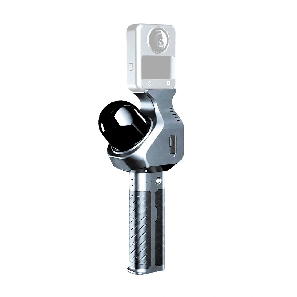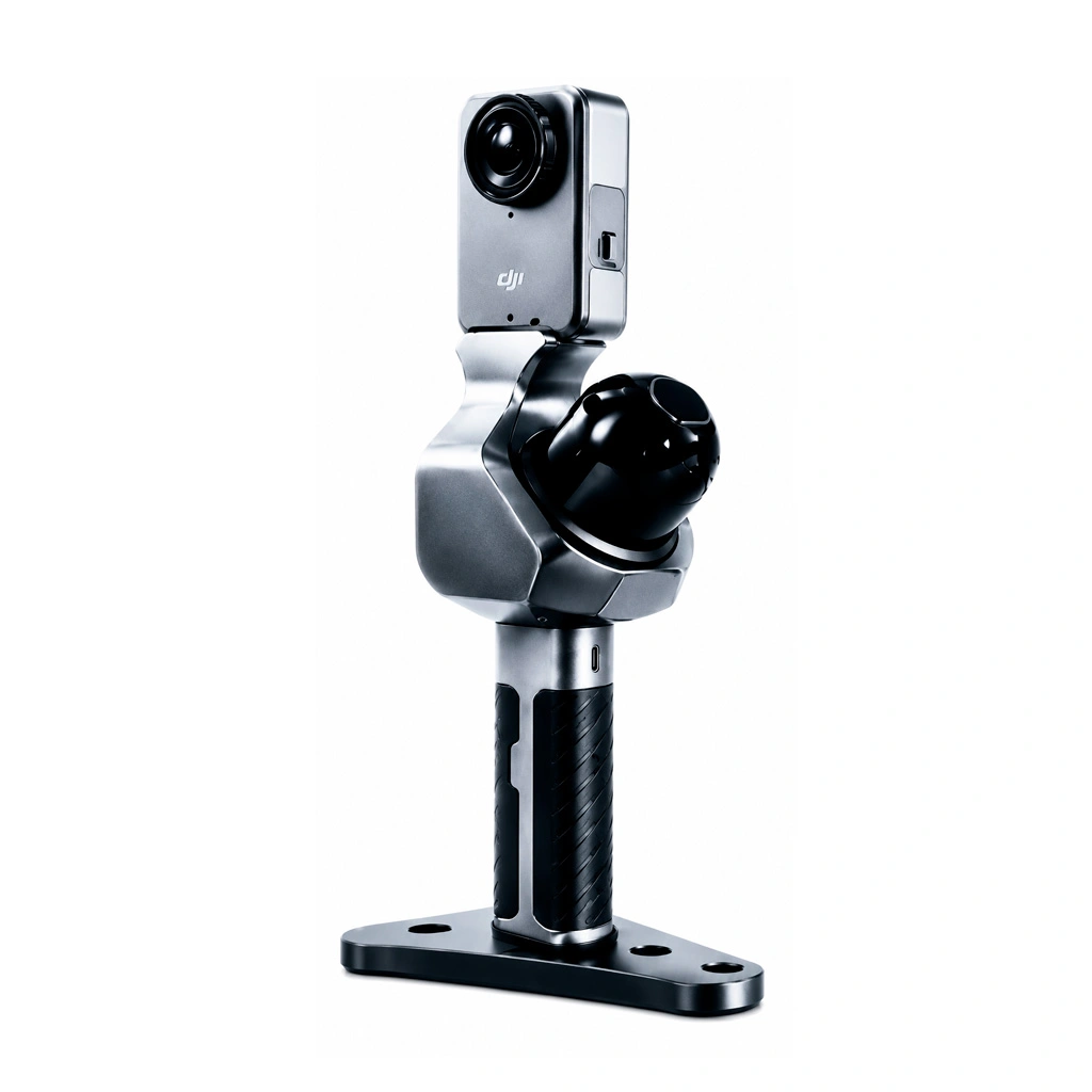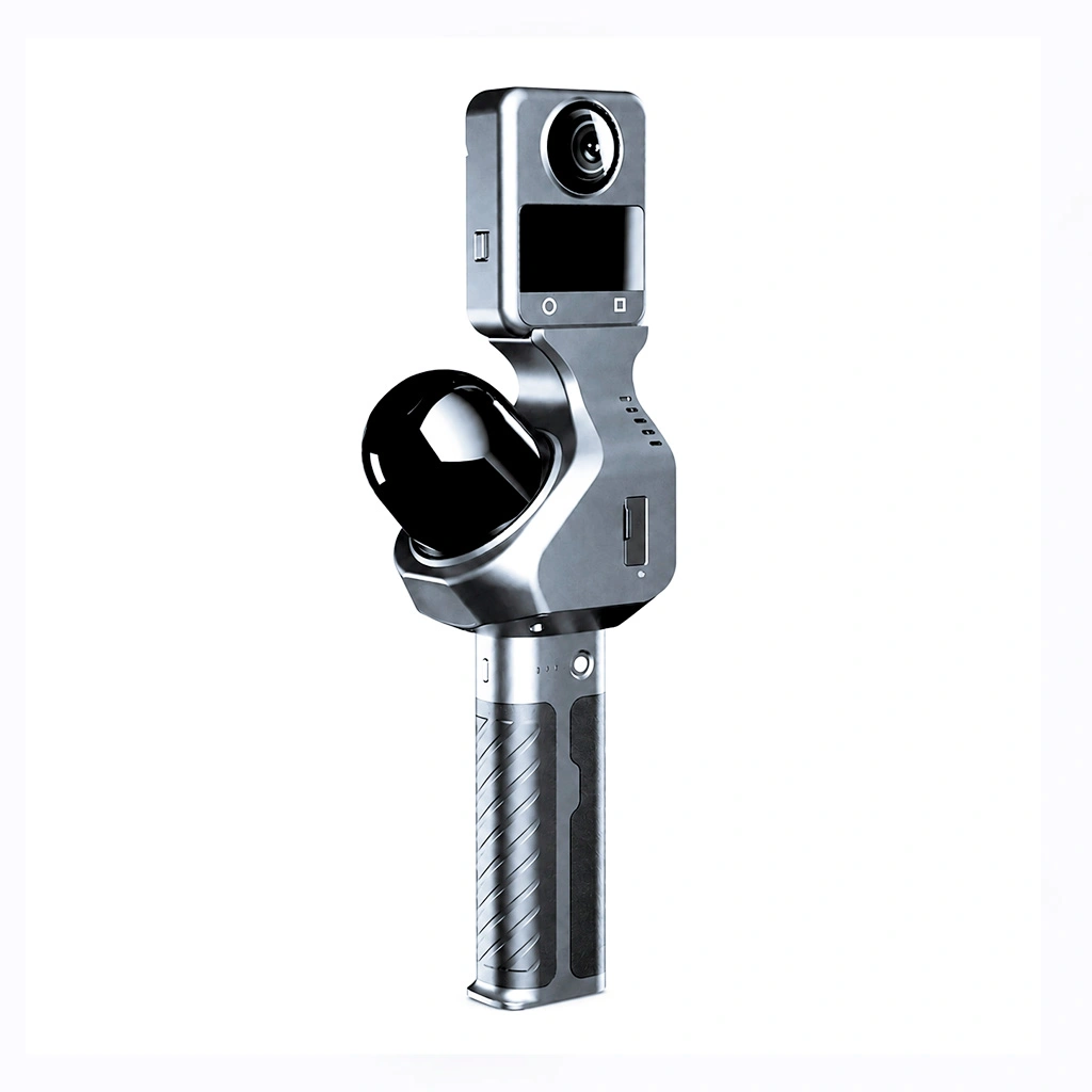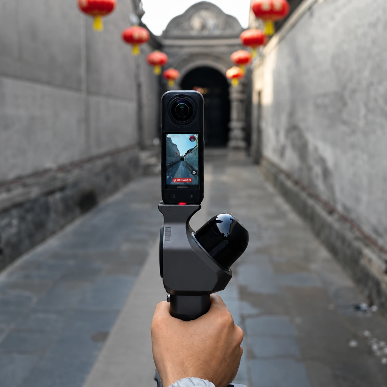






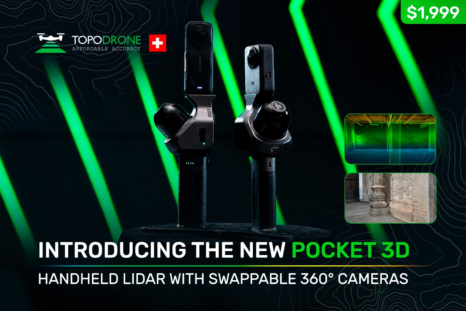
Pocket 3D was released on 20 July 2026: a handheld mobile scanning system built on LiDAR and SLAM technology. It differs from conventional handheld scanners in one design decision: the unit has no panoramic camera of its own. Instead, the operator's own consumer camera is mounted on top – a DJI Osmo 360 or an Insta360 X4 / X4 Air / X5. The laser module is responsible for the trajectory and the true scale of the scene; the 360° camera provides texture and photorealism.
The operator ends up with a colourised point cloud, panoramic images tied to their capture positions, and a 3D Gaussian Splatting (3DGS) model. The unit weighs 700 g without a camera and runs for 3 hours. Below we look at how Pocket 3D is built, what it can do and, no less importantly, where the limits of its use lie.
1. What Pocket 3D is
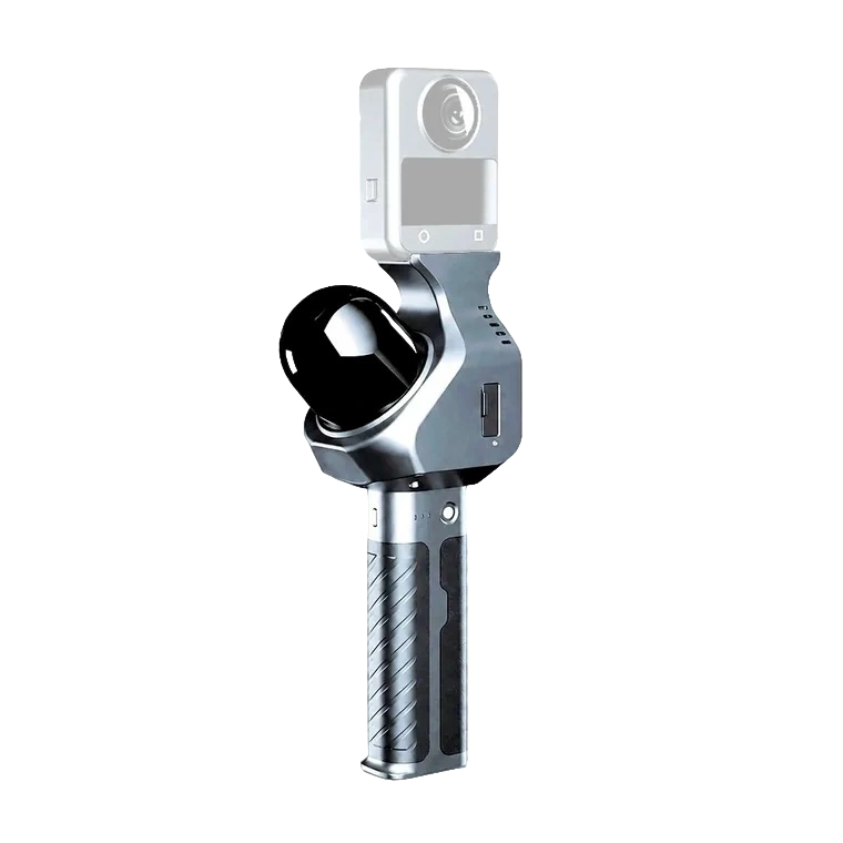
Pocket 3D belongs to the class of handheld mobile laser scanning systems that work by SLAM (Simultaneous Localisation and Mapping). The operator walks the site with the unit in hand; the LiDAR continuously measures distances to the surrounding surfaces, and the algorithm uses those measurements to compute the trajectory of the unit while assembling a single point cloud from the individual frames. No external targets, reflectors or site preparation are required.
Structurally the system consists of four assemblies: a scanning unit with a 16-channel LiDAR, a computing unit with onboard storage, a removable SP20 battery handle, and a camera mount on top. Underneath there is a base with a 1/4-inch threaded socket, so the unit can be fitted to a tripod, a monopod or another support.
The key engineering idea
Most handheld scanners in this class are fitted with a built-in 360° camera. Pocket 3D uses a standardised modular interface for off-the-shelf consumer cameras instead. Such cameras are updated far more quickly than scanning equipment, so they can be replaced as new models appear while the scanner itself and the core of the system are retained.
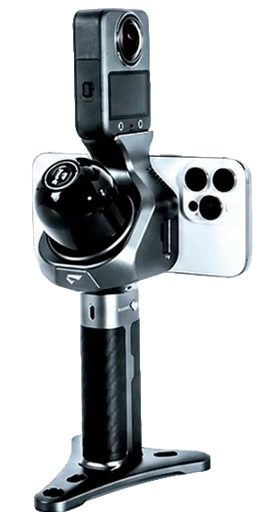
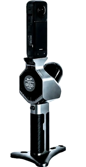
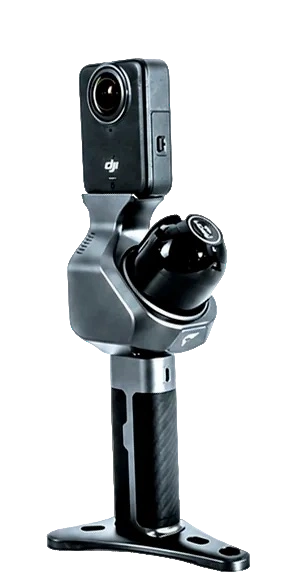
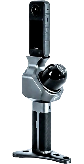
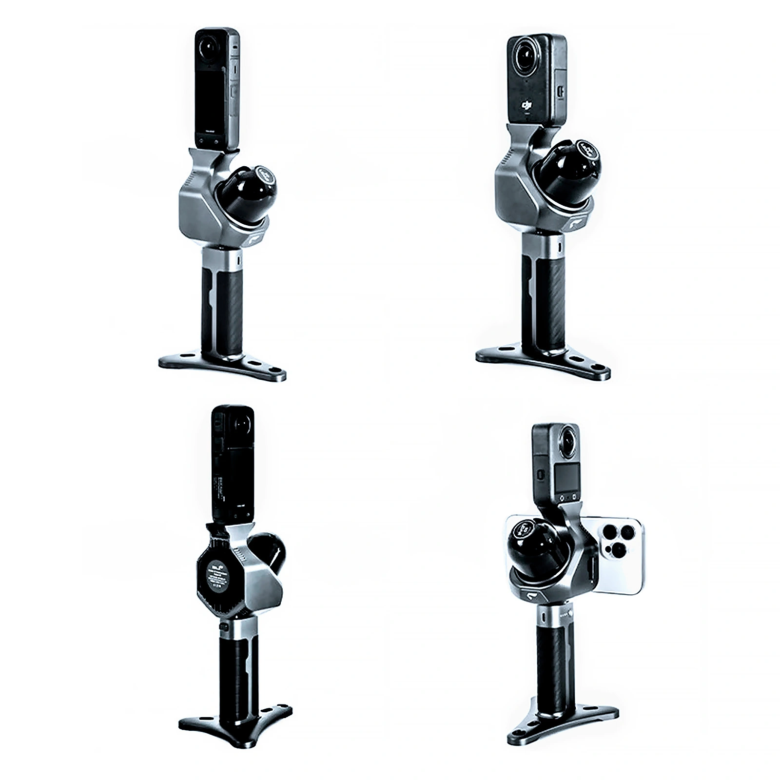
Figures 2–5.Pocket 3D assembled with different 360° cameras and with a smartphone on the magnetic mount
What is in the box
| Item | Quantity |
|---|---|
| Pocket 3D main unit | 1 pc. |
| The SP20 battery handle | 1 pc. |
| Base | 1 pc. |
| Charging cable | 1 pc. |
| Memory card | 1 pc. |
| Card reader | 1 pc. |
| SLAM GO POST Pro software | included |
The 360° camera is not part of the standard delivery set and is purchased separately.
2. Technical specifications
2.1. The complete unit
| Weight | 700 g (without a 360° camera) |
|---|---|
| Dimensions | 127 × 105 × 223 mm |
| Power consumption | 7 W |
| Storage | TF memory card, 32 GB |
| Battery model | SP20 |
| Battery capacity | 2,450 mAh |
| Operating time | 3 hours at room temperature |
| Operating temperature | −20…+50 °C |
| Relative humidity | below 95% |
2.2. LiDAR
| Ranging distance | 0.15–100 m |
|---|---|
| Range against a target with 10% reflectivity | 30 m |
| Laser channels | 16 |
| Horizontal field of view | 360° |
| Vertical field of view | 40° |
| Scan rate | 10 Hz |
| Effective point rate | 48,000 pts/s |
2.3. Accuracy
| Relative accuracy | 2 cm |
|---|---|
| Absolute accuracy | 5 cm |
Notes:
- Accuracy is stated for typical survey conditions.
- Ranging test conditions: normal incidence of the beam, ambient illuminance 0–100 klx, detection probability 50%.
2.4. Interfaces
| Interface | Purpose |
|---|---|
| Type-C | battery charging |
| Wi-Fi | supported |
| Bluetooth | supported |
| Base connector | 1/4-inch threaded socket |
2.5. What lies behind these figures
100 m and 30 m are two different quantities and must not be confused.The 0.15–100 m range describes what the rangefinder is capable of in principle. The 30 m figure is the range at which measurement remains reliable against a target with 10% reflectivity, that is, against a dark surface: fresh asphalt, soot-covered structures, dark roofing, wet concrete. It is the second figure that should govern survey planning: for real work inside buildings and across developed sites, treat 30 m as the working radius and 100 m as the limit for bright, well-reflecting surfaces with favourable beam geometry.
A vertical field of view of 40° is a narrow band.Horizontally the LiDAR sees the full 360°, but vertically only 40°. Judging by the layout, the scanning module is mounted at an angle to the axis of the handle, which rotates the band so that a single pass captures both the floor and the upper part of the space. Even so, tall bays, shafts, ceiling services and the upper storeys of a façade will call for either an additional pass with the unit tilted or a denser network of routes. This is a marked difference from instruments with a vertical field of view of 270°.
48,000 pts/s is no record, and that is a deliberate trade-off.The effective point rate determines cloud density at a given walking speed: the faster you move, the sparser the points. For centimetre-level detail of interiors, façades and sites this is sufficient; for work that needs millimetre-level geometry of individual details, it is not. The direct consequence of this trade-off is the low weight and the low power draw of just 7 W.
"2 cm" always comes with "at 60 m".This is the rated relative accuracy obtained at a range of 60 m. It describes the internal consistency of the cloud – how closely sections captured at different moments of the walk agree with one another – and not the error of georeferencing the result to an external coordinate system. Absolute accuracy (5 cm) is the more conservative and more practical figure when judging whether the unit suits a particular task.
3. Construction: what sits where
Pocket 3D assemblies and their specifications
Camera mount
LiDAR
- Ranging distance: 0.15–100 m
- Range at 10% reflectivity: 30 m
- Field of view: 360° × 40°
Battery
- Model: SP20
- Capacity: 2,450 mAh
- Operating time: 3 hours at normal temperature
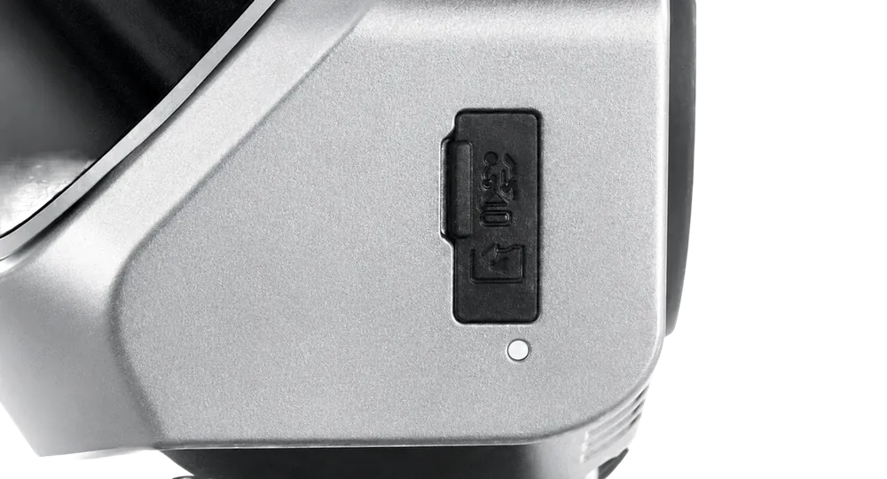
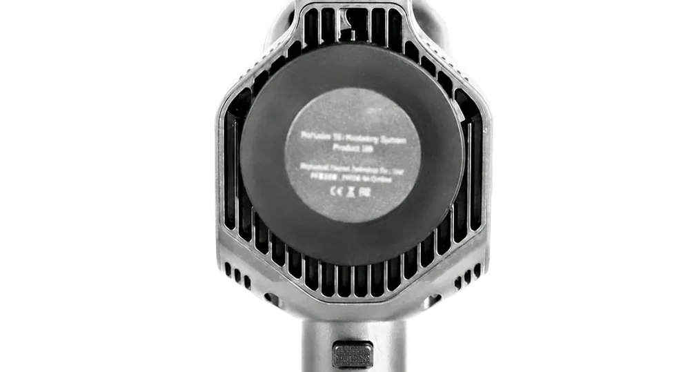
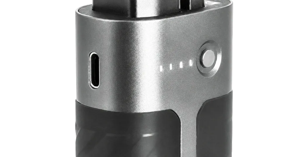
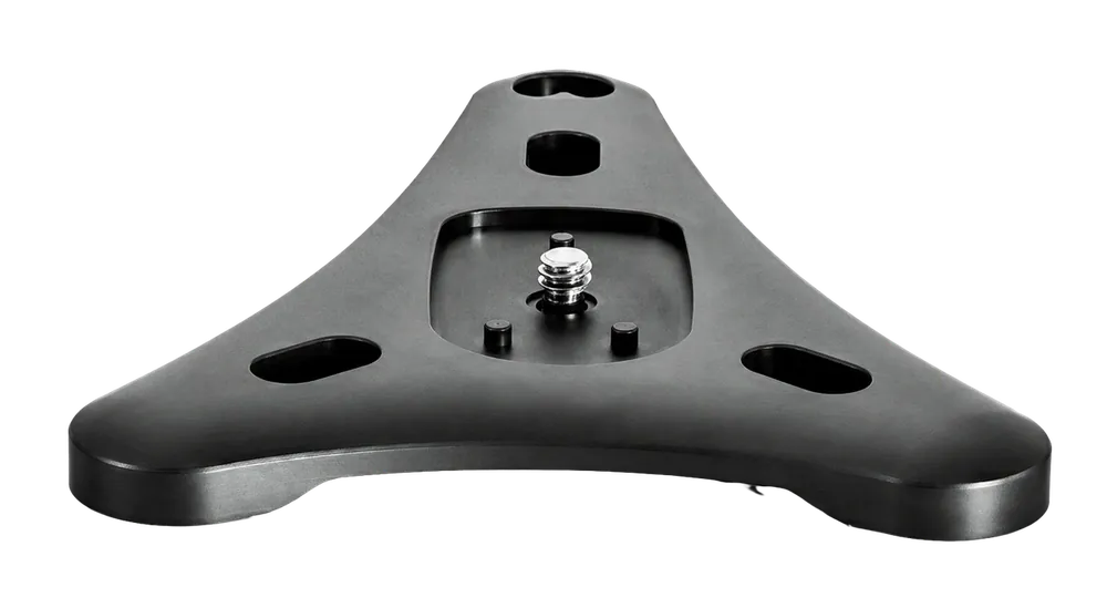
Figures 6–10.Pocket 3D layout: camera mount, LiDAR module, battery handle, memory card slot, magnetic smartphone mount, Type-C port and base with a 1/4-inch thread
- The 360° camera mount sits on top, on a vertical post. The camera is raised above the LiDAR module so that the unit itself intrudes into the frame as little as possible.
- The LiDAR module is the distinctive black dome mounted at an angle. Inside is a 16-channel scanner: 0.15–100 m, 360° × 40°, 10 Hz.
- The SP20 battery handle holds 2,450 mAh, around 3 hours of work at room temperature. It is removable, so a spare handle extends the shift without waiting for a recharge.
- The Type-C port is on the handle and is used to charge the battery.
- The 32 GB TF memory card slot is on the body of the unit; a card reader for offloading data to a workstation is supplied in the box.
- The base with a 1/4-inch thread lets the unit be fitted to a tripod or a monopod; the same base serves as a stand for static capture.
- The magnetic smartphone mount sits beside the LiDAR module.
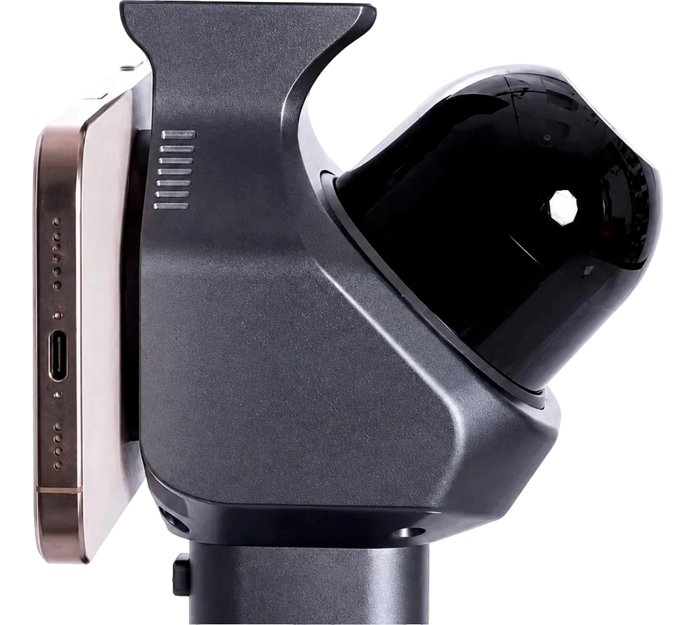
Weight deserves a separate word. The 700 g figure is the weight of the unit without a 360° camera. The cameras themselves add between 165 and 200 g depending on the model (figures from their manufacturers: Insta360 X4 Air – 165 g, DJI Osmo 360 – 183 g, Insta360 X5 – 200 g). The working combination therefore weighs around 0.87–0.9 kg, which can be held in one hand throughout a long walkthrough, and that is what defines the way the unit is used.
4. How it works: two sensors, two roles
4.1. Why a 360° camera alone is not enough
Reconstructing a three-dimensional scene from images alone is well-established practice. A 360° camera is walked around the scene, the equirectangular panoramas are unwrapped into a set of perspective views, those views are fed into COLMAP, where the SfM (Structure from Motion) algorithm estimates the camera poses, and a 3D Gaussian Splatting model is then trained in open frameworks such as Nerfstudio or gsplat. On small scenes with rich texture and even lighting, this pipeline delivers impressive photorealistic results.
The classic processing chain: panorama, SfM, point cloud, training, 3DGS model
Panorama
Point cloud: SfM + dense matching
3DGS output
SfM limitations
- Performs poorly on weakly textured scenes and in low light
- Drift accumulates over long scenes
- No information about the true scale of the scene
Diagram 1.The classic "panorama → SfM → point cloud → training → 3DGS" chain and its limitations
The trouble starts when you move from a single room to a whole building, a street or a stretch of woodland. The bottleneck is not the quality of the imagery but the accuracy of the camera pose. Purely visual pose estimation runs into four fundamental limitations:
- Dependence on texture.Woodland, snow, large white walls and glazed façades yield too few distinctive points for frames to be matched. Poses become unstable and the reconstruction may fail to converge at all.
- Sensitivity to lighting.In underground car parks, dark corners of buildings and night-time capture, image quality and the signal-to-noise ratio drop, and the quality of the reconstruction drops with them.
- Accumulated drift.The longer the route and the more loops it contains, the greater the accumulated error. The result is sections of the scene that drift apart and incomplete stitching.
- Absence of absolute scale.SfM recovers geometry up to a similarity transformation: the model has no knowledge of the real dimensions of the scene. To measure anything from it you need either calibration objects or ground control points.
On top of this comes a purely operational problem. Without quality control on site, the operator cannot confirm that enough material has been captured. Gaps and unusable sections come to light back at the workstation, after a full COLMAP run – by which time returning to site is expensive.
4.2. LiDAR: trajectory and true scale
This is precisely the gap Pocket 3D fills. The trajectory of the unit is computed from LiDAR point clouds rather than from matching visual features. Pose estimation therefore stays stable where visual methods degrade: in woodland, on snow, in an underground car park, during night-time capture. On long continuous walkthroughs, LiDAR-based positioning markedly reduces accumulated drift.
The second thing the laser provides is true physical scale. Dimensions in the model correspond to the real ones, which means distances, lengths and heights can be measured directly from the result without fitting the model to a reference object.
4.3. The 360° camera: texture and photorealism
The 360° camera is responsible for the visual side: it captures the texture of the scene and effectively determines the final quality of the 3DGS model. Because 3DGS reconstruction depends heavily on the quality of the source imagery, the modular architecture works in favour of the result here: users fit the camera they need and upgrade it independently of the scanner.
4.4. Combined processing
The Pocket 3D software uses a hybrid 3DGS training architecture. In the traditional pipeline, poses are determined entirely through SfM. Here the LiDAR point cloud serves as the primary spatial reference framework, while image-based SfM works as a supplementary mechanism for selecting visual features.
Combining Pocket 3D data with data from a 360° camera
POCKET 3D
- Spatial trajectory
- Stability on weakly textured sections
- Stability over long trajectories
- Operation in low light
- True physical scale
360° camera
- Rich scene texture
- Realistic visual representation
- Accurate reproduction of detail
- Accurate colour reproduction
Registration and data fusion
LiDAR-based registration with optimisation supported by SfM
Stable, scalable 3DGS reconstruction
- Point cloud
- Camera trajectory
- Interactive 3D scene
Diagram 2.The division of roles between the sensors and the combined processing of the data: LiDAR-based alignment refined by SfM
The diagram scrolls horizontally.
The practical effect of this architecture rests on two points:
- the Gaussians are distributed more evenly and in better order, which markedly reduces the number of floating artefacts and noisy splats typical of purely visual pipelines;
- reconstruction remains workable in weakly textured and poorly lit scenes, so the result depends less on conditions at the site.
5. Compatible 360° cameras
Four models are listed as supported at the time of the unit's release, and all of them fit the mount as supplied, with no adapters or modifications:
- DJI Osmo 360
- Insta360 X4
- Insta360 X4 Air
- Insta360 X5
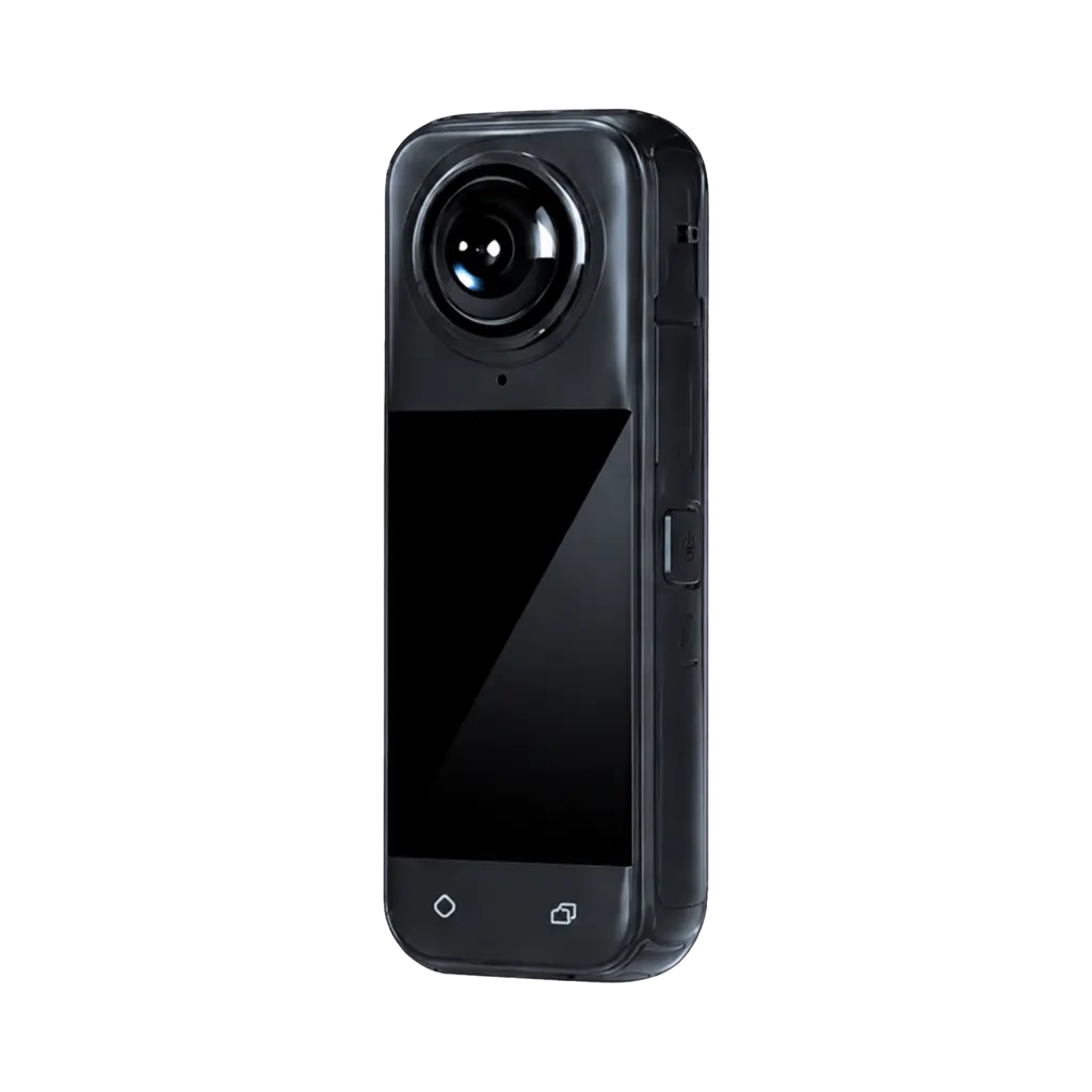
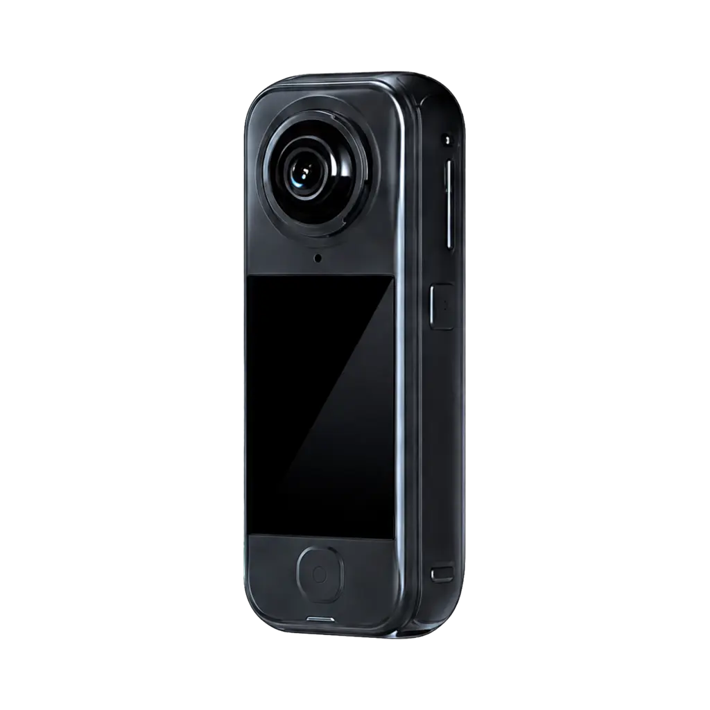
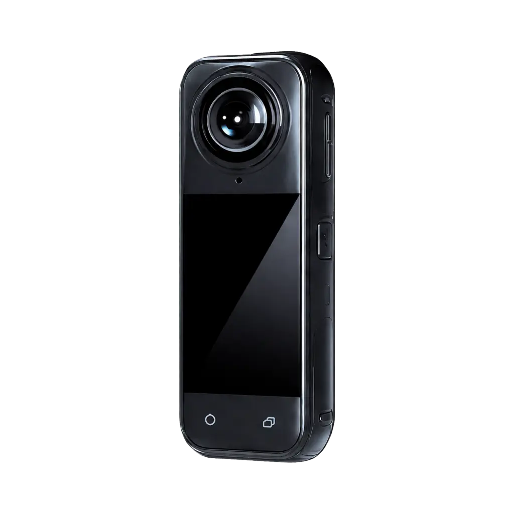
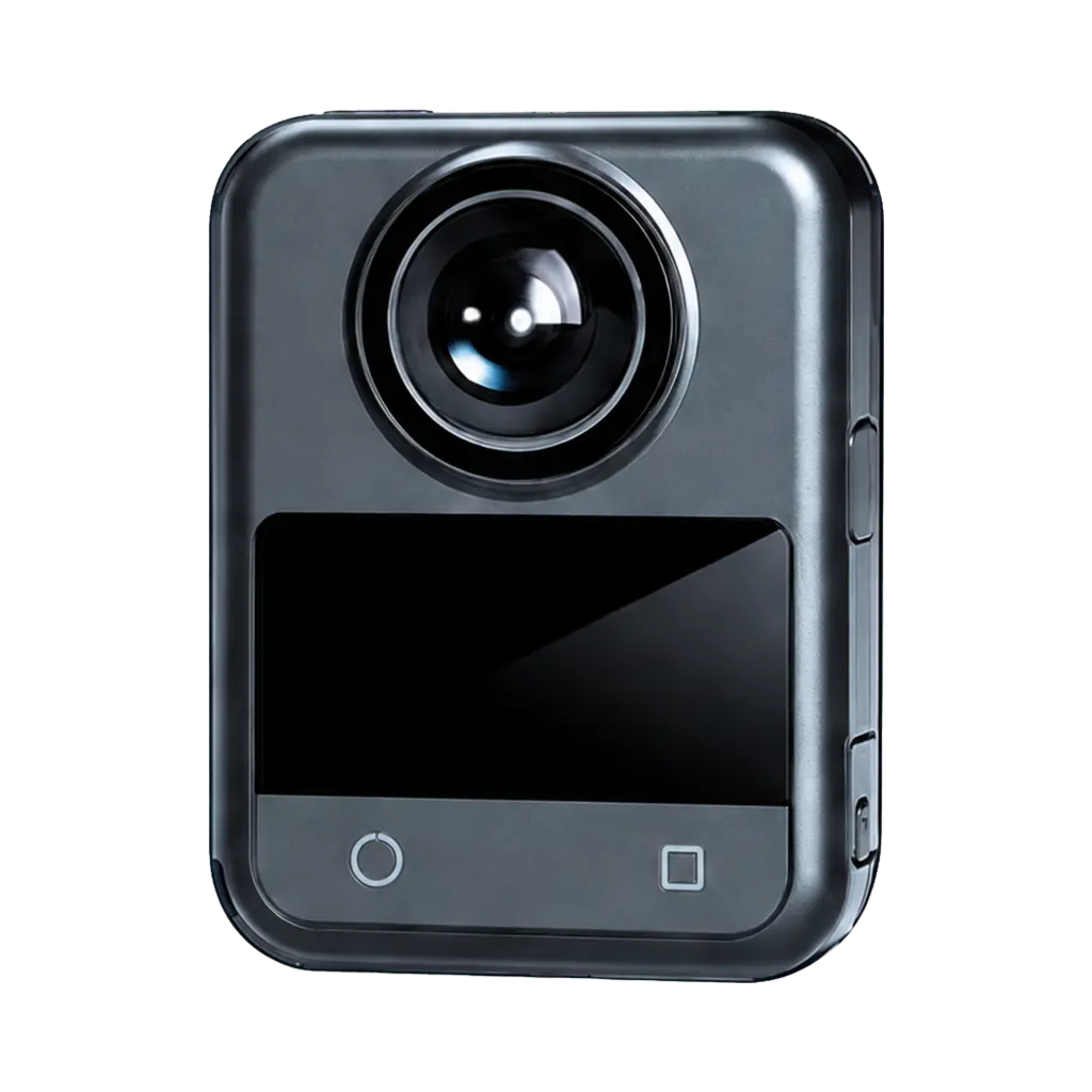
Figures 12–15.Compatible models: Insta360 X4, X4 Air, X5 and DJI Osmo 360
6. What you get as output
A single walkthrough of a site yields several types of spatial data. It is worth separating at the outset what the unit and its bundled software produce on their own from what requires further processing in third-party software.
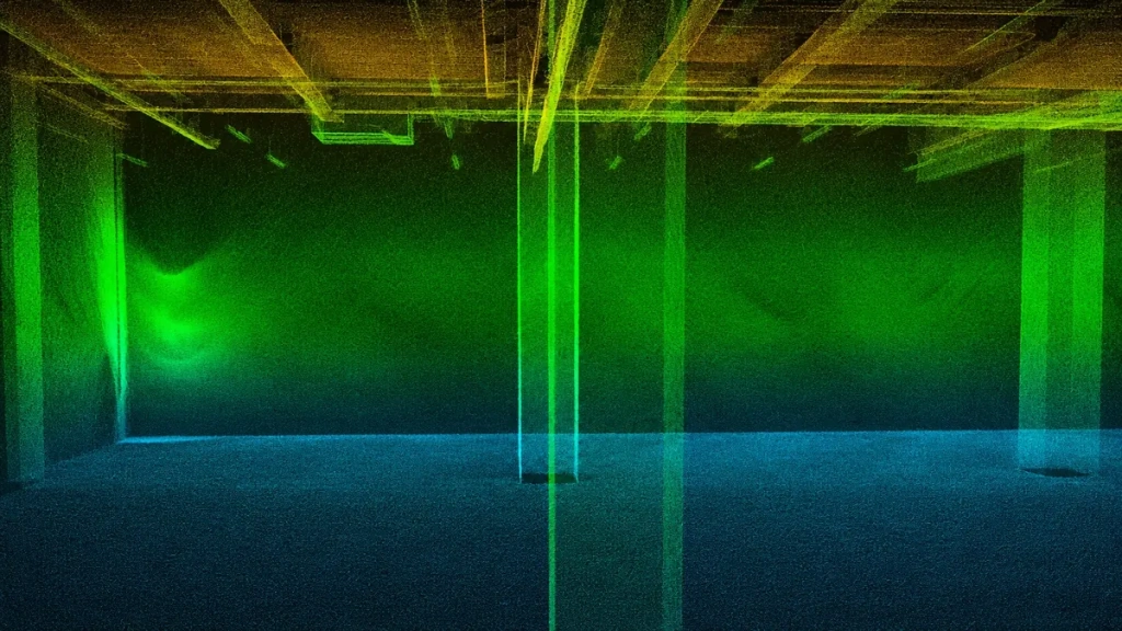
6.1. Colourised point cloud
A centimetre-level point cloud with the true scale of the scene. Distances, heights and areas are measured from it – this is the principal measurable product of the survey.
6.2. Panoramas tied to capture position
Panoramic images are stored not as a separate photo archive but with every frame tied to its position in space. This gives a traceable walkthrough of the site: moving from panorama to panorama along the actual survey trajectory.
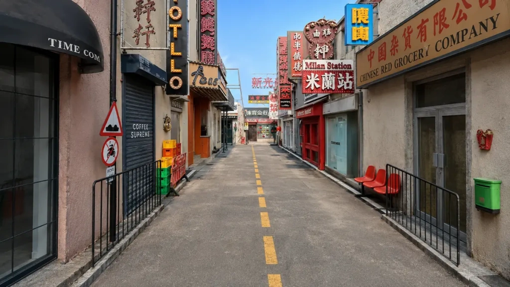
6.3. 3D Gaussian Splatting (3DGS) model
A photorealistic representation of the scene with free camera movement and walkthroughs along a defined path. The main applications are visualisation, digital twins, film and television, and cultural tourism projects.
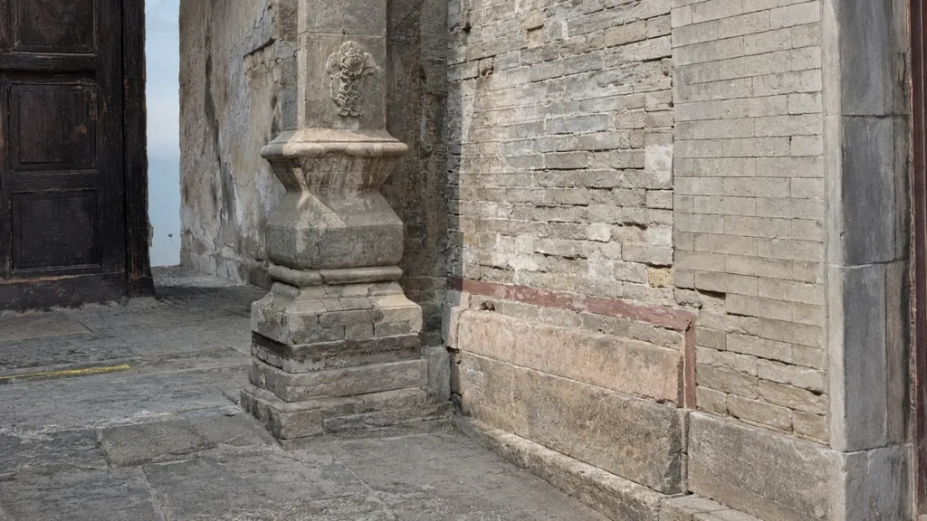
6.4. Mesh model
A lightweight triangular mesh with clean topology, suitable for rendering, visualisation and further editing.
6.5. BIM model
An engineering-grade information model with pipework, structures and dimensional annotations, which is passed on to the design office and to the construction site.
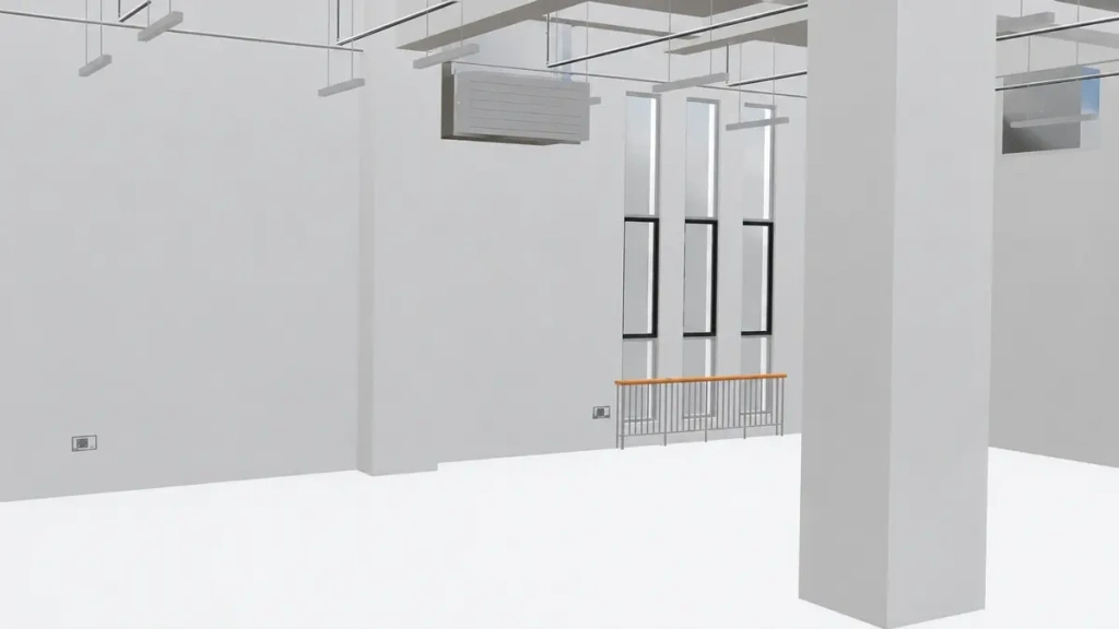
Important.As supplied, the system produces the point cloud, the pose-aware panoramas and the 3DGS model. The mesh and BIM models are also built from Pocket 3D data, but in third-party professional software. This is a separate stage of work with separate licences.
7. Software
7.1. SLAM GO POST Pro
The desktop processing package is included in the delivery set. It covers the full office workflow:
- building the point cloud from LiDAR data;
- stitching high-resolution panoramic images;
- generating the 3DGS model;
- reviewing the result, taking measurements and adding annotations;
- batch processing and project management;
- exporting data in formats compatible with third-party modelling software.
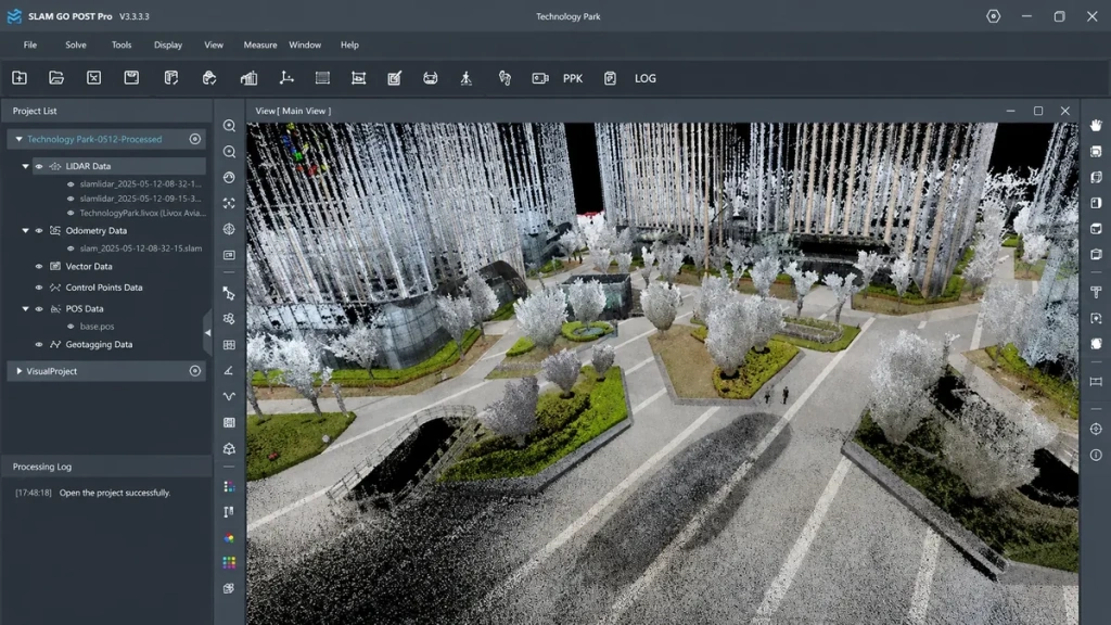
The export of camera poses together with the imagery deserves a separate mention. It allows Pocket 3D data to be fed into external reconstruction pipelines where a user already has a training workflow of their own.
7.2. Mobile application
The smartphone attaches to the unit on the magnetic mount and acts as a monitoring screen: the operator sees the scanning result in real time, during the walkthrough itself. This closes the very operational problem discussed in section 4: a failed capture shows up on site rather than several hours later at the workstation.
8. How a survey runs in the field
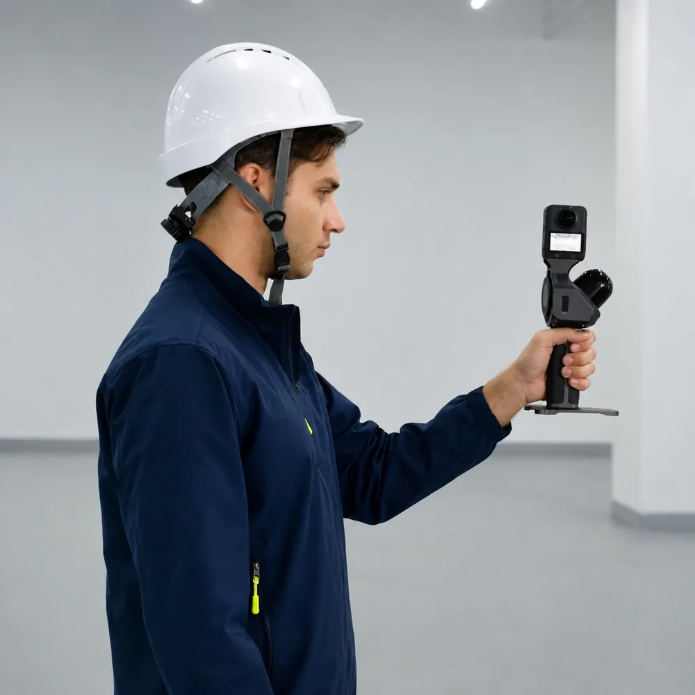
The procedure comes down to a minimum of actions: fit the 360° camera to the mount, attach the smartphone, switch the unit on, start the capture and walk the site along a route, closing loops and returning to the starting point. Processing is run in SLAM GO POST Pro in a single pass. The unit is carried throughout the walk: with a standard 360° camera the combination weighs around 0.9 kg and is held in one hand, leaving the other free for a door, a ladder or support.
Three parameters set the practical limits of a shift. Operating time is 3 hours at room temperature; the battery handle is removable, so a spare handle lifts the restriction on how long work can continue. The operating temperature range is −20 to +50 °C and relative humidity is below 95%. Storage is a 32 GB TF card, with offloading through the card reader supplied in the box.
9. Applications
The unit is designed for the rapid digitisation of spaces where correct scale is needed but millimetre-level surveying accuracy is not.
9.1. Industrial refurbishment and interiors
Capturing the existing condition of workshops, rooms and halls provides the basis for design decisions and for monitoring progress on site. For large spaces, complete coverage matters – scanning is continuous, with no need to set the unit up at individual stations.
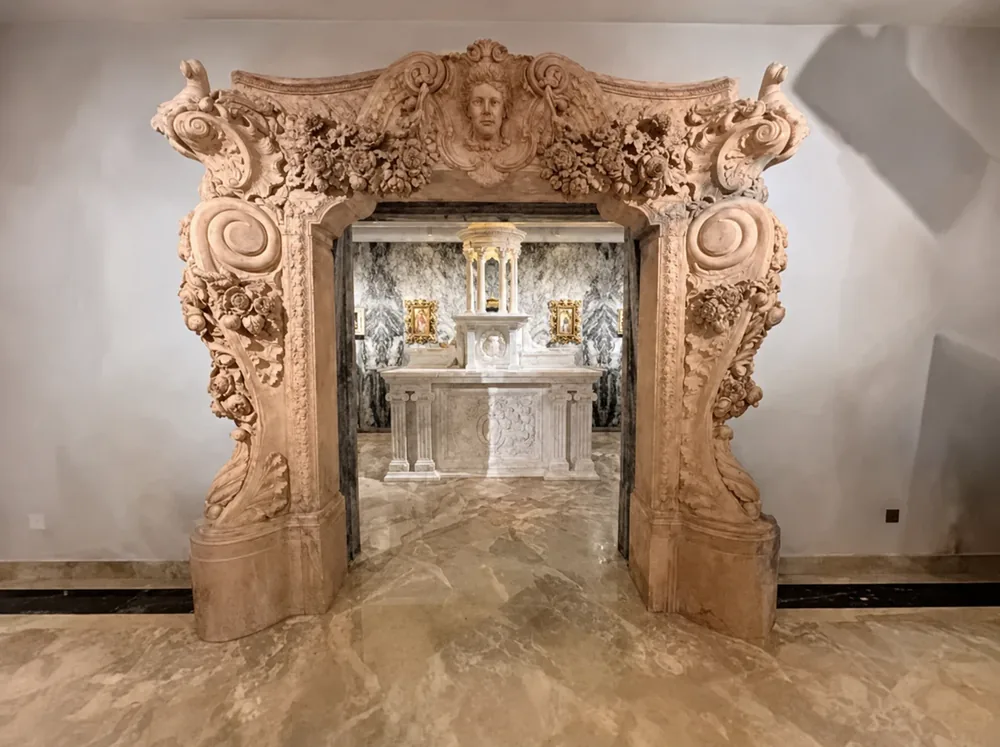
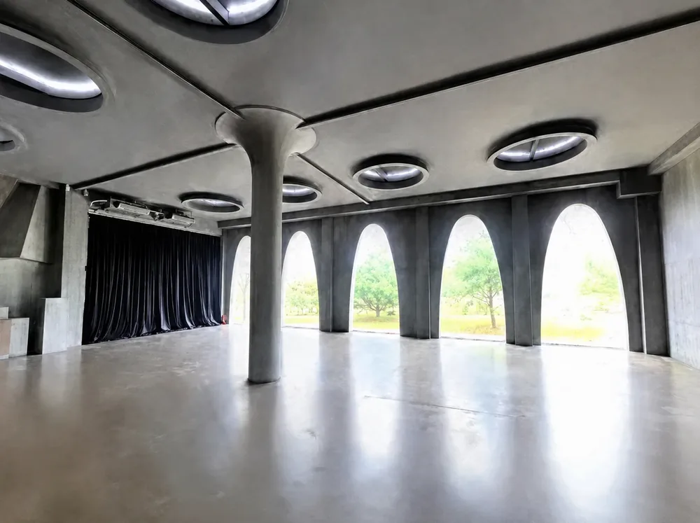
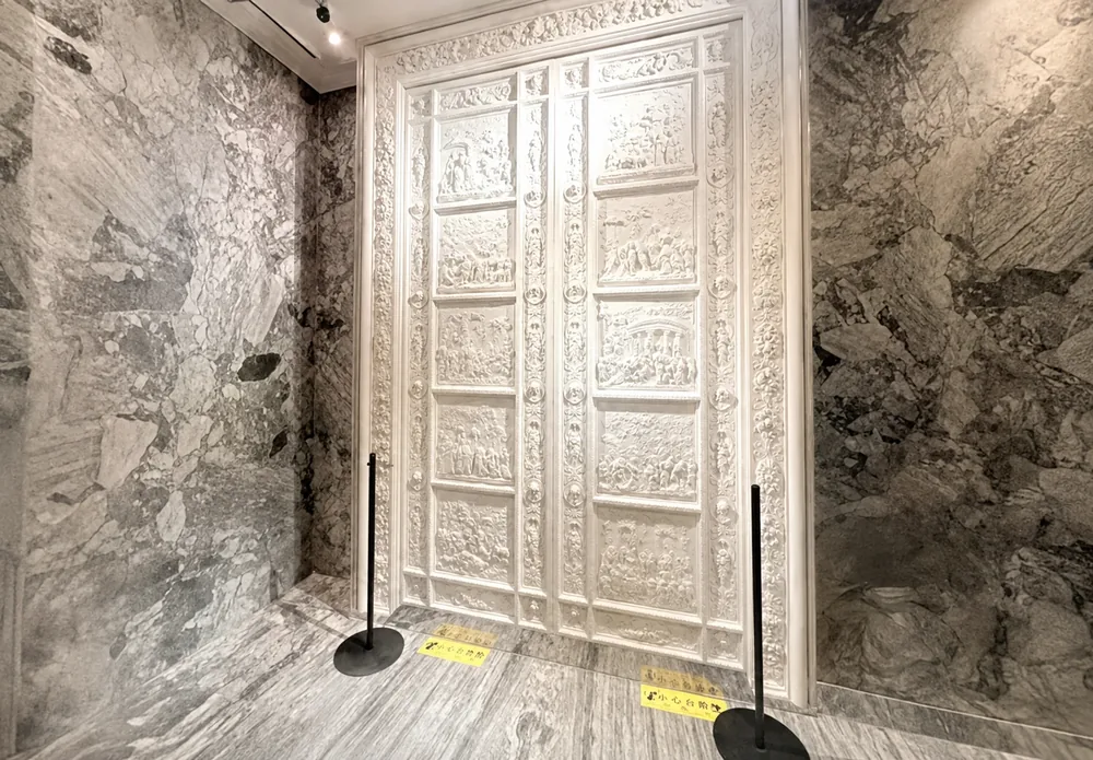
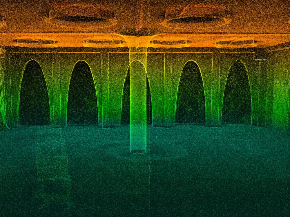
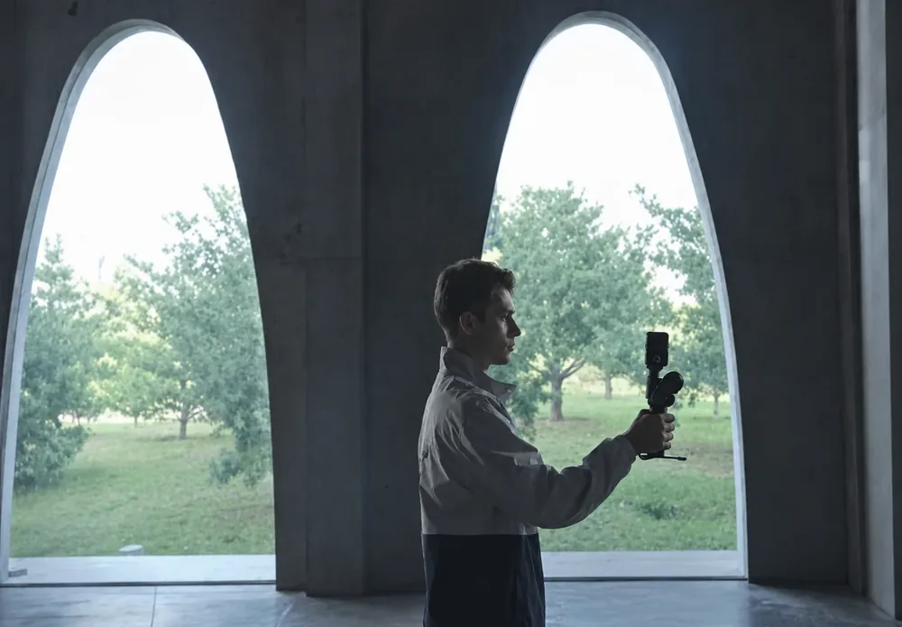
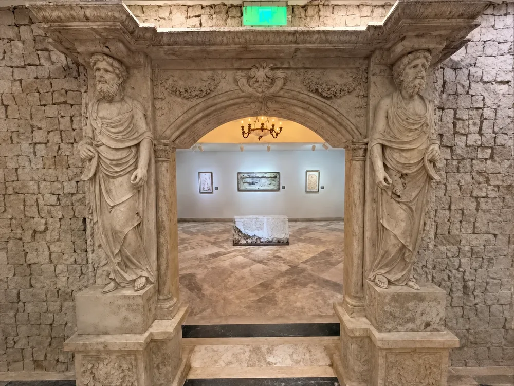
Figures 22–27.Refurbishment of industrial facilities and digitisation of exhibition spaces: real-world capture, point cloud and 3DGS model of one and the same site
9.2. Power engineering and road collision investigation
For substations, a high-accuracy three-dimensional model serves as the basis of a digital twin: inspection rounds, maintenance planning, clearance checks and safe operation. In road traffic collision investigation, speed is what matters: the scene is captured at 1:1 scale within minutes, which yields sound digital evidence for the subsequent enquiry.
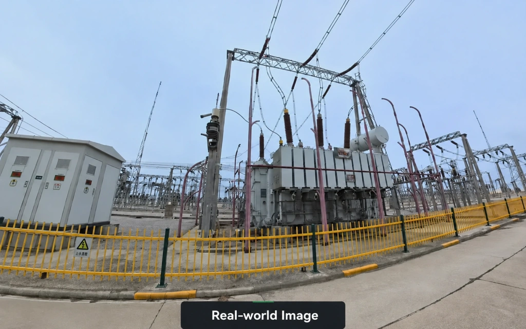
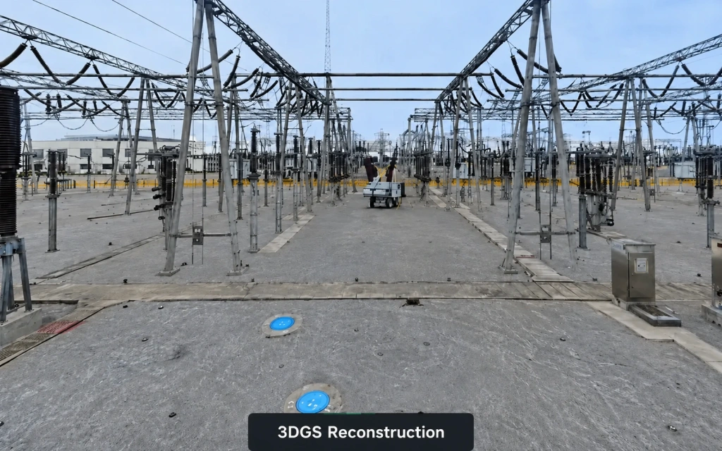
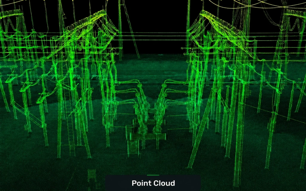
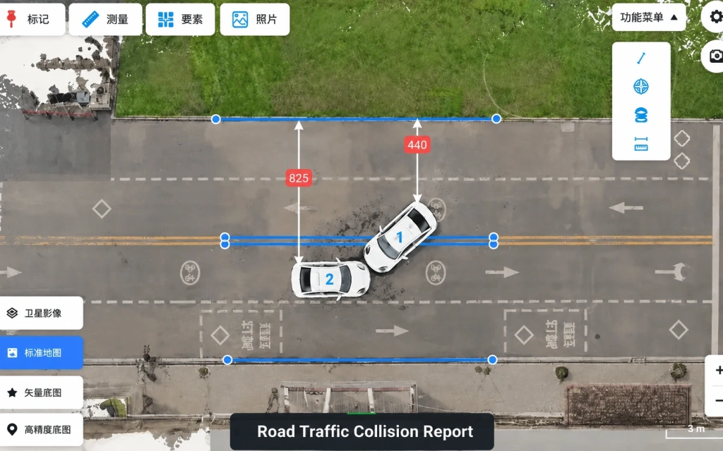
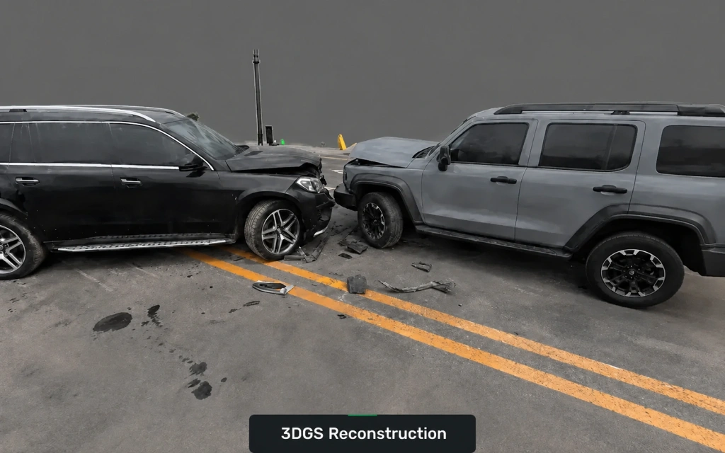
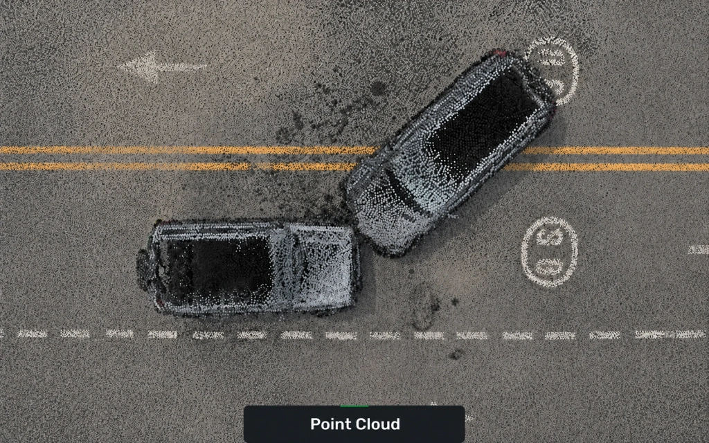
Figures 28–33.A digital twin of a substation and the capture of a road traffic collision scene
9.3. Cultural heritage and historic buildings
Rapid photorealistic capture of heritage assets and historic quarters with true dimensions preserved – for documentation, conservation projects and exhibition work.
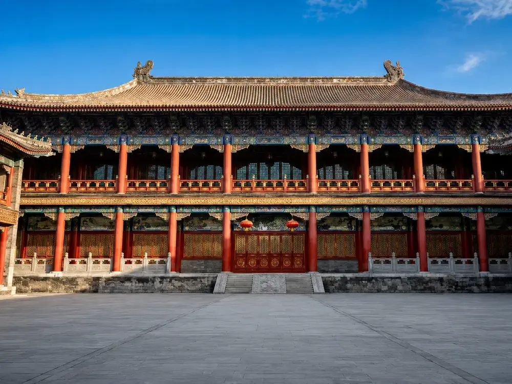
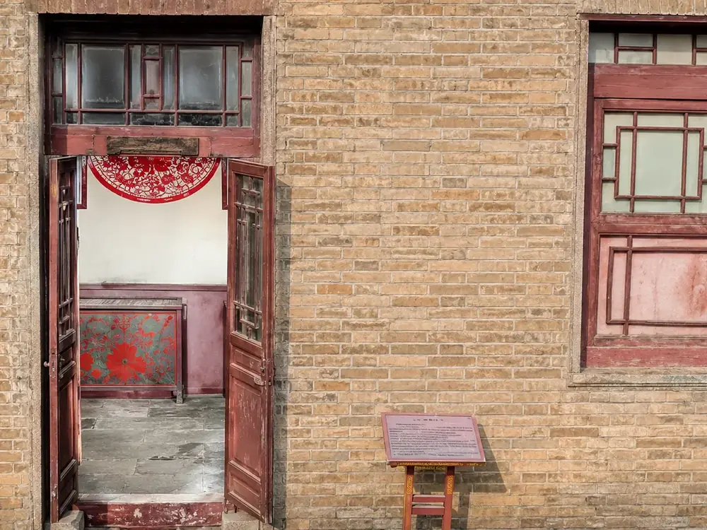
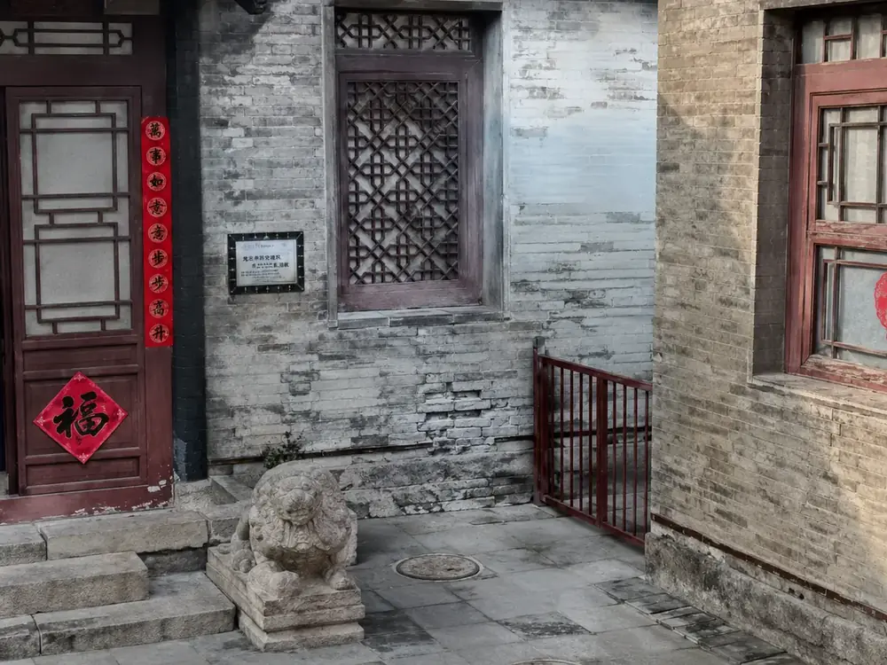
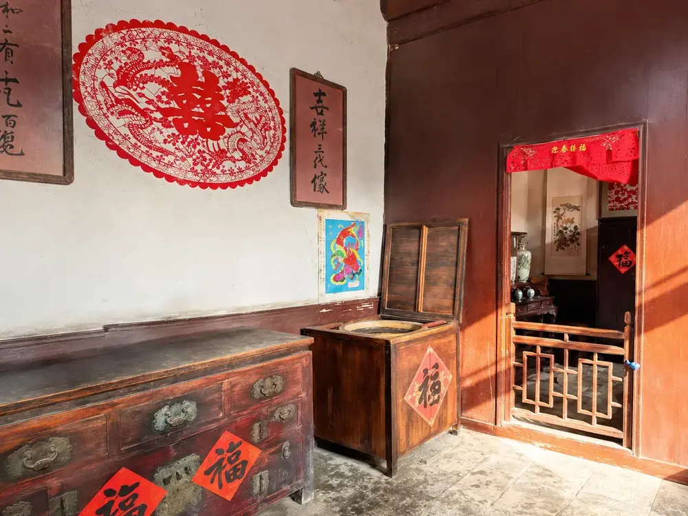

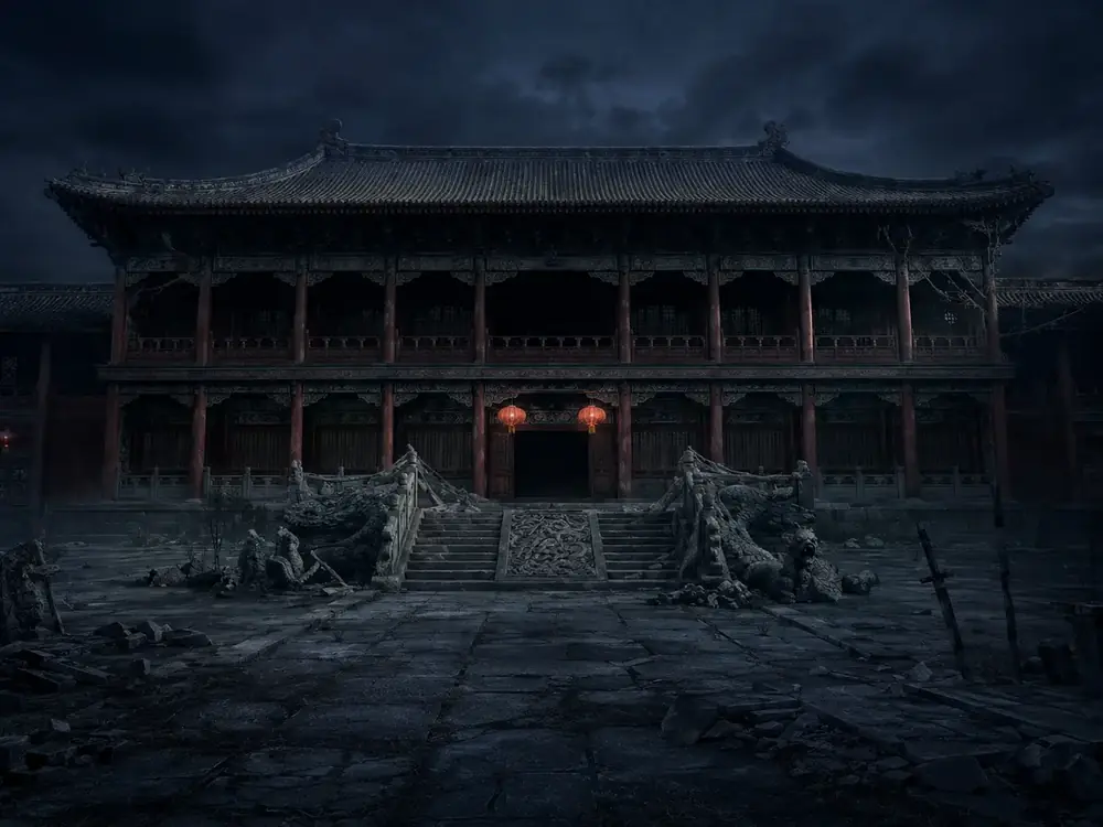
Figures 34–39.Cultural heritage assets and historic buildings in 3DGS models
9.4. Real2Sim: training robots and AI
A separate and fast-growing application is transferring real environments into simulation. Captured spaces become highly detailed 3DGS scenes in which navigation and manipulation algorithms are trained and artificial intelligence models are put through their paces.
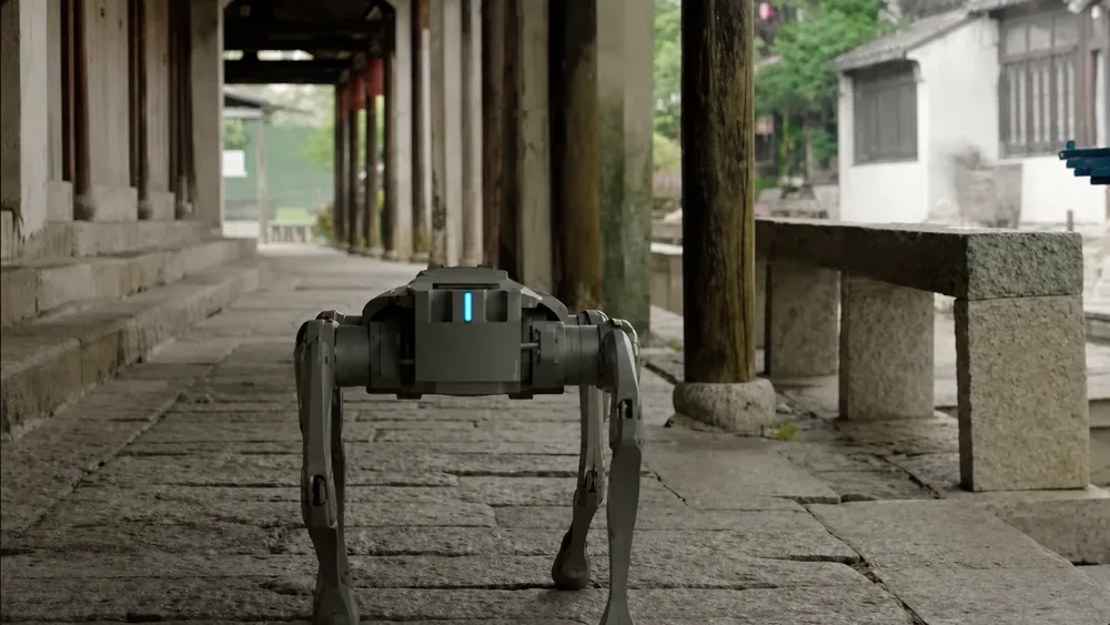
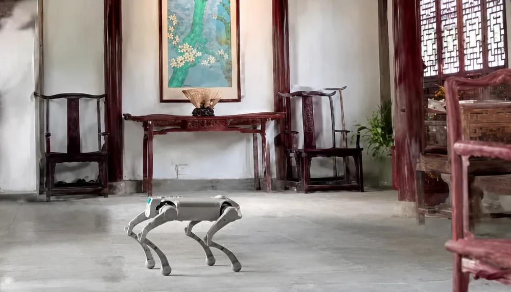
Figures 40–41.Real2Sim: real interiors carried over into a simulation environment for training robotics
9.5. Who the unit is aimed at first of all
- those who already own a 360° camera and regularly carry out 3DGS reconstruction or large-scale spatial digitisation;
- tasks involving rapid capture and three-dimensional reconstruction of small and medium sites, both indoors and outdoors: cultural tourism displays, preservation of a scene as found, and on-site scene reproduction;
- situations that need correct spatial scale but not millimetre-level accuracy: road collision investigation, forestry and landscape management, municipal assets and emergency mapping.
10. Limits of use: what Pocket 3D does not do
The unit is not intended for professional surveying work that requires millimetre-level measurement accuracy. Pocket 3D is positioned as a tool for rapid reality capture and centimetre-level spatial digitisation. It does not replace a total station or a professional surveying 3D scanner.
To this can be added several practical limitations that follow from the specification:
- No GNSS module.The unit builds its trajectory and cloud in a local coordinate system. If the result is needed in a national or site coordinate system, georeferencing to ground control points will be required.
- A working radius of 30 m against dark surfaces.Large open spaces and tall structures will call for a denser network of routes.
- A vertical field of view of 40°.Upper storeys and ceiling zones need particular attention when planning a walkthrough.
- 3DGS quality is governed by the camera and the capture conditions.The unit does not compensate for blurred or overexposed frames: the chosen 360° camera and its settings are responsible for the visual side.
11. Conclusion
Pocket 3D fills a specific technological gap. Consumer 360° cameras have long been good enough for photorealistic reconstruction; the bottleneck was never the optics but stable camera pose estimation and the true scale of the scene. LiDAR SLAM provides both, while the modular architecture makes a built-in panoramic module unnecessary and lets the camera be upgraded independently of the scanner.
The resulting tool occupies its niche honestly: 700 g, three hours of operation, centimetre-level accuracy, four types of output model and a single walkthrough of the site instead of setting the unit up station by station. It does not claim to replace a total station or a professional scanner, but where a fast, measurable digital copy of a space is needed, the combination of LiDAR and your own 360° camera looks engineering-sound.
An enquiry about Pocket 3D can be sent from the product page. Other mobile SLAM scanners can be found in the corresponding section of the catalogue.