
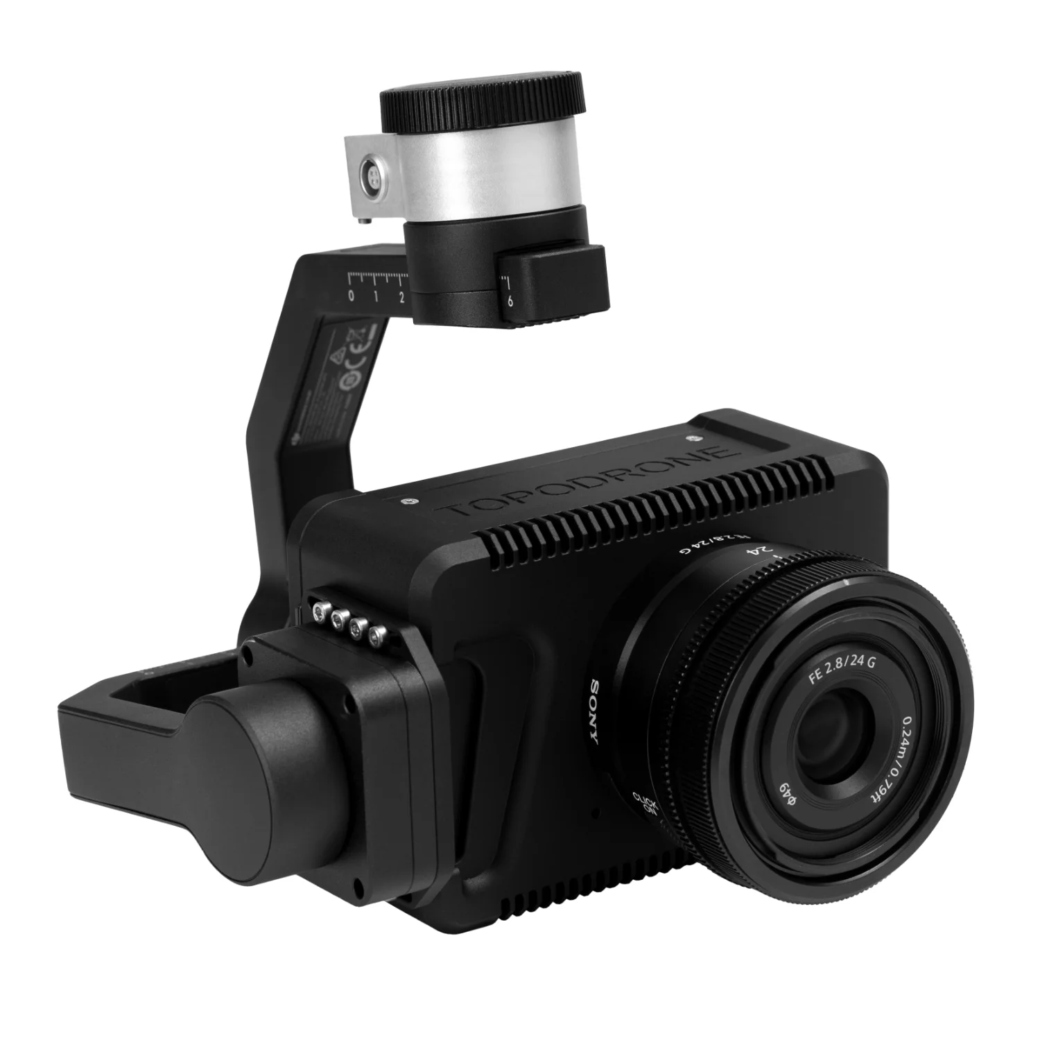
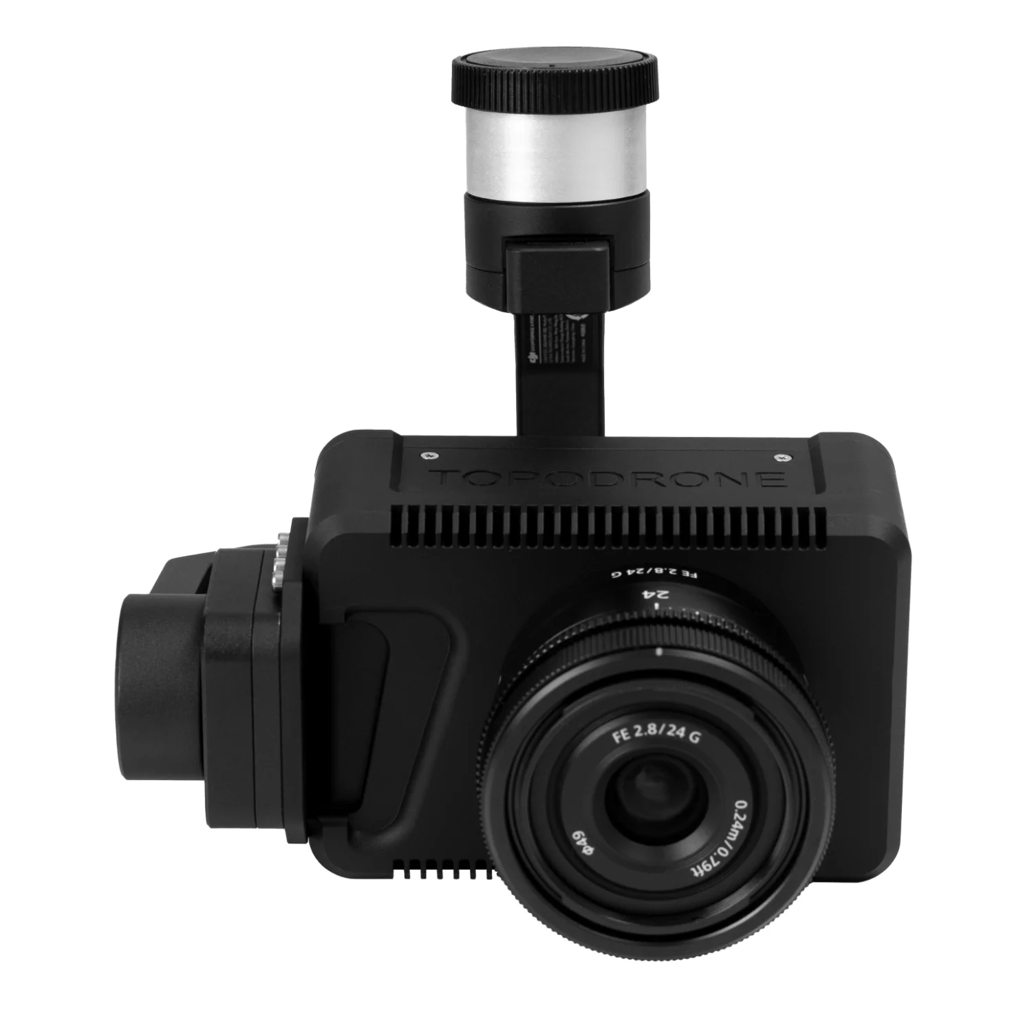
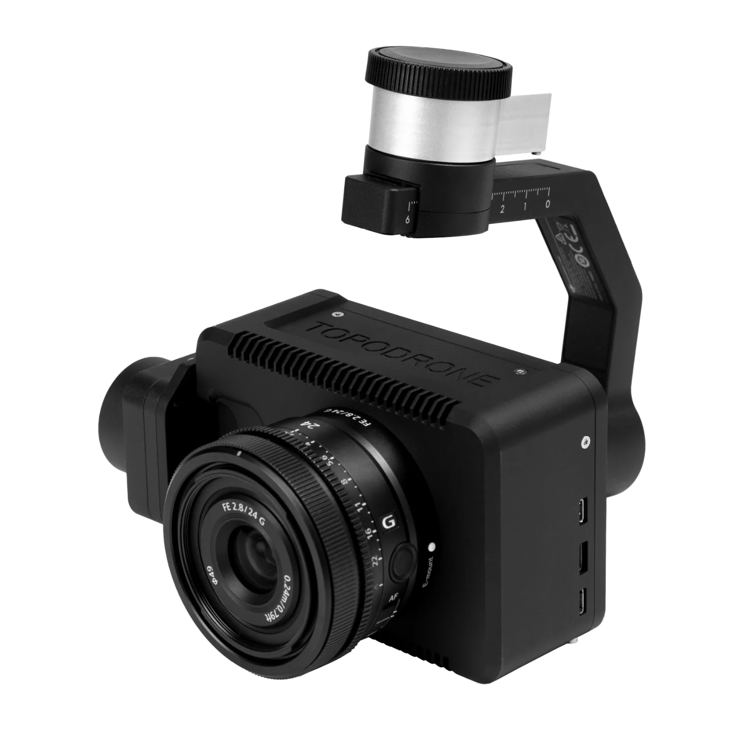
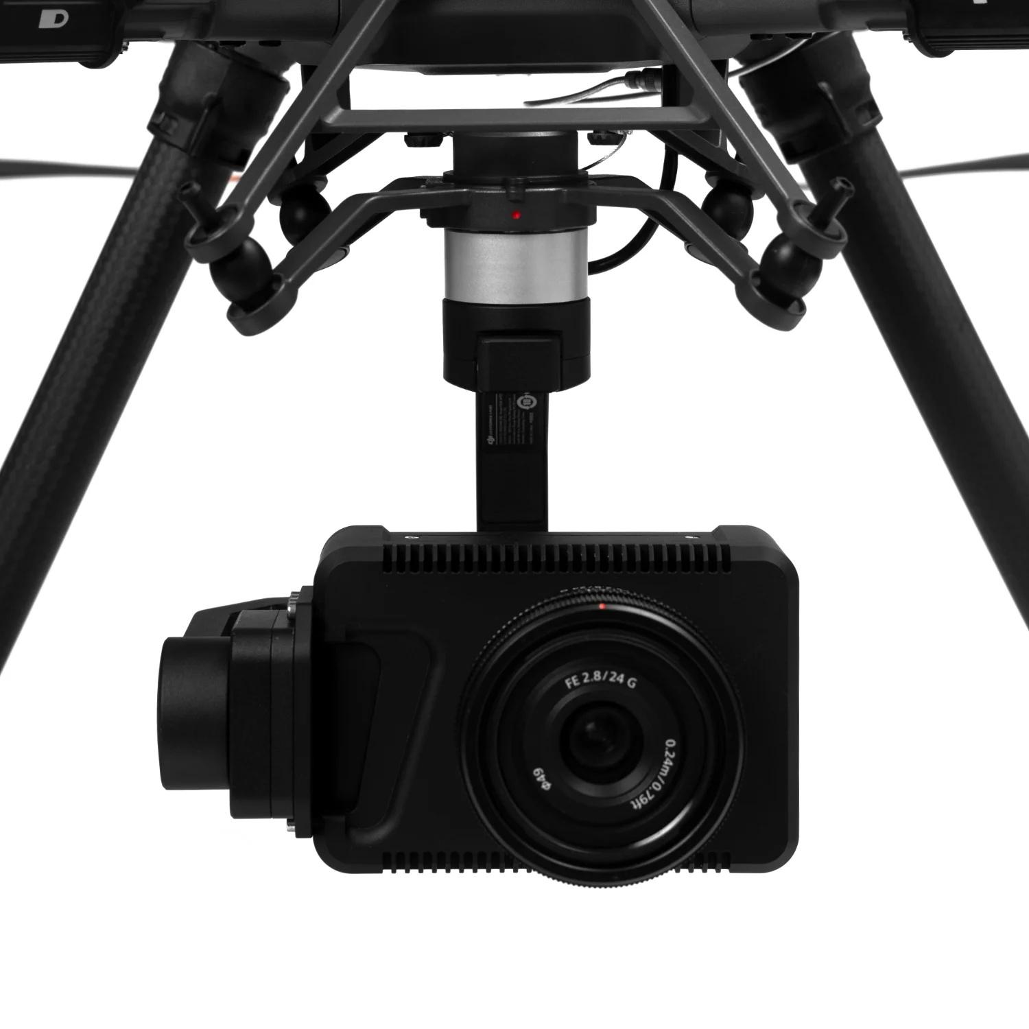
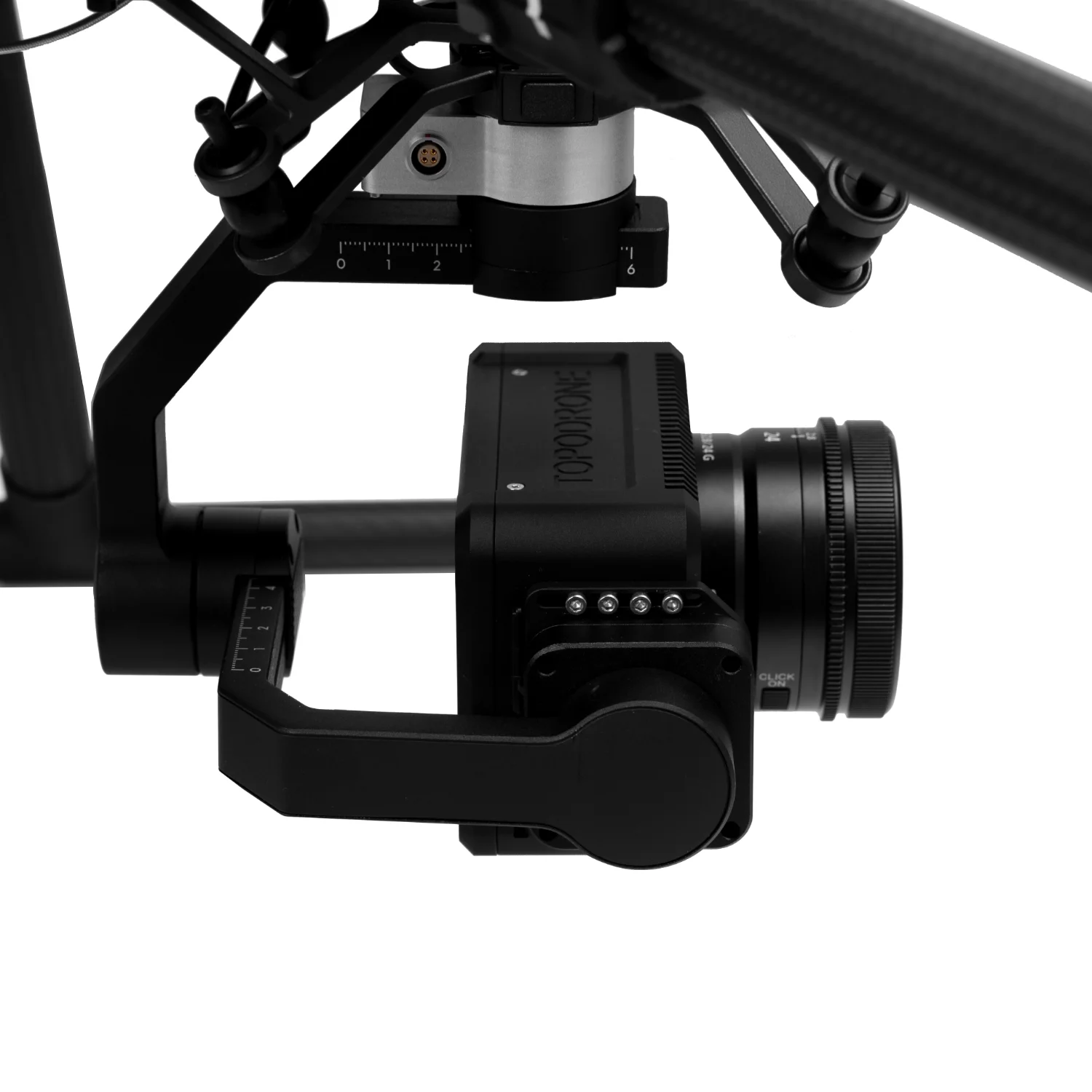
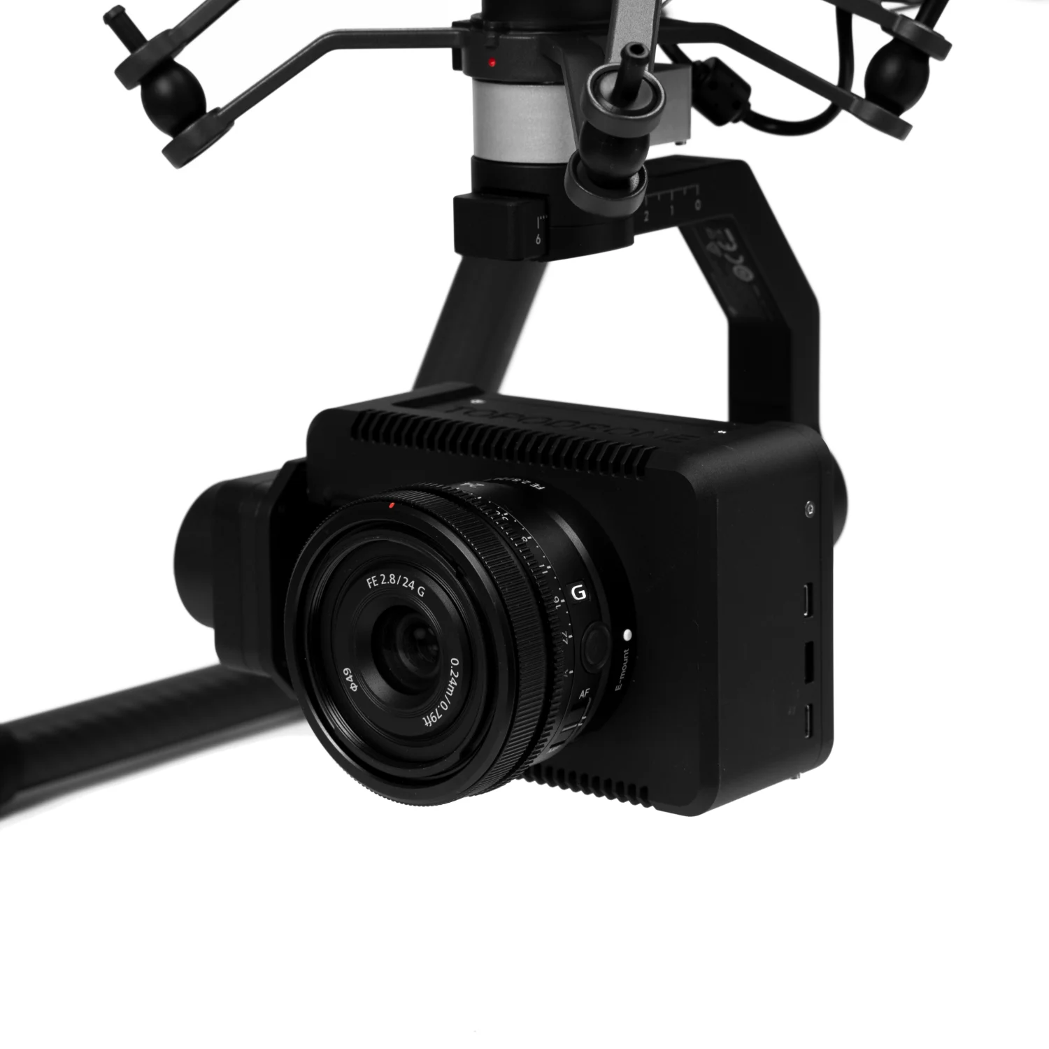

TOPODRONE PT61 with DJI X-Port
TOPODRONE PT61 is an advanced 61 MP full-frame camera with an integrated thermal imager. Fully compatible with the DJI Matrice ecosystem, the PT61 delivers high-precision aerial imaging, mapping, inspection, and thermal monitoring in all operating conditions.
Main Advantages:
- 61 MP full-frame camera with a mechanical shutter for ultra-sharp, highly detailed imagery.
- Integrated thermal imager for accurate temperature measurement and visualisation of thermal anomalies.
- Full integration with DJI Pilot — camera control, configuration, and live video streaming directly from the operator’s controller.
- High-precision PPK post-processing (3–5 cm accuracy without ground control points).
- Flexible customisation with support for multiple lenses (16 mm, 24 mm, 35 mm, 50 mm, multispectral options).
- Remote camera control and full parameter adjustment via the drone’s remote controller.
- Multi-constellation positioning support — GLONASS, GPS, BeiDou, Galileo, SBAS, QZSS.
Technical Specifications:
Camera
- Sensor: full-frame CMOS, 35.7 × 23.8 mm,
- Effective resolution: 61 MP (9504 × 6336 px),
- ISO: 100–32000,
- Operating temperature: −20°C to +50°C,
- Supported lenses: 16 mm, 24 mm, 35 mm, 50 mm, multispectral,
- Camera control and configuration via drone controller,
- Real-time video transmission to the RC,
- Weight: 920 g (with gimbal) / 570 g (without gimbal).
Thermal Imaging Sensor
- Sensor type: uncooled VOx microbolometer,
- Resolution: 320 × 256 or 640 × 512 px (on request),
- Frame rate: 30 Hz,
- Thermal sensitivity: <40 mK @ f/1.0,
- Calibration: factory NUC,
- Field of view: 4° to 95° HFOV.
GNSS (Positioning)
- Receiver type: PPK GNSS, 1408 channels,
- Logging rate: 20 Hz,
- Positioning accuracy: 3–5 cm,
- Supported constellations: GLONASS, GPS (L1C/A, L2C, L5), BeiDou, Galileo, SBAS, QZSS,
- Operation without ground control points: Yes,
- GNSS data recording to microSD: Yes.
Applications
Energy and utilities: thermal inspection of power lines and electrical equipment, identification of overheating points.
Construction and infrastructure: roof and façade thermal surveys, detection of heat loss zones.
Solar farms: detection of faulty or overheating photovoltaic panels.
Agriculture: crop and soil condition analysis, monitoring of plant health and moisture levels.
Search and rescue: locating people in remote areas, fog, smoke or low-light conditions.
Fire safety: identification of fire hotspots even in dense smoke.
Warranty
12 months.