
LiDAR360 Forestry, Next Version Upgrade
LiDAR360 Forestry is a specialised module for the analysis, assessment, and management of forest resources. Designed for professionals in forestry, environmental monitoring, and natural resource management, it provides high-precision LiDAR data processing and in-depth stand analysis.
Upgrade Licence (Upgrade to the Next Major Version)
A one-time upgrade of an existing licence to the next major version of the module.
Terms:
- Applicable to previous versions (e.g. V8 → V9).
- Upgrading is sequential — skipping versions is not permitted (e.g. V6 → V7 → V8).
- Major upgrade (transition to the next main version).
- Minor updates (patches and builds containing fixes and improvements) — free for 1 year.
- Technical support is extended for the full duration of the upgraded licence.
Main Features:
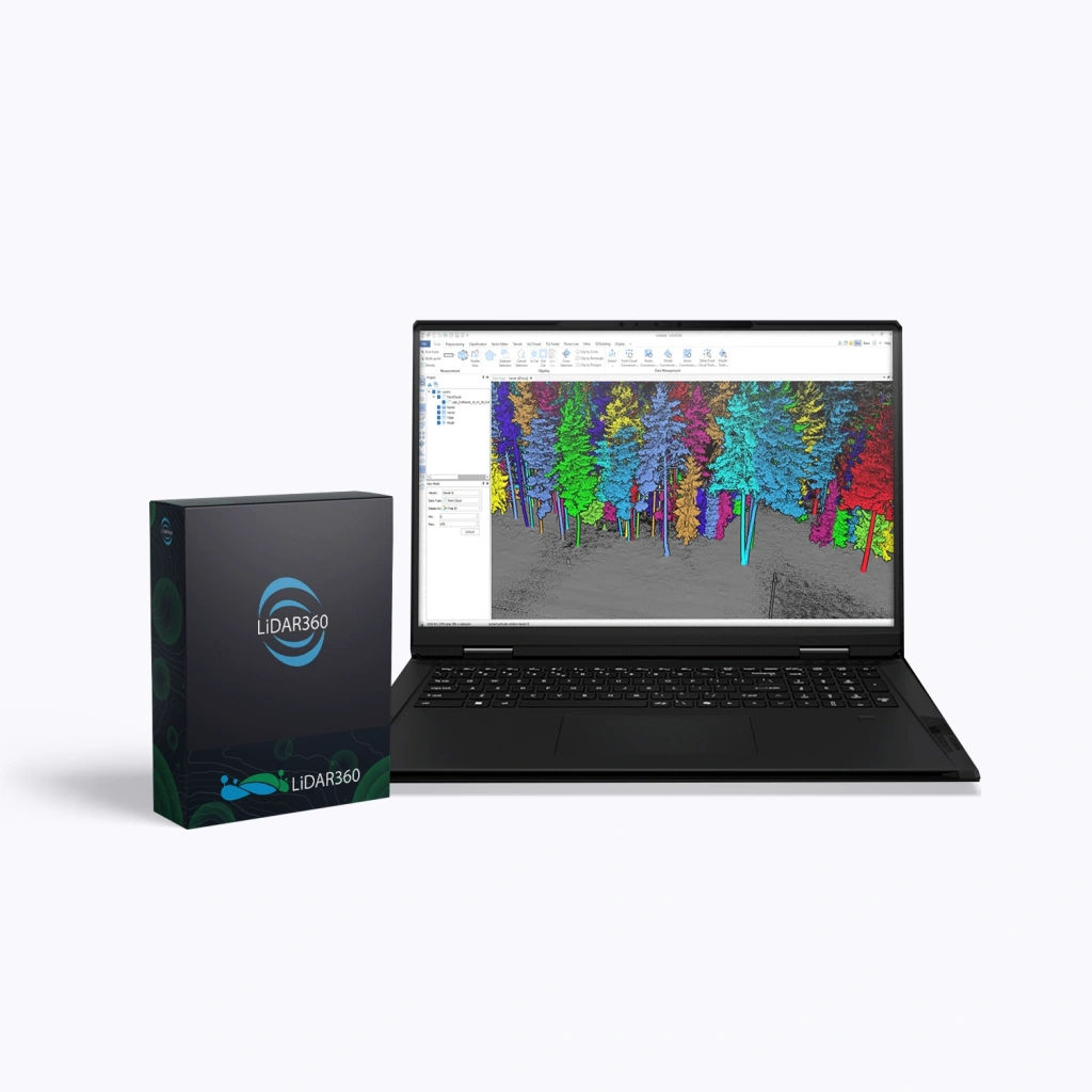
- AI-based tree segmentation: automatic detection and delineation of individual trees using artificial intelligence algorithms for various data types (aerial, terrestrial, and mobile scanning).
- Tree parameter extraction: calculation of over 18 tree-level attributes including height, diameter, volume, crown structure, and more.
- Stand and forest inventory analysis: computation of more than 90 stand-level metrics — density, timber volume, biomass, species composition, and age-class distribution.
- Change monitoring: detection of growth dynamics, forest degradation, and structural changes to support decision-making in conservation and sustainable forest management.
- Visualisation and export: clear presentation of analytical results and seamless integration with other LiDAR360 modules as well as GIS and CAD systems.
Who LiDAR360 Forestry Is For:
LiDAR360 Forestry is ideal for forestry agencies, research institutes, environmental organisations, and companies involved in natural resource management. The module enhances forest inventory accuracy, accelerates analytical workflows, and enables data-driven decision-making based on objective, measurable indicators.
Conclusion
LiDAR360 Forestry is a powerful solution for digital forest analysis and planning of forest management activities. A perpetual licence ensures long-term stability, predictable costs, and complete independence from subscription-based models.
Increase the efficiency of your forest resource management and adopt modern analytical technologies with LiDAR360 Forestry.
Upgrade your licence today!