
3Dsurvey RTK Videogrammetry, 1 Year
5
Art. TDCH8507
$580
Specifications
Warranty
:
12 months
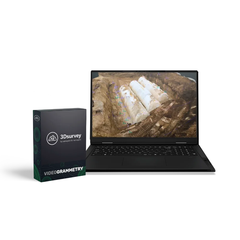
3Dsurvey RTK Videogrammetry is a module for fast and accurate documentation of construction and engineering assets using video. The tool makes it possible to create realistic 3D terrain models using video footage, satellite positioning data, and RTK corrections, which ensures centimetre-level accuracy without traditional photogrammetric flights or complex scanners. This approach is ideal for construction sites, underground utilities, pipelines, and linear infrastructure where regular condition recording and subsequent change analysis are required.
RTK Videogrammetry Licence for 1 Year
The licence provides access to the additional RTK Videogrammetry module for 12 months with the option for further renewal.
Advantages:
- High capture speed — recording an object in video mode without complex settings.
- RTK-level accuracy — the 3Dsurvey SiteScan mobile app uses reference station data to correct GPS errors.
- Compatibility with popular devices — supports GNSS receivers Emlid Reach RX, Trimble® DA2, ArduSimple and Stonex S580+.
- Android support — the SiteScan app is available for Android 10 and higher.
- Intelligent processing — automatic creation of 3D models, profiles, as well as depth, volume, and distance measurements.
- Easy implementation — all you need to get started is a smartphone, an RTK receiver, and the app.
Functionality:
- Georeferenced video capture — recording video footage linked to RTK coordinates.
- Building 3D models from video — creating accurate spatial models based on the recorded material.
- Measurements and analysis — extracting distances, depths, profiles, and volumes.
- Integration with NTRIP services — receiving corrections from network base stations.
- 3Dsurvey SiteScan mobile app — capture control, RTK connection settings, accuracy monitoring.
- User guides and demo datasets — access to training materials and sample projects for self-testing.
- Compatibility with 3Dsurvey 3.0 and above — the module easily connects as an additional extension to the main platform.
Ideally suited for:
- Construction and engineering companies;
- Surveying and cadastral services;
- Organisations performing monitoring of underground networks and infrastructure;
- Designers and BIM specialists.
Loading...
Common
Warranty
12 months