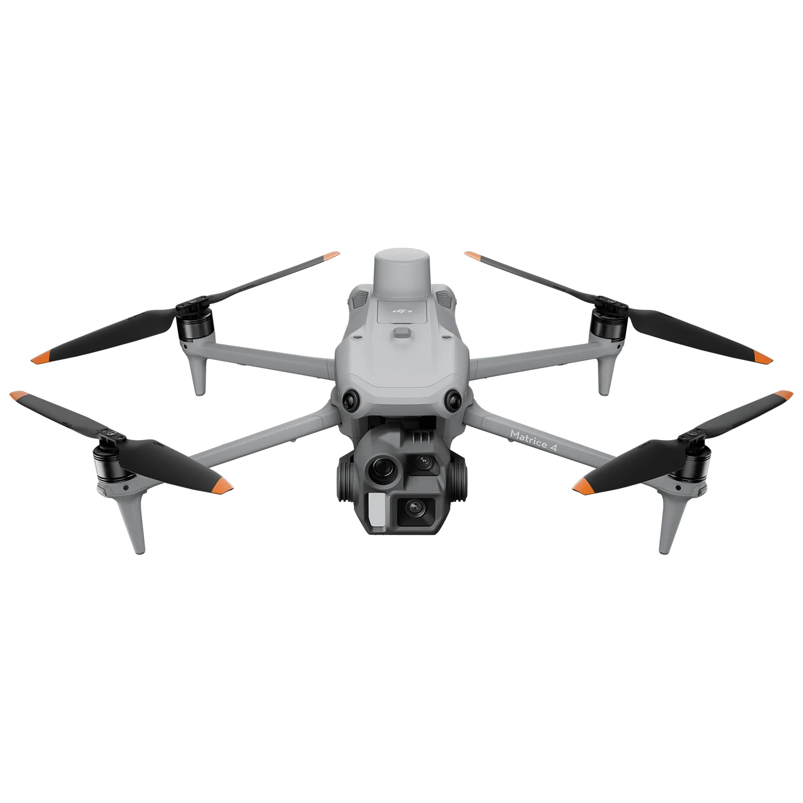
Knowledge base
Blog
Services
  • Surveying equipment development
    • Drone and VTOL camera development
    • LiDAR development for your brand
  • Surveying services
    • Bathymetric survey service
    • Laser scanning and photogrammetry data processing
    • Laser scanning service
    • Photogrammetry service
  • Surveyor training
    • Comprehensive training in flight and data processing
Company
  • Staff
  • News
  • Reviews
  • Vacancy
  • Licenses
  • Documents
  • Partners
Information
  • Requisites
Brands
Contacts
    +41 21 588 02 11
    +41 21 588 02 11 09:00-18:00 whatsapp.svg
    Sales [email protected] email.png
    Support [email protected] email.png
    Telegram Channel @topodronesa tg.svg
    Telegram Chat @topodronesagroup tg.svg
    Telegram Bot @topodronecombot tg.svg
    Facebook @topodronesa ycz1c9257s6gh7g315r8q6tob3bnddba.png
    Youtube @topodronesa youtube.png
    LinkedIn @topodrone 9ratq3v3eavnhupo1akvxp0sbx4vopj5.png
    X @topodrone twitter.png
    Instagram @topodrone tpxkj71axu6dxt423lwj5idzwcej1njx.png
    Email
    [email protected] - Sales
    [email protected] - Support
    The address
    TOPODRONE SA, Rue de la Gare 13, 1820 Montreux, Switzerland
    Working hours
    10:00-18:00
    TOPODRONE
    SPH Engineering
    3Dsurvey
    Velodyne
    DJI
    GreenValley International
    Honeywell
    Fixar
    Blue Marble Geographics
    Sony
    Agisoft
    EMLID
    Pix4D
    Autel Robotics
    SHAREUAV
    • LiDAR
      LiDAR
      • Aerial Survey LiDAR
      • SLAM Survey LiDAR
      • LiDAR Accessories
    • Bathymetry
      Bathymetry
    • Photogrammetry
      Photogrammetry
      • Mapping Drones
      • Drone Mapping Cameras
      • VTOL Mapping Cameras
    • PPK Upgrade Kits
      PPK Upgrade Kits
      • PPK for Drones
      • PPK for any UAV
    • Spectrography
      Spectrography
      • Thermal
      • Multispectral
    • UAV
      UAV
      • DJI
      • Autel Robotics
      • FIXAR
      • Innotech drone
    • Payload
      Payload
      • Aerial Survey LiDAR
      • Bathymetric Scanner
      • Photogrammetric Cameras
      • Thermal Cameras
      • Multispectral Cameras
      • Beacon
    • Software
      Software
      • TOPODRONE
      • UgCS
      • Agisoft
      • 3Dsurvey
      • LiDAR360
      • DJI
      • PIX4D
    • GNSS Equipment
      GNSS Equipment
      • EMLID
      • DJI
    TOPODRONE – LiDAR & UAV Survey
    Log in
    0 Comparison
    0 Favorites
    0 Cart
    TOPODRONE – LiDAR & UAV Survey
    Log in
    0 Comparison
    0 Favorites
    0 Cart
    TOPODRONE – LiDAR & UAV Survey
    Telephones
    +41 21 588 02 11 09:00-18:00 whatsapp.svg
    Sales [email protected] email.png
    Support [email protected] email.png
    Telegram Channel @topodronesa tg.svg
    Telegram Chat @topodronesagroup tg.svg
    Telegram Bot @topodronecombot tg.svg
    Facebook @topodronesa ycz1c9257s6gh7g315r8q6tob3bnddba.png
    Youtube @topodronesa youtube.png
    LinkedIn @topodrone 9ratq3v3eavnhupo1akvxp0sbx4vopj5.png
    X @topodrone twitter.png
    Instagram @topodrone tpxkj71axu6dxt423lwj5idzwcej1njx.png
    Email
    [email protected] - Sales
    [email protected] - Support
    The address
    TOPODRONE SA, Rue de la Gare 13, 1820 Montreux, Switzerland
    Working hours
    10:00-18:00
    0
    0
    0
    • Cabinet
    • 0 Compare
    • 0 Favorite
    • 0 Cart
    • Brands
    • Sales
    • Services
      • Services
      • Surveying equipment development
        • Surveying equipment development
        • Drone and VTOL camera development
        • LiDAR development for your brand
      • Surveying services
        • Surveying services
        • Bathymetric survey service
        • Laser scanning and photogrammetry data processing
        • Laser scanning service
        • Photogrammetry service
      • Surveyor training
        • Surveyor training
        • Comprehensive training in flight and data processing
    • Company
      • Company
      • Staff
      • News
      • Reviews
      • Vacancy
      • Licenses
      • Documents
      • Partners
    • Blog
    • Information
      • Information
      • Requisites
    • Contacts
    +41 21 588 02 11 09:00-18:00
    • Telephones
    • +41 21 588 02 11 09:00-18:00
      whatsapp.svg
    • Sales [email protected]
      email.png
    • Support [email protected]
      email.png
    • Telegram Channel @topodronesa
      tg.svg
    • Telegram Chat @topodronesagroup
      tg.svg
    • Telegram Bot @topodronecombot
      tg.svg
    • Facebook @topodronesa
      ycz1c9257s6gh7g315r8q6tob3bnddba.png
    • Youtube @topodronesa
      youtube.png
    • LinkedIn @topodrone
      9ratq3v3eavnhupo1akvxp0sbx4vopj5.png
    • X @topodrone
      twitter.png
    • Instagram @topodrone
      tpxkj71axu6dxt423lwj5idzwcej1njx.png
    • [email protected] - Sales
      [email protected] - Support
    • TOPODRONE SA, Rue de la Gare 13, 1820 Montreux, Switzerland
    • 10:00-18:00
    Main
    Products
    Photogrammetry
    Mapping Drones
    DJI Matrice 4E
    DJI Matrice 4E
    DJI Matrice 4E
    DJI Matrice 4E
    DJI Matrice 4E
    DJI Matrice 4E
    DJI Matrice 4E
    DJI Matrice 4E
    DJI Matrice 4E
    DJI Matrice 4E
    DJI Matrice 4E
    DJI Matrice 4E
    DJI Matrice 4E

    DJI Matrice 4E

    5
    Art. TDCH6131
    $4 700
    Available
    Specifications
    Warranty : 12 months
    $4 700
    Available
    • Description
    • Reviews
    • Specifications

    DJI Matrice 4E is a cutting-edge industrial platform that combines powerful optics, advanced sensors and intelligent flight algorithms. Purpose-built for surveying, construction, mining and other professional applications, the Matrice 4E marks a new era in precision aerial imaging and mapping.

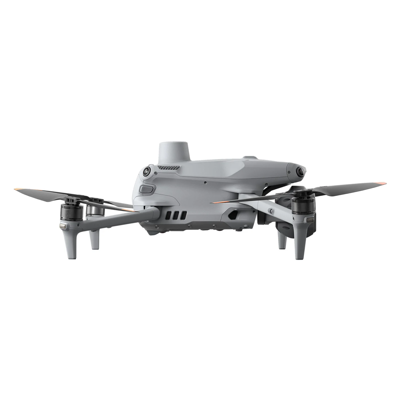
    The aircraft integrates three high-grade cameras and a laser rangefinder, delivering detailed observation, measurement and imaging with exceptional accuracy. Its compact airframe, refined aerodynamics and intelligent features make the Matrice 4E a robust tool for enterprise operations where reliability, stability and data precision are paramount.

    Key Advantages of the DJI Matrice 4E

    • Multi-sensor observation system — wide-angle, medium telephoto and long-range cameras work in synergy, capturing both broad overviews and the finest structural details.
    • Precision laser ranging — the built-in rangefinder measures distances up to 1,800 metres with minimal error, enabling accurate terrain modelling and 3D map generation.
    • Maximum mapping efficiency — flight speeds up to 21 m/s and a shooting interval of 0.5 s ensure rapid coverage of large survey areas.
    • Intelligent automation — Smart Track, FlyTo and POI modes allow complex missions to be executed hands-free, boosting operator productivity.
    • Outstanding link stability — the O4 Enterprise transmission system delivers a robust signal at ranges of up to 25 km.

    Functionality

    1. Intelligent imaging and analysis

    The system automatically recognises vehicles, vessels and infrastructure, streamlining data collection during inspections and search-and-rescue operations. Support for high-resolution panoramas and intelligent tracking makes documentation fast, accurate and effortless.

    2. Laser rangefinder — a precision measurement tool

    With point designation, line measurement and area-calculation functions, the Matrice 4E becomes a mobile surveying instrument. Operators can quickly determine object coordinates, assess areas and share data via DJI Pilot or FlightHub 2.

    3. Advanced optics for any mission

    • Wide-angle camera: 20 MP, 4/3 CMOS sensor, mechanical shutter.
    • Medium telephoto camera: 48 MP, 1/1.3" CMOS, 70 mm focal length — ideal for structural and powerline inspections.
    • Telephoto camera: 48 MP, 1/1.5" CMOS, 168 mm focal length — captures fine detail at distances up to 250 m.

    4. Advanced imaging modes

    • Electronic Dehazing — removes haze electronically for clearer imagery in foggy or polluted conditions.
    • Smart 3D Capture — intelligent 3D-model creation and automated route planning for repeatable flights.
    • Distortion Correction 2.0 — optical calibration with distortion reduced to as little as 2 pixels.

    5. Flight efficiency and safety

    • The Fusion Positioning System combines RTK, GNSS and visual positioning, ensuring stable hover and precise return-to-home even when satellite signals are compromised.
    • Intelligent route planning with terrain-aware maps enables obstacle avoidance and safe operation in complex environments, including mountainous and urban areas.
    • A 5-directional sensing suite and downward sensors prevent collisions, protecting both the aircraft and its surroundings.

    6. Communications and control

    DJI RC Plus 2 Enterprise

    The controller features a bright display with IP54 protection and an operating range from −20 °C to +50 °C. It supports hybrid O4 Enterprise + 4G transmission, maintaining stable video links even in densely populated or remote areas.

    O4 Enterprise Video Transmission

    Video transmission with bandwidth up to 20 MB/s and a range of up to 25 km. An eight-antenna system ensures uninterrupted control and reliable data synchronisation.

    Additional accessories and ecosystem

    • DJI AL1 Spotlight — illuminates targets up to 100 m away with full gimbal synchronisation.
    • DJI AS1 Loudspeaker — broadcasts messages up to 300 m; supports live audio and text-to-speech output.
    • D-RTK 3 Station — centimetre-level positioning accuracy, support for multiple aircraft and repeater mode.
    • DJI Power 1000 Energy Station — charges batteries at up to 200 W, full charge in 48 minutes, and provides a 2,200 W output for field operations.

    Warranty

    12 months.


    Loading...
    5
    Common
    Warranty
    12 months
    Back to the list
    Connect with us
    +41 21 588 02 11
    +41 21 588 02 11 09:00-18:00 whatsapp.svg
    Sales [email protected] email.png
    Support [email protected] email.png
    Telegram Channel @topodronesa tg.svg
    Telegram Chat @topodronesagroup tg.svg
    Telegram Bot @topodronecombot tg.svg
    Facebook @topodronesa ycz1c9257s6gh7g315r8q6tob3bnddba.png
    Youtube @topodronesa youtube.png
    LinkedIn @topodrone 9ratq3v3eavnhupo1akvxp0sbx4vopj5.png
    X @topodrone twitter.png
    Instagram @topodrone tpxkj71axu6dxt423lwj5idzwcej1njx.png
    Email
    [email protected] - Sales
    [email protected] - Support
    The address
    TOPODRONE SA, Rue de la Gare 13, 1820 Montreux, Switzerland
    Working hours
    10:00-18:00
    [email protected] - Sales
    [email protected] - Support
    TOPODRONE SA, Rue de la Gare 13, 1820 Montreux, Switzerland
    Products
    Sales
    Brands
    Services
    Applications
    Company
    Staff
    News
    Reviews
    Vacancy
    Licenses
    Documents
    Partners
    Information
    Requisites
    Help
    Payment
    Delivery
    Warranty
    FAQ
    © 2025 TOPODRONE SA
    Privacy Policy
    Main page Product 0 Comparison Contacts Blog Applications