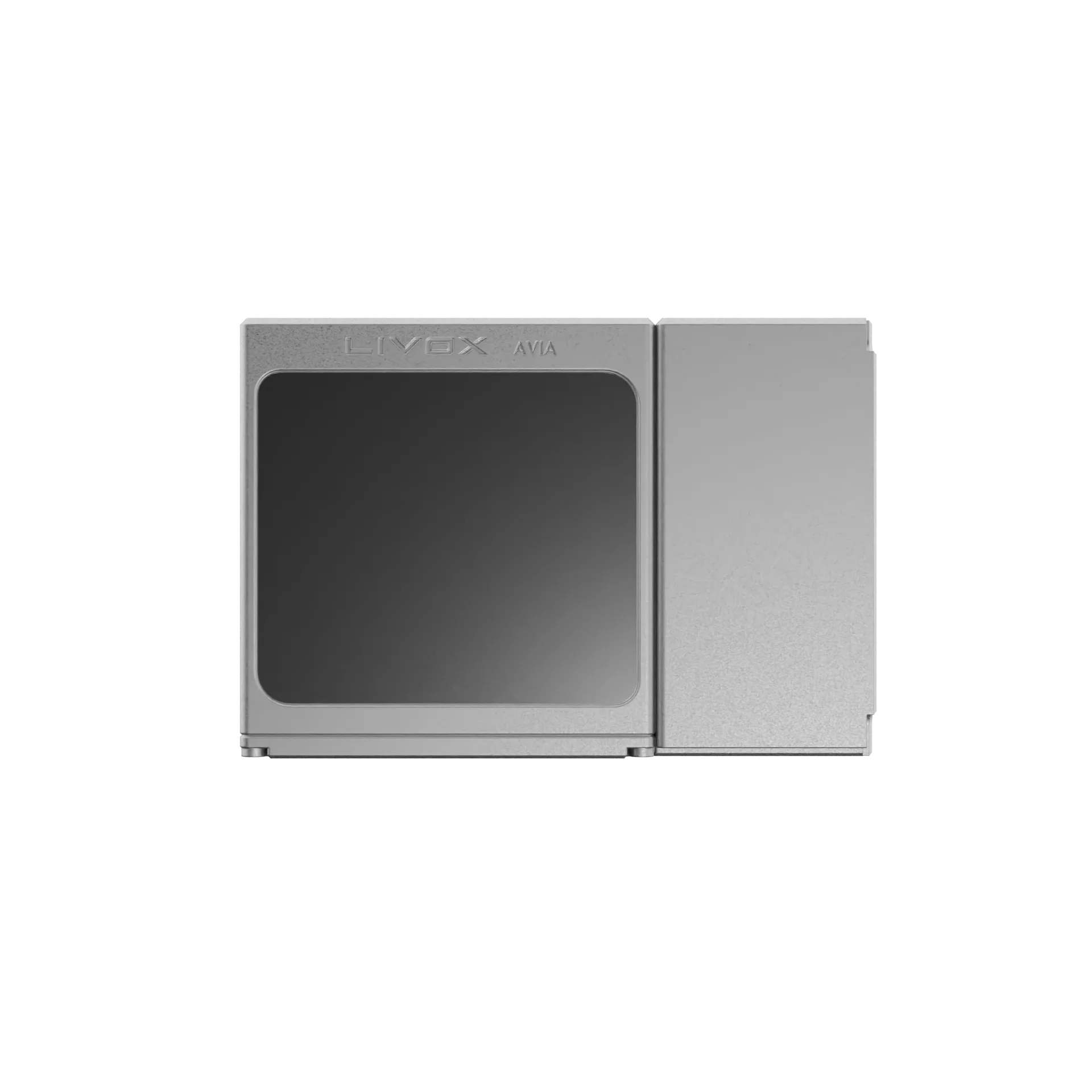
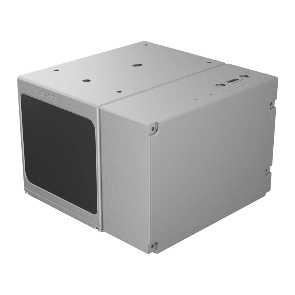
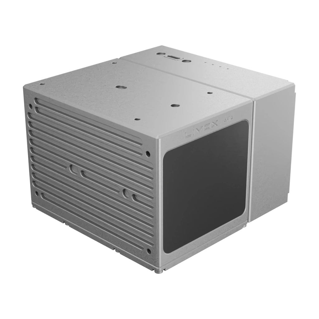
Knowledge base
Blog
Services
  • Surveying equipment development
    • Drone and VTOL camera development
    • LiDAR development for your brand
  • Surveying services
    • Bathymetric survey service
    • Laser scanning and photogrammetry data processing
    • Laser scanning service
    • Photogrammetry service
  • Surveyor training
    • Comprehensive training in flight and data processing
Company
  • Staff
  • News
  • Reviews
  • Vacancy
  • Licenses
  • Documents
  • Partners
Information
  • Requisites
Brands
Contacts
    +41 21 588 02 11
    +41 21 588 02 11 09:00-18:00 whatsapp.svg
    Sales [email protected] email.png
    Support [email protected] email.png
    Telegram Channel @topodronesa tg.svg
    Telegram Chat @topodronesagroup tg.svg
    Telegram Bot @topodronecombot tg.svg
    Facebook @topodronesa ycz1c9257s6gh7g315r8q6tob3bnddba.png
    Youtube @topodronesa youtube.png
    LinkedIn @topodrone 9ratq3v3eavnhupo1akvxp0sbx4vopj5.png
    X @topodrone twitter.png
    Instagram @topodrone tpxkj71axu6dxt423lwj5idzwcej1njx.png
    Email
    [email protected] - Sales
    [email protected] - Support
    The address
    TOPODRONE SA, Rue de la Gare 13, 1820 Montreux, Switzerland
    Working hours
    10:00-18:00
    TOPODRONE
    SPH Engineering
    3Dsurvey
    Velodyne
    DJI
    GreenValley International
    Honeywell
    Fixar
    Blue Marble Geographics
    Sony
    Agisoft
    EMLID
    Pix4D
    Autel Robotics
    SHAREUAV
    • LiDAR
      LiDAR
      • Aerial Survey LiDAR
      • SLAM Survey LiDAR
      • LiDAR Accessories
    • Bathymetry
      Bathymetry
    • Photogrammetry
      Photogrammetry
      • Mapping Drones
      • Drone Mapping Cameras
      • VTOL Mapping Cameras
    • PPK Upgrade Kits
      PPK Upgrade Kits
      • PPK for Drones
      • PPK for any UAV
    • Spectrography
      Spectrography
      • Thermal
      • Multispectral
    • UAV
      UAV
      • DJI
      • Autel Robotics
      • FIXAR
      • Innotech drone
    • Payload
      Payload
      • Aerial Survey LiDAR
      • Bathymetric Scanner
      • Photogrammetric Cameras
      • Thermal Cameras
      • Multispectral Cameras
      • Beacon
    • Software
      Software
      • TOPODRONE
      • UgCS
      • Agisoft
      • 3Dsurvey
      • LiDAR360
      • DJI
      • PIX4D
    • GNSS Equipment
      GNSS Equipment
      • EMLID
      • DJI
    TOPODRONE – LiDAR & UAV Survey
    Log in
    0 Comparison
    0 Favorites
    0 Cart
    TOPODRONE – LiDAR & UAV Survey
    Log in
    0 Comparison
    0 Favorites
    0 Cart
    TOPODRONE – LiDAR & UAV Survey
    Telephones
    +41 21 588 02 11 09:00-18:00 whatsapp.svg
    Sales [email protected] email.png
    Support [email protected] email.png
    Telegram Channel @topodronesa tg.svg
    Telegram Chat @topodronesagroup tg.svg
    Telegram Bot @topodronecombot tg.svg
    Facebook @topodronesa ycz1c9257s6gh7g315r8q6tob3bnddba.png
    Youtube @topodronesa youtube.png
    LinkedIn @topodrone 9ratq3v3eavnhupo1akvxp0sbx4vopj5.png
    X @topodrone twitter.png
    Instagram @topodrone tpxkj71axu6dxt423lwj5idzwcej1njx.png
    Email
    [email protected] - Sales
    [email protected] - Support
    The address
    TOPODRONE SA, Rue de la Gare 13, 1820 Montreux, Switzerland
    Working hours
    10:00-18:00
    0
    0
    0
    • Cabinet
    • 0 Compare
    • 0 Favorite
    • 0 Cart
    • Brands
    • Sales
    • Services
      • Services
      • Surveying equipment development
        • Surveying equipment development
        • Drone and VTOL camera development
        • LiDAR development for your brand
      • Surveying services
        • Surveying services
        • Bathymetric survey service
        • Laser scanning and photogrammetry data processing
        • Laser scanning service
        • Photogrammetry service
      • Surveyor training
        • Surveyor training
        • Comprehensive training in flight and data processing
    • Company
      • Company
      • Staff
      • News
      • Reviews
      • Vacancy
      • Licenses
      • Documents
      • Partners
    • Blog
    • Information
      • Information
      • Requisites
    • Contacts
    +41 21 588 02 11 09:00-18:00
    • Telephones
    • +41 21 588 02 11 09:00-18:00
      whatsapp.svg
    • Sales [email protected]
      email.png
    • Support [email protected]
      email.png
    • Telegram Channel @topodronesa
      tg.svg
    • Telegram Chat @topodronesagroup
      tg.svg
    • Telegram Bot @topodronecombot
      tg.svg
    • Facebook @topodronesa
      ycz1c9257s6gh7g315r8q6tob3bnddba.png
    • Youtube @topodronesa
      youtube.png
    • LinkedIn @topodrone
      9ratq3v3eavnhupo1akvxp0sbx4vopj5.png
    • X @topodrone
      twitter.png
    • Instagram @topodrone
      tpxkj71axu6dxt423lwj5idzwcej1njx.png
    • [email protected] - Sales
      [email protected] - Support
    • TOPODRONE SA, Rue de la Gare 13, 1820 Montreux, Switzerland
    • 10:00-18:00
    Main
    Products
    LiDAR
    Aerial Survey LiDAR
    TOPODRONE AVIA
    TOPODRONE AVIA
    TOPODRONE AVIA
    TOPODRONE AVIA
    TOPODRONE AVIA
    TOPODRONE AVIA
    TOPODRONE AVIA

    TOPODRONE AVIA

    5
    Art. TDCH1104
    $9 100
    Available
    Specifications
    Статьи : FIRST RESULTS OF FIXAR 007 TOGETHER WITH TOPODRONE LIDAR PAYLOAD FIELD TEST OR HOW TO GET 4 SQ.KM OF LIDAR POINT CLOUD PER FLIGHT
    Country of origin : Switzerland
    Warranty : 12 months
    Weight : 0.8 kg
    Operating Temperature Range : -20°C ... +65°C
    Recording Data to Internal Memory : Yes
    Recording Data to a Memory Card : Yes
    Camera Integration : Yes
    Built-in IMU : Yes
    Built-in GNSS : Yes
    All Specifications
    Description
    The most affordable LiDAR with 150 m operating range and 5 cm XYZ accuracy for aerial laser scanning
    More details
    $9 100
    Available
    TOPODRONE
    All items of TOPODRONE
    All products of the category
    • Description
    • Reviews
    • Specifications

    Features

    • The most affordable LiDAR on the market
    • Modern solid-state laser sensor Livox Avia
    • High-precision IMU integrated with GNSS receiver TOPODRONE PPK
    • The speed of dense point cloud generation is 10 times higher than in photogrammetry
    • The laser scanning is performed automatically
    • Allows you to get terrain under trees and tall grass
    • Installation on any drone, including:
      • DJI Matrice 300 RTK
      • DJI Matrice 200 / 200 V2
      • DJI Matrice 210 / 210 V2 / 210 RTK

    • Performing aerial laser scanning without GCPs
    • Works in PPK mode without the need to access the Internet
    • Getting fixed solutions at a distance of up to 25 km from base stations
    • Writing data to a microSD
    • Automatic conversion to local coordinate systems
    • The possibility of purchasing an Upgrade Kit for assembling a LiDAR from an already purchased laser sensor

    In the box

    • TOPODRONE AVIA LiDAR
    • Removable GNSS L1/L2 antenna
    • Mounting for GNSS antenna
    • Cables
    • MicroSD 16Gb
    • TOPOLiDAR Point Cloud software
    • User manuals and video tutorials

    Warranty

    12 months.

    Loading...
    5
    Common
    Country of origin
    Switzerland
    Warranty
    12 months
    Weight
    0.8 kg
    Operating Temperature Range
    -20°C ... +65°C
    LiDAR
    Recording Data to Internal Memory
    Yes
    Recording Data to a Memory Card
    Yes
    Camera Integration
    Yes
    Built-in IMU
    Yes
    Built-in GNSS
    Yes
    Max. Beam Length
    450 m
    Recommended Flight Altitude
    150 m
    Positioning Accuracy
    3-5 cm
    Field of View (FOV)
    70.4° x 77.2°
    Scan Rate
    240000 - 720000
    Laser Wavelength
    905 nm
    IMU Operating Frequency
    200 Hz
    GNSS Equipment
    GNSS channels number
    184
    Update Rates
    10 Hz
    Supported Signals
    BeiDou B1I, B2I, B3I, B1C, B2a, B2b, GLONASS L1, L2, L3, GPS L1C/A, L2C, L1C, L2P (Y), L5, Galileo E1, E5b, E5a, E6, QZSS L1, L2, L5, SBAS L1C/A
    Operating Mode
    PPK
    Antenna
    External

    Media

    TOPODRONE AVIA
    TOPODRONE AVIA
    TOPODRONE AVIA
    TOPODRONE AVIA
    TOPODRONE AVIA