Knowledge base
Blog
Services
  • Surveying equipment development
    • Drone and VTOL camera development
    • LiDAR development for your brand
  • Surveying services
    • Bathymetric survey service
    • Laser scanning and photogrammetry data processing
    • Laser scanning service
    • Photogrammetry service
  • Surveyor training
    • Comprehensive training in flight and data processing
Company
  • Staff
  • News
  • Reviews
  • Vacancy
  • Licenses
  • Documents
  • Partners
Information
  • Requisites
Brands
Contacts
    +41 21 588 02 11
    +41 21 588 02 11 09:00-18:00 whatsapp.svg
    Sales [email protected] email.png
    Support [email protected] email.png
    Telegram Channel @topodronesa tg.svg
    Telegram Chat @topodronesagroup tg.svg
    Telegram Bot @topodronecombot tg.svg
    Facebook @topodronesa ycz1c9257s6gh7g315r8q6tob3bnddba.png
    Youtube @topodronesa youtube.png
    LinkedIn @topodrone 9ratq3v3eavnhupo1akvxp0sbx4vopj5.png
    X @topodrone twitter.png
    Instagram @topodrone tpxkj71axu6dxt423lwj5idzwcej1njx.png
    Email
    [email protected] - Sales
    [email protected] - Support
    The address
    TOPODRONE SA, Rue de la Gare 13, 1820 Montreux, Switzerland
    Working hours
    10:00-18:00
    TOPODRONE
    SPH Engineering
    3Dsurvey
    Velodyne
    DJI
    GreenValley International
    Honeywell
    Fixar
    Blue Marble Geographics
    Sony
    Agisoft
    EMLID
    Pix4D
    Autel Robotics
    SHAREUAV
    • LiDAR
      LiDAR
      • Aerial Survey LiDAR
      • SLAM Survey LiDAR
      • LiDAR Accessories
    • Bathymetry
      Bathymetry
    • Photogrammetry
      Photogrammetry
      • Mapping Drones
      • Drone Mapping Cameras
      • VTOL Mapping Cameras
    • PPK Upgrade Kits
      PPK Upgrade Kits
      • PPK for Drones
      • PPK for any UAV
    • Spectrography
      Spectrography
      • Thermal
      • Multispectral
    • UAV
      UAV
      • DJI
      • Autel Robotics
      • FIXAR
      • Innotech drone
    • Payload
      Payload
      • Aerial Survey LiDAR
      • Bathymetric Scanner
      • Photogrammetric Cameras
      • Thermal Cameras
      • Multispectral Cameras
      • Beacon
    • Software
      Software
      • TOPODRONE
      • UgCS
      • Agisoft
      • 3Dsurvey
      • LiDAR360
      • DJI
      • PIX4D
    • GNSS Equipment
      GNSS Equipment
      • EMLID
      • DJI
    TOPODRONE – LiDAR & UAV Survey
    Log in
    0 Comparison
    0 Favorites
    0 Cart
    TOPODRONE – LiDAR & UAV Survey
    Log in
    0 Comparison
    0 Favorites
    0 Cart
    TOPODRONE – LiDAR & UAV Survey
    Telephones
    +41 21 588 02 11 09:00-18:00 whatsapp.svg
    Sales [email protected] email.png
    Support [email protected] email.png
    Telegram Channel @topodronesa tg.svg
    Telegram Chat @topodronesagroup tg.svg
    Telegram Bot @topodronecombot tg.svg
    Facebook @topodronesa ycz1c9257s6gh7g315r8q6tob3bnddba.png
    Youtube @topodronesa youtube.png
    LinkedIn @topodrone 9ratq3v3eavnhupo1akvxp0sbx4vopj5.png
    X @topodrone twitter.png
    Instagram @topodrone tpxkj71axu6dxt423lwj5idzwcej1njx.png
    Email
    [email protected] - Sales
    [email protected] - Support
    The address
    TOPODRONE SA, Rue de la Gare 13, 1820 Montreux, Switzerland
    Working hours
    10:00-18:00
    0
    0
    0
    • Cabinet
    • 0 Compare
    • 0 Favorite
    • 0 Cart
    • Brands
    • Sales
    • Services
      • Services
      • Surveying equipment development
        • Surveying equipment development
        • Drone and VTOL camera development
        • LiDAR development for your brand
      • Surveying services
        • Surveying services
        • Bathymetric survey service
        • Laser scanning and photogrammetry data processing
        • Laser scanning service
        • Photogrammetry service
      • Surveyor training
        • Surveyor training
        • Comprehensive training in flight and data processing
    • Company
      • Company
      • Staff
      • News
      • Reviews
      • Vacancy
      • Licenses
      • Documents
      • Partners
    • Blog
    • Information
      • Information
      • Requisites
    • Contacts
    +41 21 588 02 11 09:00-18:00
    • Telephones
    • +41 21 588 02 11 09:00-18:00
      whatsapp.svg
    • Sales [email protected]
      email.png
    • Support [email protected]
      email.png
    • Telegram Channel @topodronesa
      tg.svg
    • Telegram Chat @topodronesagroup
      tg.svg
    • Telegram Bot @topodronecombot
      tg.svg
    • Facebook @topodronesa
      ycz1c9257s6gh7g315r8q6tob3bnddba.png
    • Youtube @topodronesa
      youtube.png
    • LinkedIn @topodrone
      9ratq3v3eavnhupo1akvxp0sbx4vopj5.png
    • X @topodrone
      twitter.png
    • Instagram @topodrone
      tpxkj71axu6dxt423lwj5idzwcej1njx.png
    • [email protected] - Sales
      [email protected] - Support
    • TOPODRONE SA, Rue de la Gare 13, 1820 Montreux, Switzerland
    • 10:00-18:00
    Main
    Products
    LiDAR
    Aerial Survey LiDAR
    DJI Zenmuse L3
    DJI Zenmuse L3
    DJI Zenmuse L3
    DJI Zenmuse L3
    DJI Zenmuse L3
    DJI Zenmuse L3
    DJI Zenmuse L3
    DJI Zenmuse L3
    DJI Zenmuse L3
    DJI Zenmuse L3
    DJI Zenmuse L3

    DJI Zenmuse L3

    5
    Art. TDCH7101
    $0
    Available
    Specifications
    Статьи : DJI Matrice 400
    Warranty : 12 months
    $0
    Available
    • Description
    • Reviews
    • Specifications

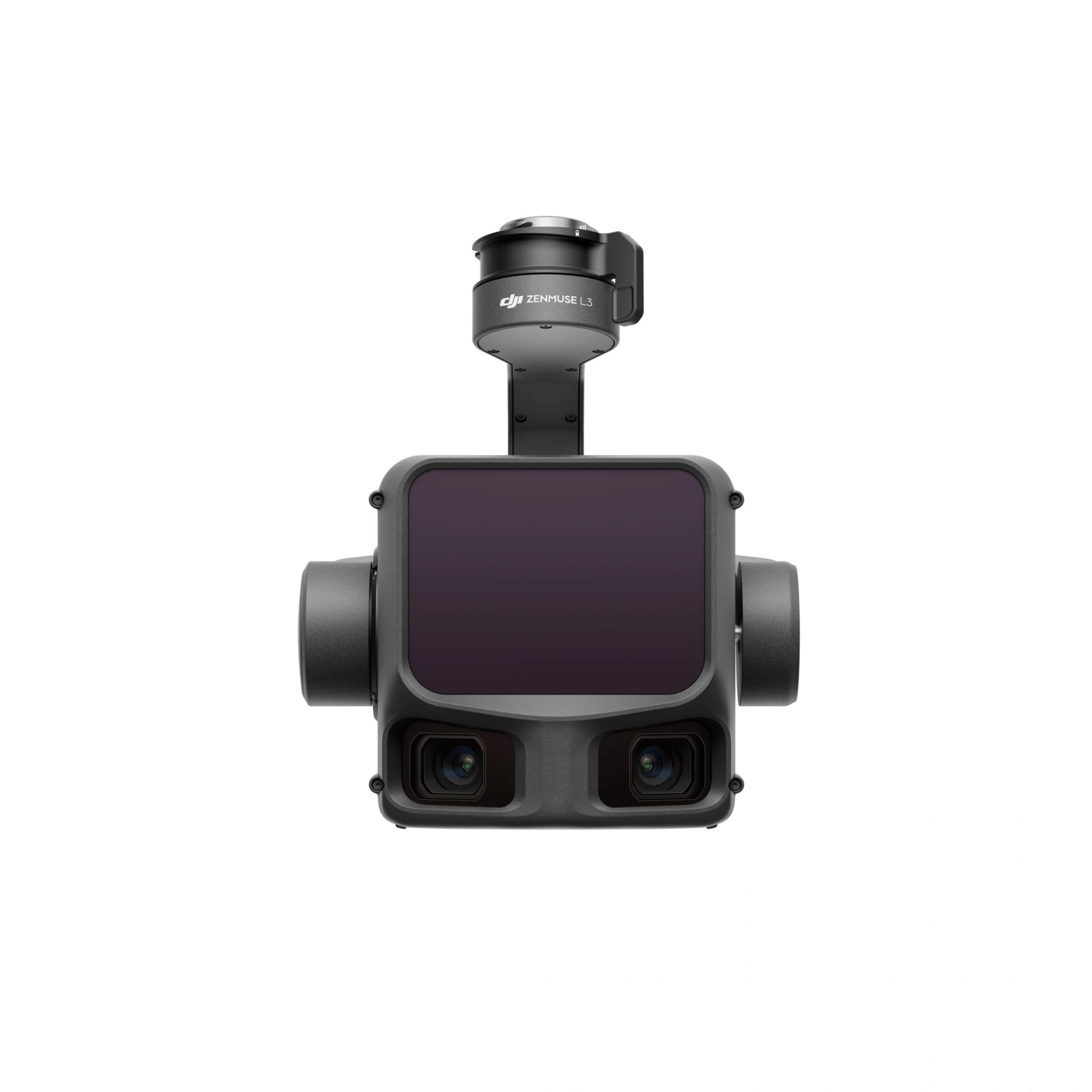
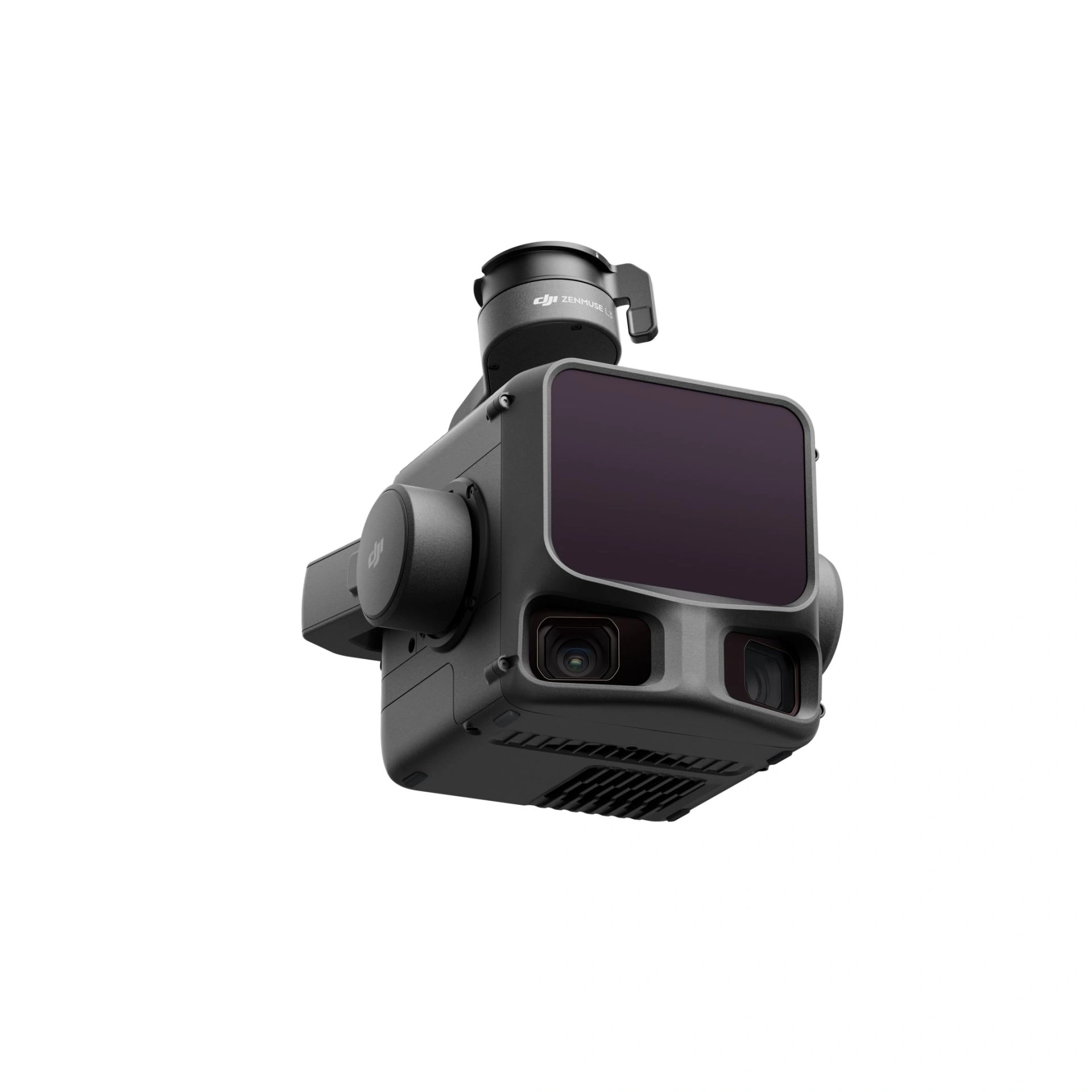
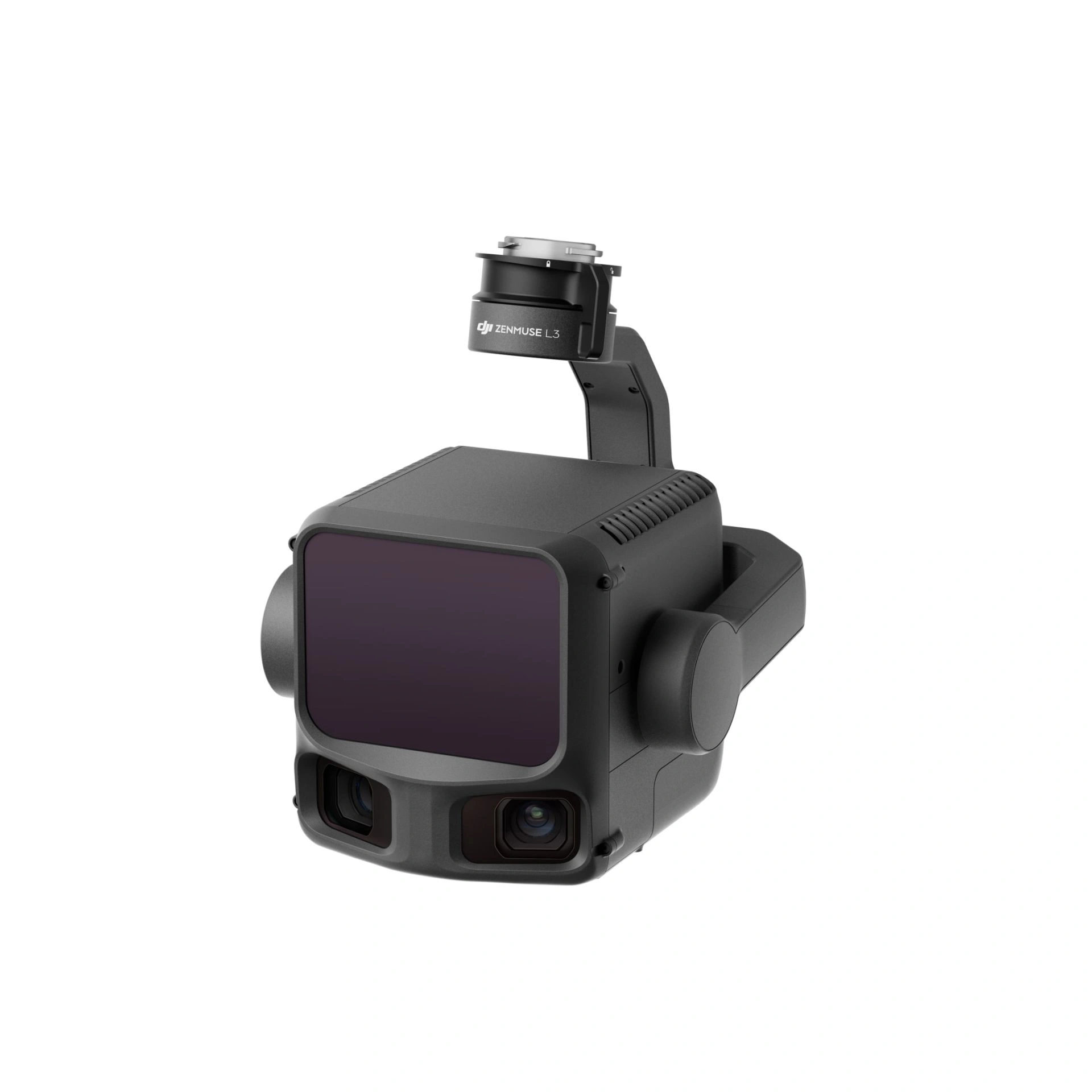
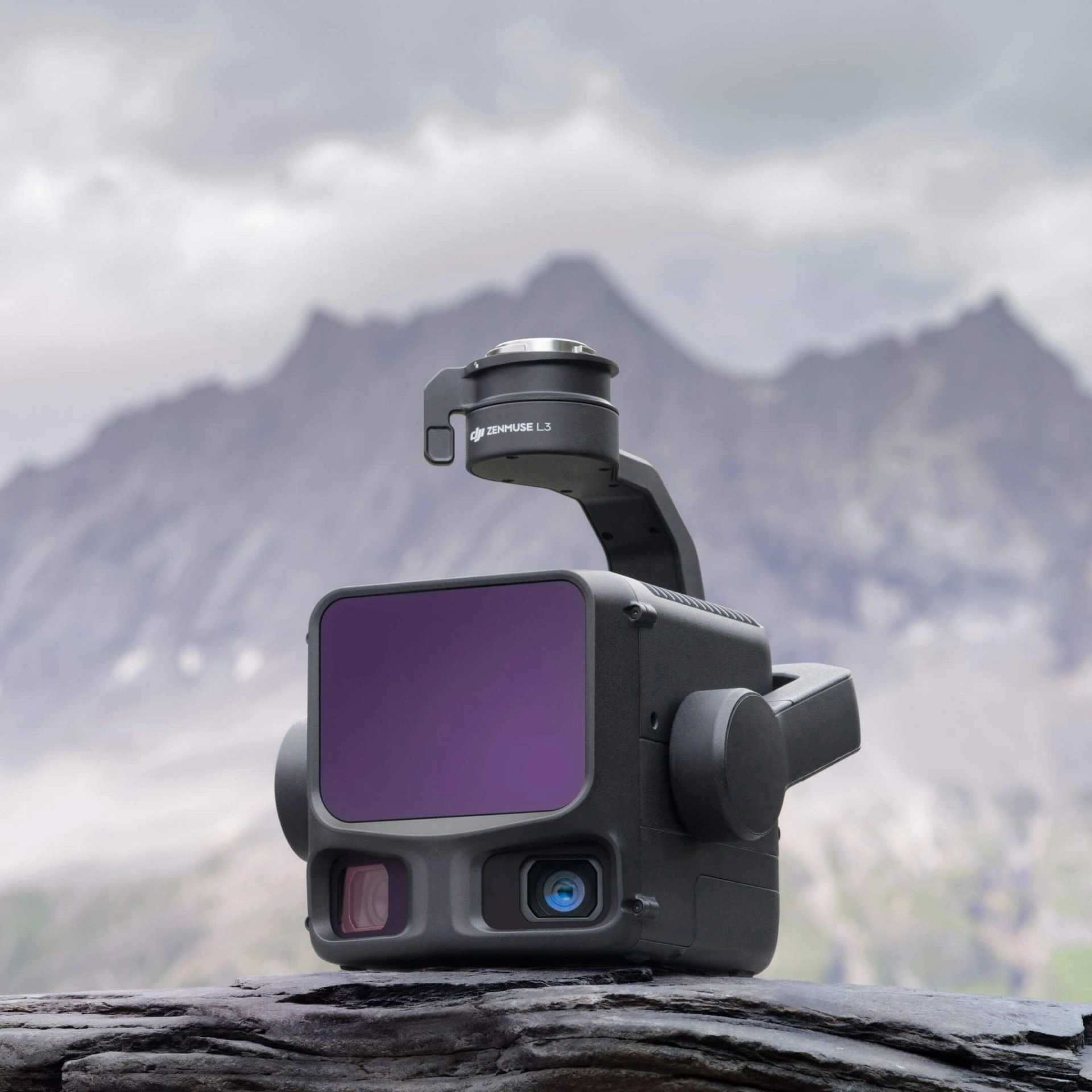
    DJI Zenmuse L3 — High-Precision, Long-Range LiDAR System

    DJI Zenmuse L3 is a next-generation airborne LiDAR system engineered for high-accuracy surveying of large areas. Operating at a wavelength of 1535 nm, its laser can detect objects up to 950 m away, even with surface reflectivity as low as 10%. The system is equipped with dual 100 MP RGB cameras and a high-precision POS (Position and Orientation System), enabling rapid acquisition of detailed geospatial data and coverage of up to 100 km² per day.

    Key Advantages of the Zenmuse L3

    • Range and Coverage — Detects targets at distances of up to 950 m under varying illumination and low reflectivity conditions.
    • Exceptional Accuracy — Measurement repeatability within 5 mm at 150 m, with vertical accuracy up to 3 cm at a flight altitude of 120 m.
    • Ultra-Small Laser Footprint — Spot diameter five times smaller than that of the Zenmuse L2, allowing precise mapping of fine features.
    • High Point Density — High pulse energy and low beam divergence enable accurate terrain modelling, even under vegetation or in complex relief.
    • Operational Efficiency — Up to 10 km² per flight sortie and as much as 100 km² per full operational day.

    Core Functionality

    Scanning Modes:
    • Linear — Generates a uniform point grid ideal for detailed topographic and mapping applications.
    • Star-shaped — Provides enhanced accuracy and canopy penetration; suited for forestry and urban environments.
    • Non-repetitive — Offers a wide scan angle, optimised for inspection of powerlines and linear infrastructure.
    • Dual RGB Camera System — Two 100 MP cameras with mechanical shutters, supporting pixel binning for improved colour fidelity and imaging efficiency.
    • Wide Field of View — A 107° horizontal FoV increases coverage per frame and accelerates data capture.
    • Integration with DJI Terra — Supports PPK post-processing for survey-grade accuracy, 3D modelling via Gaussian Splatting, and seamless LiDAR–RGB fusion into unified point clouds.
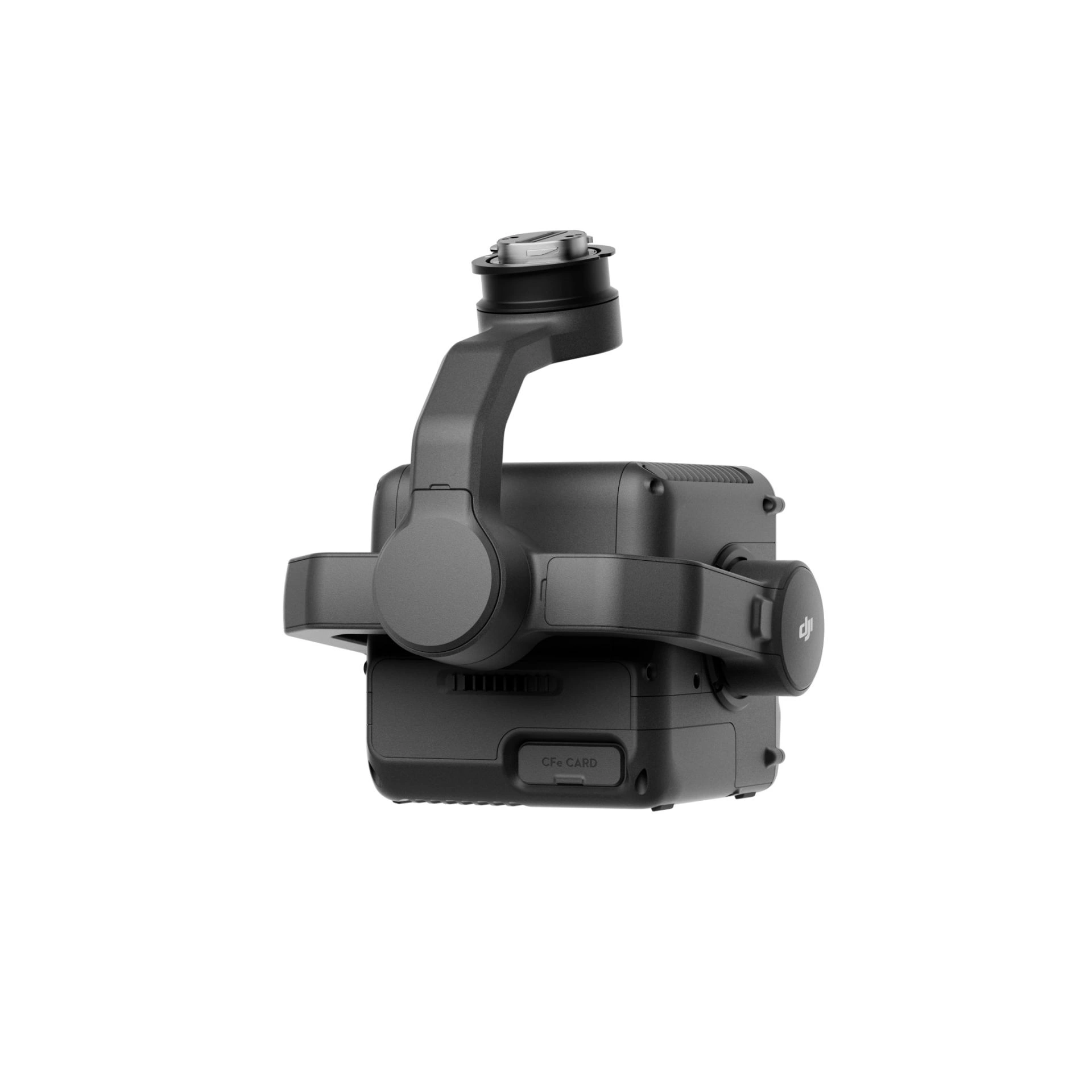
    • Data Security — CFexpress and AES-256 encryption, with one-tap deletion of flight logs for secure data management.

    Technical Compatibility

    • Designed exclusively for use with the DJI Matrice 400, due to its 1.6 kg payload capacity, reinforced gimbal rails, and high-power 1535 nm laser module.
    • Fully integrated into the DJI ecosystem — from data capture and PPK processing in DJI Terra to cloud-based analytics via DJI FlightHub 2.

    Primary Applications

    • Topographic and engineering surveying
    • Geological mapping and risk assessment
    • Forestry management and vegetation analysis
    • Inspection of power transmission and transport networks
    • Mining operations and infrastructure mapping

    Warranty

    12 months.

    Loading...
    5
    Common
    Warranty
    12 months

    Media

    DJI Zenmuse L3
    DJI Zenmuse L3
    DJI Zenmuse L3
    DJI Zenmuse L3