Knowledge base
Blog
Services
  • Surveying equipment development
    • Drone and VTOL camera development
    • LiDAR development for your brand
  • Surveying services
    • Bathymetric survey service
    • Laser scanning and photogrammetry data processing
    • Laser scanning service
    • Photogrammetry service
  • Surveyor training
    • Comprehensive training in flight and data processing
Company
  • Staff
  • News
  • Reviews
  • Vacancy
  • Licenses
  • Documents
  • Partners
Information
  • Requisites
Brands
Contacts
    +41 21 588 02 11
    +41 21 588 02 11 09:00-18:00 whatsapp.svg
    Sales [email protected] email.png
    Support [email protected] email.png
    Telegram Channel @topodronesa tg.svg
    Telegram Chat @topodronesagroup tg.svg
    Telegram Bot @topodronecombot tg.svg
    Facebook @topodronesa ycz1c9257s6gh7g315r8q6tob3bnddba.png
    Youtube @topodronesa youtube.png
    LinkedIn @topodrone 9ratq3v3eavnhupo1akvxp0sbx4vopj5.png
    X @topodrone twitter.png
    Instagram @topodrone tpxkj71axu6dxt423lwj5idzwcej1njx.png
    Email
    [email protected] - Sales
    [email protected] - Support
    The address
    TOPODRONE SA, Rue de la Gare 13, 1820 Montreux, Switzerland
    Working hours
    10:00-18:00
    TOPODRONE
    SPH Engineering
    3Dsurvey
    Velodyne
    DJI
    GreenValley International
    Honeywell
    Fixar
    Blue Marble Geographics
    Sony
    Agisoft
    EMLID
    Pix4D
    Autel Robotics
    SHAREUAV
    • LiDAR
      LiDAR
      • Aerial Survey LiDAR
      • SLAM Survey LiDAR
      • LiDAR Accessories
    • Bathymetry
      Bathymetry
    • Photogrammetry
      Photogrammetry
      • Mapping Drones
      • Drone Mapping Cameras
      • VTOL Mapping Cameras
    • PPK Upgrade Kits
      PPK Upgrade Kits
      • PPK for Drones
      • PPK for any UAV
    • Spectrography
      Spectrography
      • Thermal
      • Multispectral
    • UAV
      UAV
      • DJI
      • Autel Robotics
      • FIXAR
      • Innotech drone
    • Payload
      Payload
      • Aerial Survey LiDAR
      • Bathymetric Scanner
      • Photogrammetric Cameras
      • Thermal Cameras
      • Multispectral Cameras
      • Beacon
    • Software
      Software
      • TOPODRONE
      • UgCS
      • Agisoft
      • 3Dsurvey
      • LiDAR360
      • DJI
      • PIX4D
    • GNSS Equipment
      GNSS Equipment
      • EMLID
      • DJI
    TOPODRONE – LiDAR & UAV Survey
    Log in
    0 Comparison
    0 Favorites
    0 Cart
    TOPODRONE – LiDAR & UAV Survey
    Log in
    0 Comparison
    0 Favorites
    0 Cart
    TOPODRONE – LiDAR & UAV Survey
    Telephones
    +41 21 588 02 11 09:00-18:00 whatsapp.svg
    Sales [email protected] email.png
    Support [email protected] email.png
    Telegram Channel @topodronesa tg.svg
    Telegram Chat @topodronesagroup tg.svg
    Telegram Bot @topodronecombot tg.svg
    Facebook @topodronesa ycz1c9257s6gh7g315r8q6tob3bnddba.png
    Youtube @topodronesa youtube.png
    LinkedIn @topodrone 9ratq3v3eavnhupo1akvxp0sbx4vopj5.png
    X @topodrone twitter.png
    Instagram @topodrone tpxkj71axu6dxt423lwj5idzwcej1njx.png
    Email
    [email protected] - Sales
    [email protected] - Support
    The address
    TOPODRONE SA, Rue de la Gare 13, 1820 Montreux, Switzerland
    Working hours
    10:00-18:00
    0
    0
    0
    • Cabinet
    • 0 Compare
    • 0 Favorite
    • 0 Cart
    • Brands
    • Sales
    • Services
      • Services
      • Surveying equipment development
        • Surveying equipment development
        • Drone and VTOL camera development
        • LiDAR development for your brand
      • Surveying services
        • Surveying services
        • Bathymetric survey service
        • Laser scanning and photogrammetry data processing
        • Laser scanning service
        • Photogrammetry service
      • Surveyor training
        • Surveyor training
        • Comprehensive training in flight and data processing
    • Company
      • Company
      • Staff
      • News
      • Reviews
      • Vacancy
      • Licenses
      • Documents
      • Partners
    • Blog
    • Information
      • Information
      • Requisites
    • Contacts
    +41 21 588 02 11 09:00-18:00
    • Telephones
    • +41 21 588 02 11 09:00-18:00
      whatsapp.svg
    • Sales [email protected]
      email.png
    • Support [email protected]
      email.png
    • Telegram Channel @topodronesa
      tg.svg
    • Telegram Chat @topodronesagroup
      tg.svg
    • Telegram Bot @topodronecombot
      tg.svg
    • Facebook @topodronesa
      ycz1c9257s6gh7g315r8q6tob3bnddba.png
    • Youtube @topodronesa
      youtube.png
    • LinkedIn @topodrone
      9ratq3v3eavnhupo1akvxp0sbx4vopj5.png
    • X @topodrone
      twitter.png
    • Instagram @topodrone
      tpxkj71axu6dxt423lwj5idzwcej1njx.png
    • [email protected] - Sales
      [email protected] - Support
    • TOPODRONE SA, Rue de la Gare 13, 1820 Montreux, Switzerland
    • 10:00-18:00
    Main
    Products
    LiDAR
    Aerial Survey LiDAR
    TOPODRONE 200+
    TOPODRONE 200+
    TOPODRONE 200+
    TOPODRONE 200+
    TOPODRONE 200+
    TOPODRONE 200+
    TOPODRONE 200+
    TOPODRONE 200+
    TOPODRONE 200+
    TOPODRONE 200+
    TOPODRONE 200+
    Recommend
    Hit

    TOPODRONE 200+

    5
    Art. TDCH1101
    $15 500
    Available
    Specifications
    Country of origin : Switzerland
    Year of release : 2023
    Warranty : 12 months
    Weight : 720 g
    Product Dimensions : 118х155х105 mm
    Operating Temperature Range : -20℃ to 60℃
    Storage Temperature Range : -40℃ to 85℃
    Sensor Model : Hesai XT32M2X
    Recording Data to Internal Memory : Yes
    Recording Data to a Memory Card : Yes
    All Specifications
    Description
    The most productive and lightest 360° LiDAR on the market with a 200 m working range, weighing 720 g, can be installed on a drone, car and backpack.
    More details
    $15 500
    Available
    TOPODRONE
    All items of TOPODRONE
    All products of the category
    • Description
    • Reviews
    • Specifications

    TOPODRONE 200+ - High-Precision Aerial Survey LiDAR for Professional Mapping

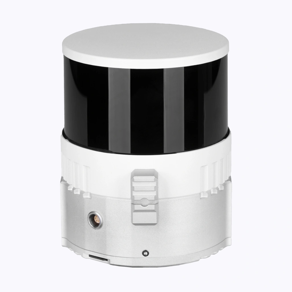
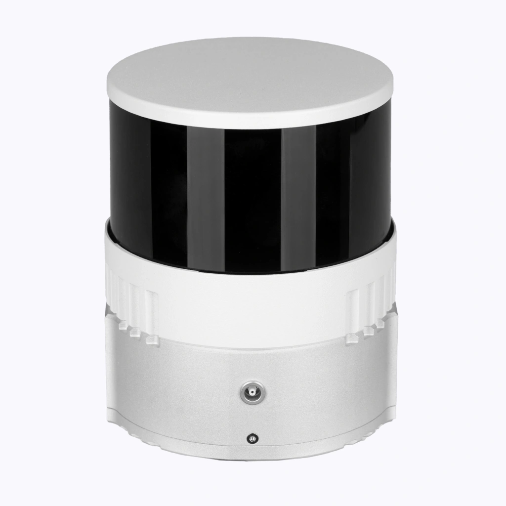
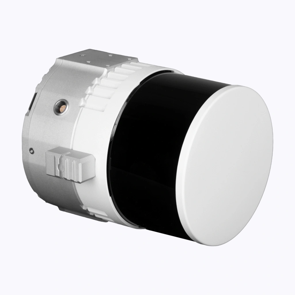
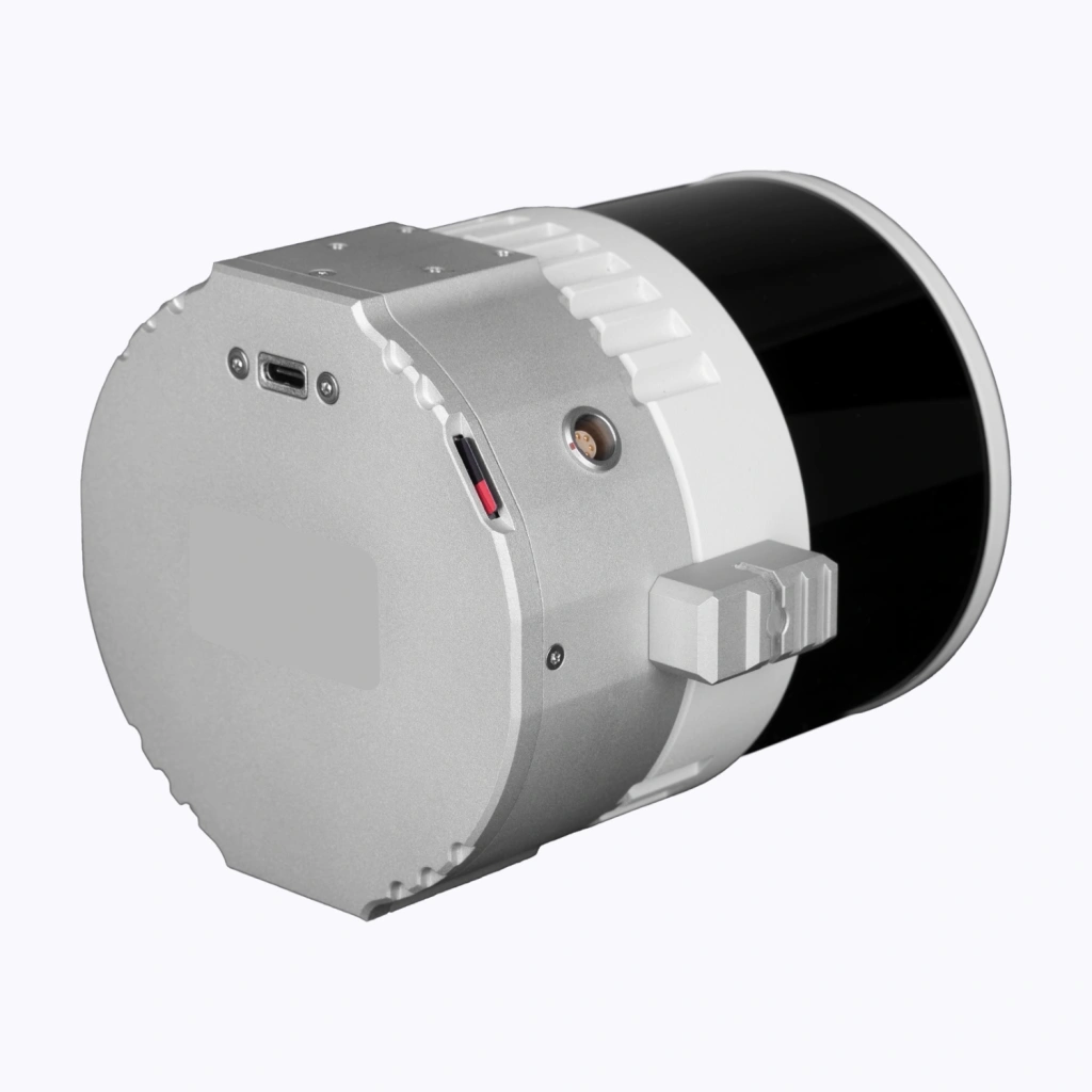
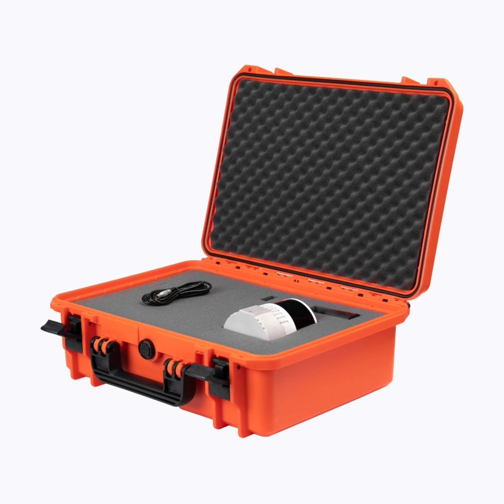
    The TOPODRONE 200+ is a cutting-edge aerial survey LiDAR system designed for professionals who demand high accuracy and reliability in their mapping projects. With its advanced Hesai XT32M2X sensor, this lightweight and compact LiDAR system delivers exceptional performance in a variety of environments, making it ideal for topographic surveys, forestry, infrastructure inspection, and more.

    Key Features:

    • High Precision: Achieve 3-5 cm accuracy with 32 beams and a 360° x 40.3° field of view, ensuring detailed and reliable data collection.

    • Long Range: Scan up to 300 meters with a recommended flight altitude of 120 meters, covering large areas efficiently.

    • Fast Data Capture: With a scan rate of 640-1920 kHz and a laser wavelength of 905 nm, the TOPODRONE 200+ captures data quickly and accurately.

    • Robust Design: Built to withstand harsh conditions, it operates in temperatures ranging from -20℃ to 60℃ and is stored safely in temperatures from -40℃ to 85℃.

    • Lightweight & Portable: Weighing just 720 g and measuring 118х155х105 mm, it’s easy to transport and deploy in the field.

    • Integrated GNSS & IMU: Equipped with built-in GNSS and IMU for precise positioning and orientation, ensuring high-quality data even in challenging environments.

    • PPK Compatibility: Supports Post-Processed Kinematic (PPK) for enhanced accuracy, making it perfect for high-precision mapping tasks.

    Why Choose TOPODRONE 200+?

    The TOPODRONE 200+ is engineered for professionals who need a reliable, high-performance LiDAR solution. Whether you're conducting aerial surveys, inspecting infrastructure, or mapping large terrains, this system offers the precision, speed, and durability you need to get the job done right.

    Applications:

    • Topographic Mapping: Create detailed 3D models of terrain with unmatched accuracy.

    • Forestry Management: Monitor tree density, height, and biomass with ease.

    • Infrastructure Inspection: Assess bridges, roads, and power lines with high-resolution data.

    • Urban Planning: Generate precise models for city development and planning.

    Perfect for Professionals:

    The TOPODRONE 200+ is the ultimate tool for surveyors, engineers, and GIS professionals who require high-quality LiDAR data. Its compact design, combined with advanced features, makes it a versatile solution for a wide range of applications.

    Upgrade your mapping capabilities with the TOPODRONE 200+ – the LiDAR system that delivers precision, reliability, and performance in every scan.

    Loading...
    5
    Common
    Country of origin
    Switzerland
    Year of release
    2023
    Warranty
    12 months
    Weight
    720 g
    Product Dimensions
    118х155х105 mm
    Operating Temperature Range
    -20℃ to 60℃
    Storage Temperature Range
    -40℃ to 85℃
    LiDAR
    Sensor Model
    Hesai XT32M2X
    Recording Data to Internal Memory
    Yes
    Recording Data to a Memory Card
    Yes
    Camera Integration
    Yes
    Built-in IMU
    Yes
    Built-in GNSS
    Yes
    Built-in Cameras
    Yes
    Max. Beam Length
    300 m
    Recommended Flight Altitude
    120 m
    Recommended Beam Length for Mobile Scanning
    70 m
    Positioning Accuracy
    3-5 cm
    Number of Beams
    32
    Field of View (FOV)
    360° x 40.3°
    Sensor Resolution
    0.09° x 1.3°
    Scan Rate
    640-1920 kHz
    Laser Wavelength
    905 nm
    IMU Operating Frequency
    200 Hz
    GNSS Equipment
    GNSS channels number
    184
    Update Rates
    10 Hz
    Supported Signals
    BeiDou B1I, B2I, B3I, B1C, B2a, B2b, GLONASS L1, L2, L3, GPS L1C/A, L2C, L1C, L2P (Y), L5, Galileo E1, E5b, E5a, E6, QZSS L1, L2, L5, SBAS L1C/A
    Operating Mode
    PPK
    Antenna
    External
    Back to the list
    Connect with us
    +41 21 588 02 11
    +41 21 588 02 11 09:00-18:00 whatsapp.svg
    Sales [email protected] email.png
    Support [email protected] email.png
    Telegram Channel @topodronesa tg.svg
    Telegram Chat @topodronesagroup tg.svg
    Telegram Bot @topodronecombot tg.svg
    Facebook @topodronesa ycz1c9257s6gh7g315r8q6tob3bnddba.png
    Youtube @topodronesa youtube.png
    LinkedIn @topodrone 9ratq3v3eavnhupo1akvxp0sbx4vopj5.png
    X @topodrone twitter.png
    Instagram @topodrone tpxkj71axu6dxt423lwj5idzwcej1njx.png
    Email
    [email protected] - Sales
    [email protected] - Support
    The address
    TOPODRONE SA, Rue de la Gare 13, 1820 Montreux, Switzerland
    Working hours
    10:00-18:00
    [email protected] - Sales
    [email protected] - Support
    TOPODRONE SA, Rue de la Gare 13, 1820 Montreux, Switzerland
    Products
    Sales
    Brands
    Services
    Applications
    Company
    Staff
    News
    Reviews
    Vacancy
    Licenses
    Documents
    Partners
    Information
    Requisites
    Help
    Payment
    Delivery
    Warranty
    FAQ
    © 2025 TOPODRONE SA
    Privacy Policy
    Main page Product 0 Comparison Contacts Blog Applications