
Reach RS2+
5
Art. TDCH9104
$2 000
Specifications
Country of origin
:
Switzerland
Warranty
:
12 months
Description
Professional multifrequency L1 / L2 / L5 GNSS RTK / PPK geodesic receiver
More details

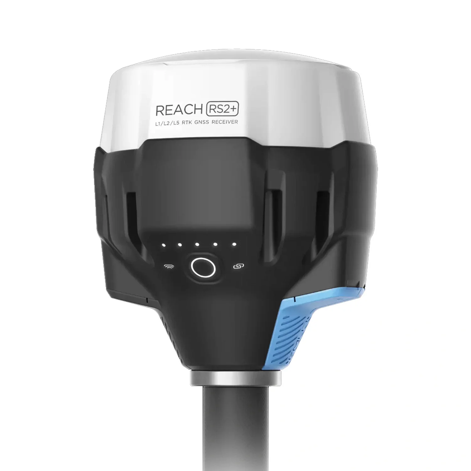
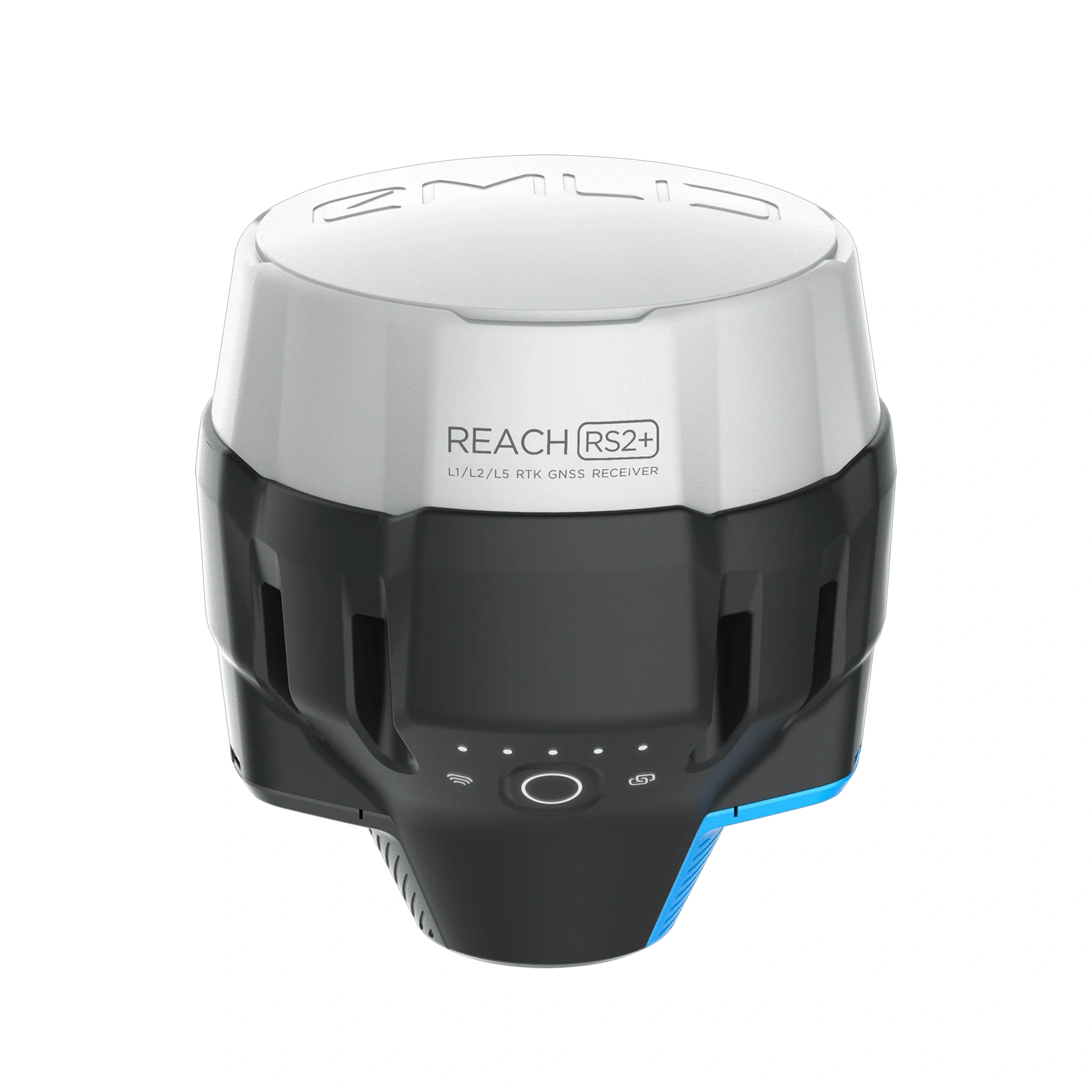
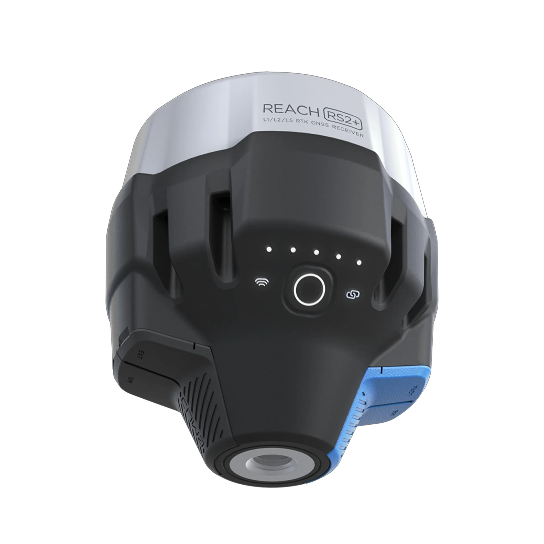
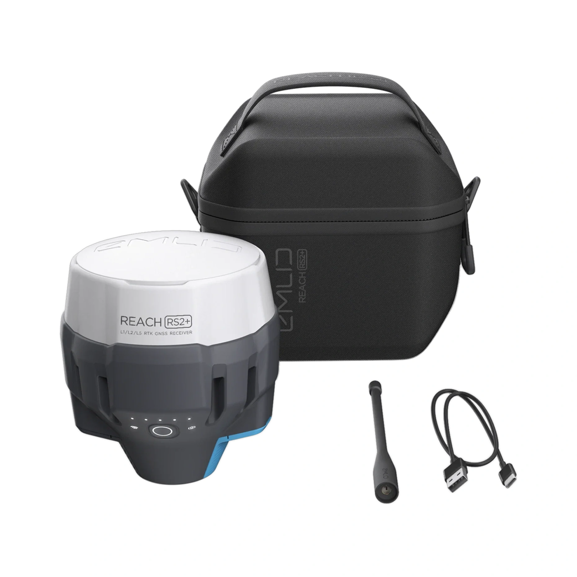
Reach RS2+
The Reach RS2+ is a multi-band RTK GNSS receiver delivering centimetre-level accuracy for surveying, mapping and navigation tasks.
It is operated via a mobile app, providing a straightforward workflow in the field.
Functionality & Capabilities
- Multi-band GNSS tracking for consistent RTK positioning
- Centimetre-grade accuracy for demanding field operations
- Mobile app support for iOS and Android
- Wi-Fi and Bluetooth connectivity for linking with external devices
- USB Type-C charging with a 6–40 V power input range
- Up to 16 hours of operation in LTE RTK rover mode
- Long-range LoRa radio support for extended communications
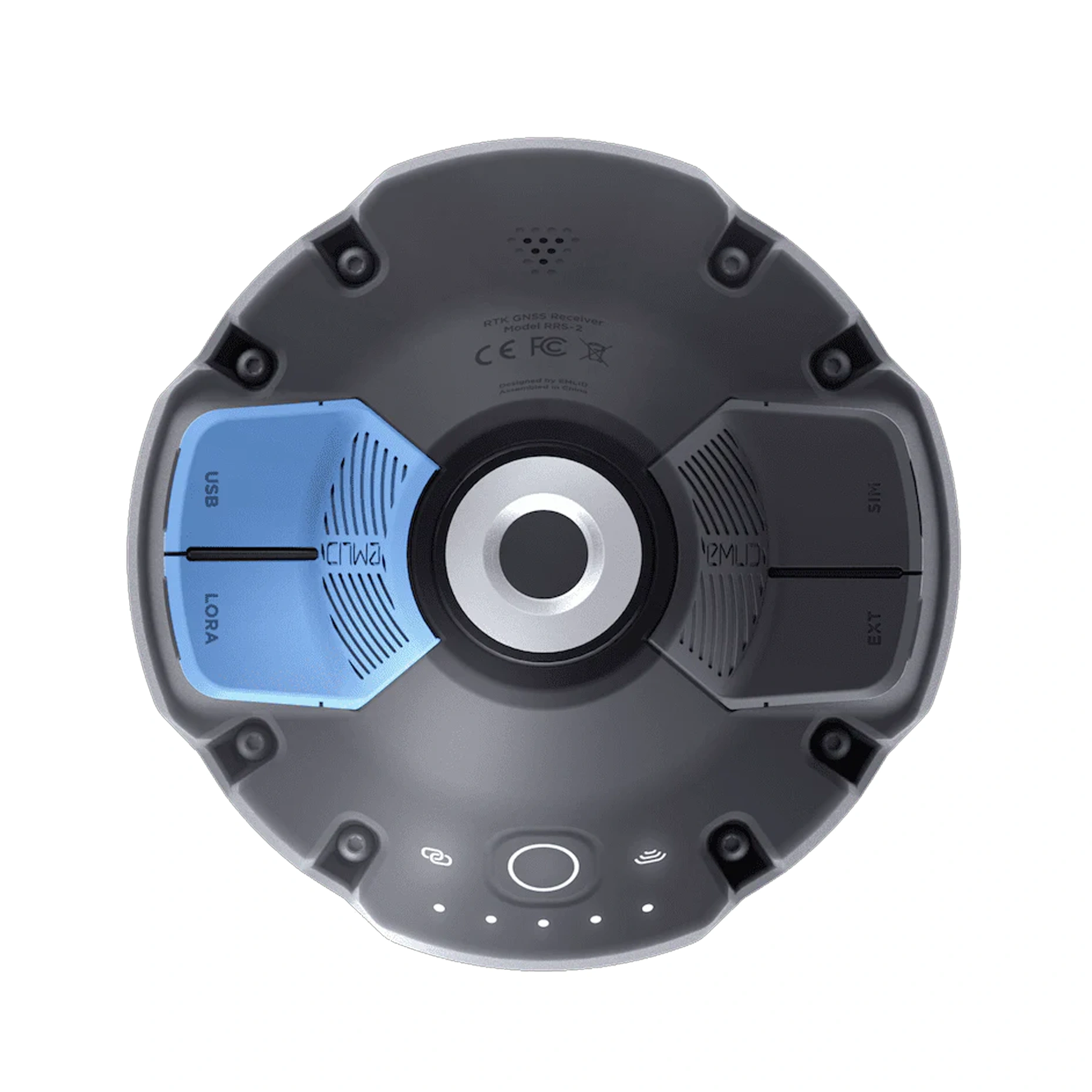
GNSS
- GPS/QZSS: L1C/A, L2C
- GLONASS: L1OF, L2OF
- BeiDou: B1I, B2I
- Galileo: E1-B/C, E5b
Long-Range Radio
- LoRa 868/915 MHz
- Range up to 8 km
Power & Battery
- Up to 16 hours of LTE RTK rover operation
- LiFePO₄ battery
- 6–40 V input
- USB Type-C charging
Connectivity
- Wi-Fi and Bluetooth for linking with other devices
Loading...
Common
Country of origin
Switzerland
Warranty
12 months