
")
Modern laser scanning and photogrammetry technologies reveal extensive potential for application in a wide range of fields — from engineering calculations to landscape analysis. They enable the creation of virtual twins of objects and territories in the form of detailed point clouds, which serve as a basis for precise measurements, modelling, and planning.
A prime example of these technologies is the survey conducted in Interlaken, Switzerland. Using the TOPODRONE LiDAR 200+ system and the P61 photogrammetric camera, a high-precision aerial survey of a section of transport infrastructure and adjacent areas was performed, unlocking new possibilities for analysis and design.
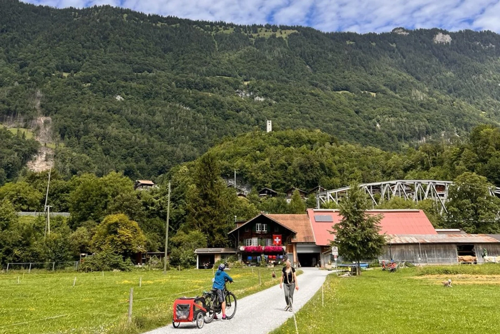
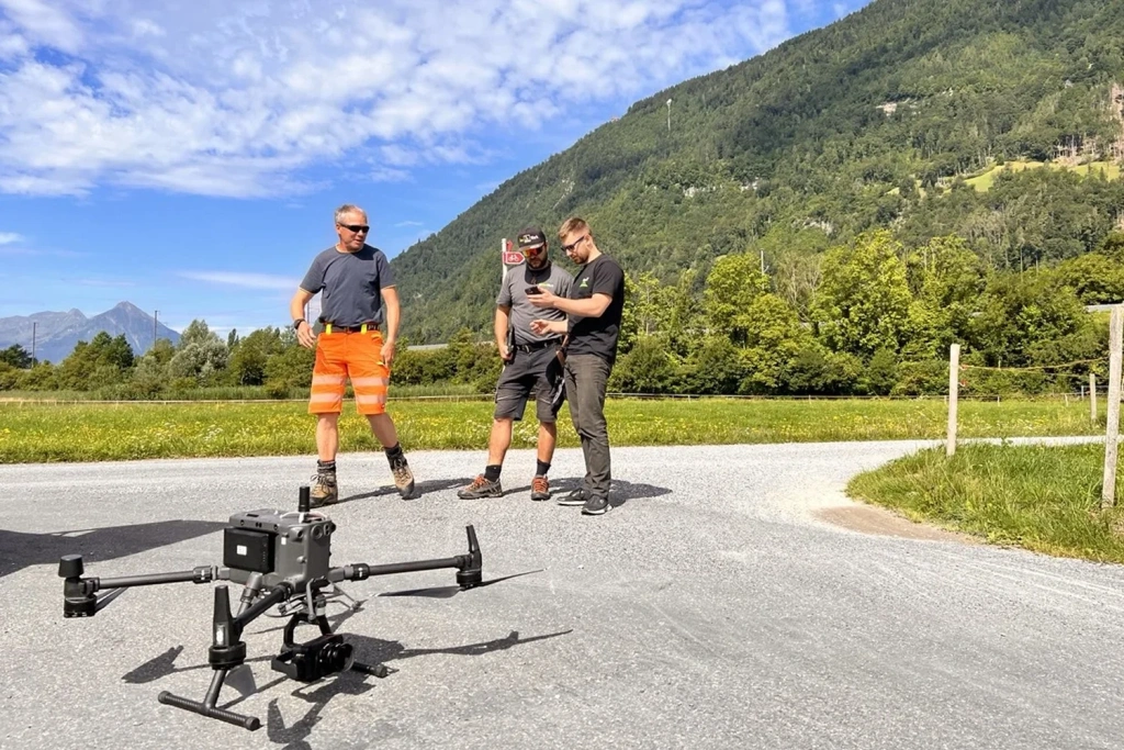
Figures 1–2. Preparation for fieldwork in Interlaken
Survey Methodology and Technical Basis for the Project
The survey in Interlaken employed an area-based method, enabling the creation of a continuous and dense point cloud. The dataset captures all key infrastructure elements: carriageways, verges, green zones, and adjacent buildings.
The application of LiDAR technology significantly accelerated data acquisition and enhanced safety. Instead of deploying engineers onto busy roads, a drone equipped with a laser scanner completed the task in 15–20 minutes. During this time, several kilometres of the route were captured, including complex structures such as bridges, tunnels, slopes, and supports.
This approach ensured complete safety for personnel, eliminated the human factor, and guaranteed high data accuracy and reproducibility. Based on the data collected, a high-precision 3D model was generated, reflecting the current state of the road surface, embankments, and drainage and engineering structures.
Equipment and Software:
- Flight Planning and Management — UgCS Expert
- Drone — DJI Matrice 300 RTK
- LiDAR System — TOPODRONE LiDAR 200+ with a high-precision laser module, inertial navigation, and PPK support
- Photogrammetric Camera — P61 for obtaining high-quality colour textures
- Data Processing — TOPODRONE Post Processing (TPP), LiDAR360, Agisoft Metashape
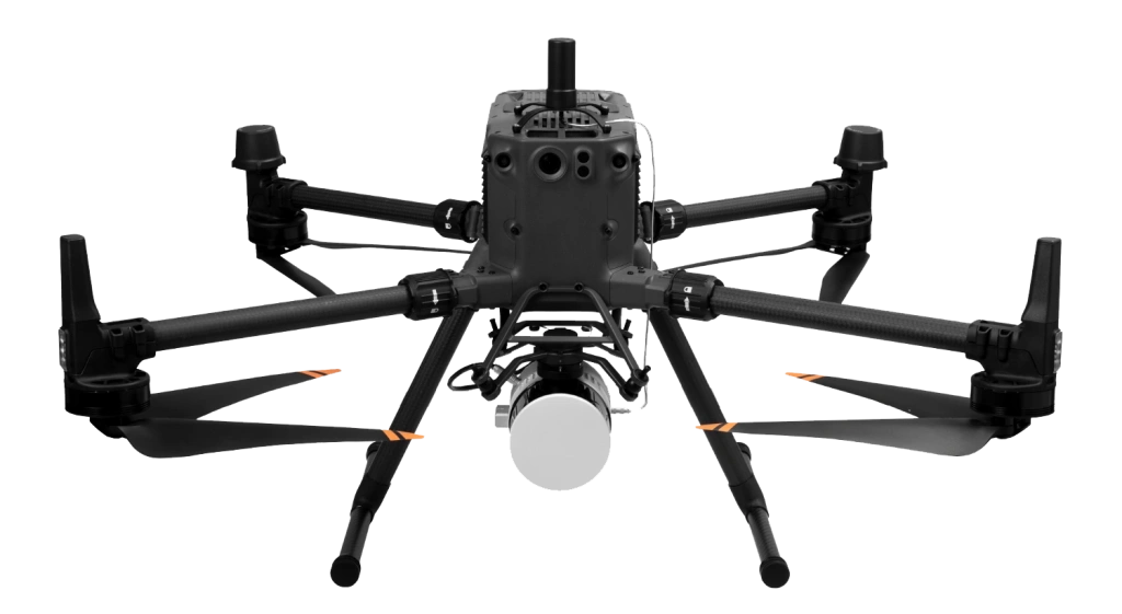
Figure 3. DJI Matrice 300 RTK + TOPODRONE LiDAR 200+ and PPK
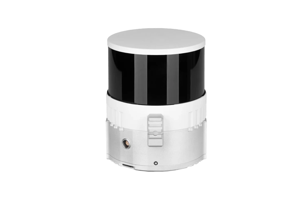
Image 4. TOPODRONE LiDAR 200+ Scanner
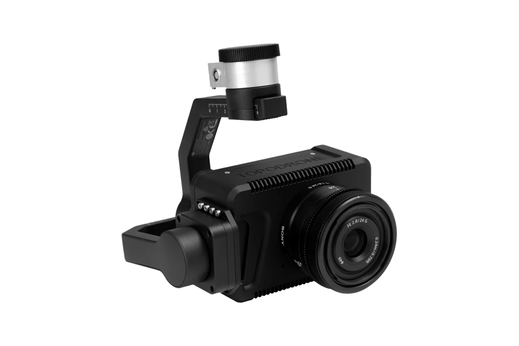
Image 5. TOPODRONE P61 Photogrammetric Camera
Results and Capabilities:
- Accurate capture of terrain and object geometry with a dense point cloud.
- Flight speed of approximately 7 m/s while maintaining high data quality.
- Accuracy of 3–5 cm even in challenging conditions: between buildings, under tree canopies, and near engineering structures.
- Capability for data integration into GIS for further monitoring, infrastructure analysis, risk assessment, and development planning.
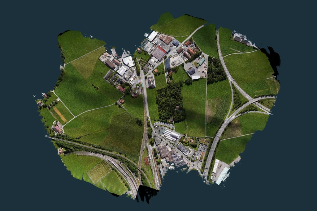
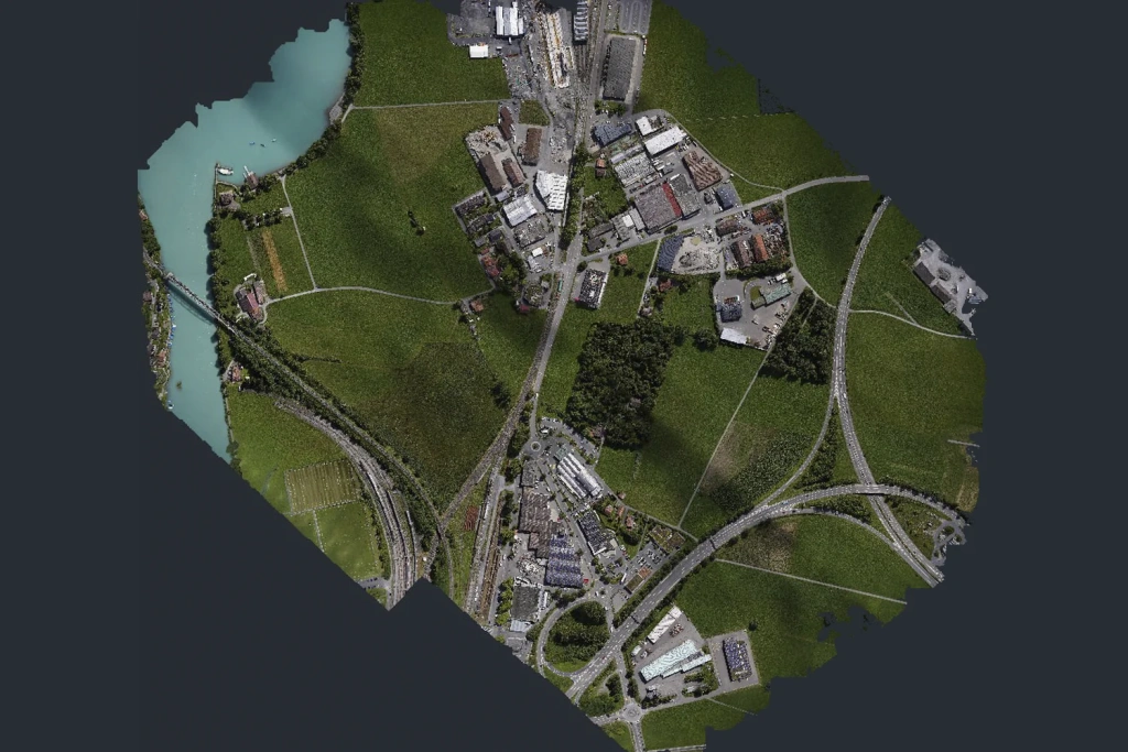
Figures 6–7. Digital Terrain Model (left) and orthophotomap from photogrammetry (right)
Final visualisation and data integration were performed in LiDAR360, resulting in a unified .las file. Additionally, the TOPODRONE P61 camera was used during the survey to colourise the point cloud. More realistic and saturated colours from the photogrammetric survey enhanced the visual appeal of the 3D model. This digital twin is used for engineering analysis, modelling, and area development planning.
The use of LiDAR allowed not only for the creation of detailed 3D models of roads and infrastructure objects but also ensured the georeferencing and accuracy essential for subsequent development, inventory, and traffic flow analysis.
Potential Applications of the Data
1. Measurement of Building Volumes and Dimensions
The point cloud enables accurate determination of building height, area, volume, and geometry without site visits. High data accuracy, achieved by combining LiDAR and photogrammetry, results in a detailed 3D model referenced to a coordinate grid.
Applications span a wide range of tasks:
- Assessment of deformation and condition of facades.
- Calculation of construction material volumes.
- Creation of BIM models and planning of construction works.
- Integration into CAD and GIS for urban planning analysis.
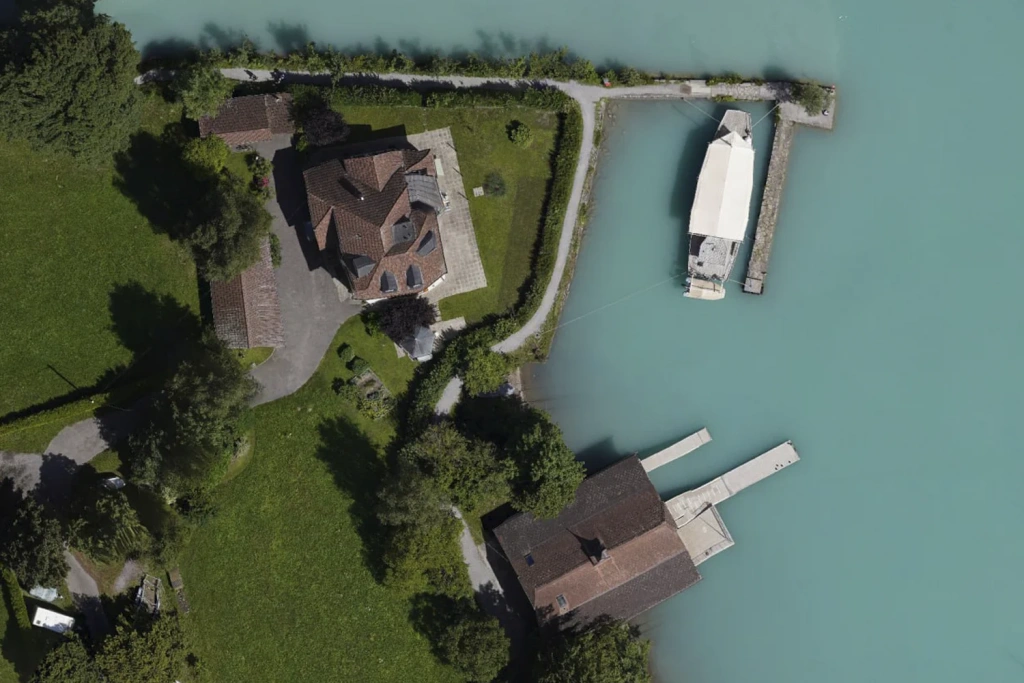
Figure 8. Photogrammetry with P61
In urban planning, such measurements allow for the consideration of terrain, development density, and infrastructure. High-precision 3D models enable verification of compliance with master plans, identification of unauthorised land use, and errors in cadastral data. The technology facilitates the creation and updating of 1:500 scale mapping bases for more accurate decision-making.
The use of unmanned systems accelerates data collection, reduces costs, and enables regular monitoring, which is particularly relevant for dense urban areas and complex infrastructure objects.
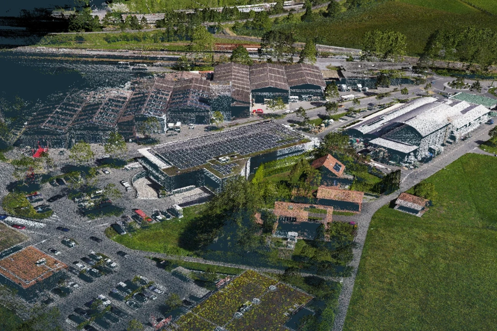
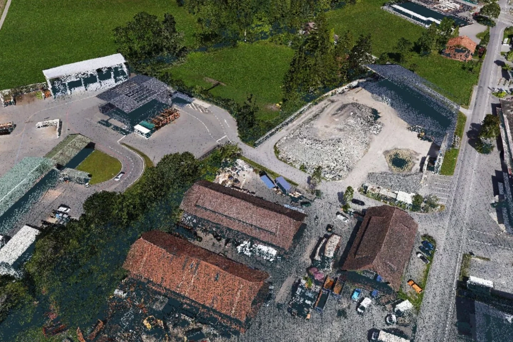
Figures 9–11. Survey of building volumes and dimensions
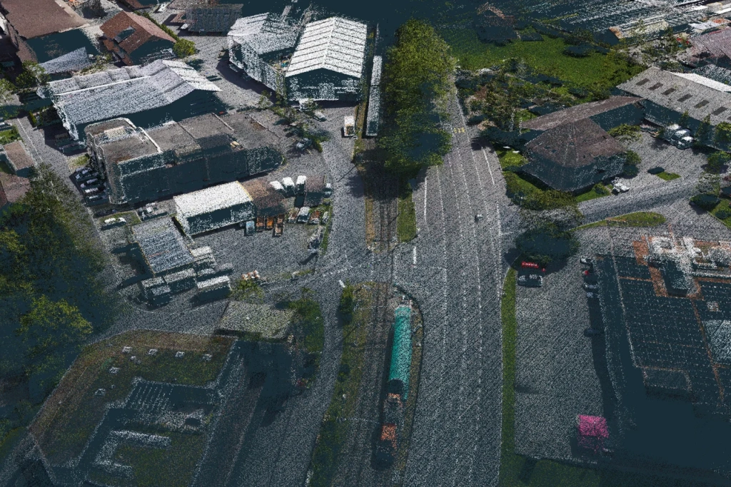
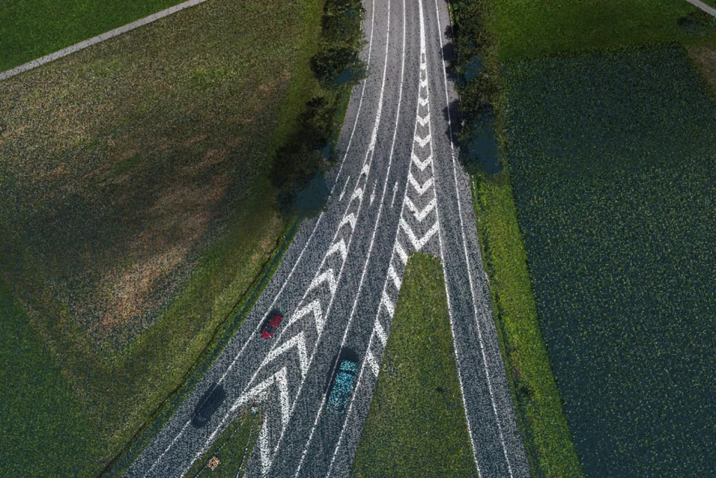
2. Analysis and Control of Road Markings
The point cloud, colourised with RGB camera data, allows for high-precision extraction and classification of road infrastructure elements, including road markings, curbs and carriageway edges, pedestrian crossings, traffic islands, separation strips, as well as road gradients, roadside embankments, and slopes.
These data support a wide array of tasks:
- Updating and adjusting traffic management schemes.
- Objective control of pavement condition and marking wear.
- Analysis of overpass and roadside slope condition.
- Verification of contractor work quality and volume, and compliance with design documentation.
Detailed object geometry is indispensable for planning road reconstruction and optimising traffic flows, where precise referencing to real-world conditions is critical.
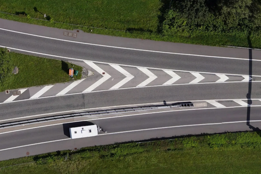
Figure 12. Photogrammetry of a road junction
The technological advantage lies in the combination of LiDAR and photogrammetry, enabling the creation of high-precision digital twins of road surfaces for remote planning and assessment, minimising the need for field visits.
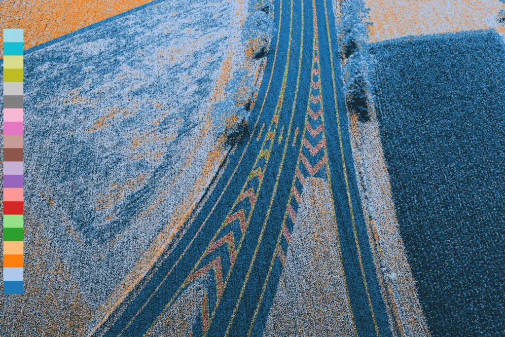
Figures 13–14. Laser scanning of road markings
3. Individual Tree Survey and Analysis of Green Spaces
LiDAR survey also provides the capability for individual analysis of trees and shrubs, including determination of height, crown volume, plant condition, and distances between plants. Such data are applied in landscape design, slope stability assessment, shading calculation, and monitoring of natural areas.
In mountainous regions like Interlaken, this is particularly important for preventing soil erosion and planning stabilisation measures. The high density of laser pulses from the TOPODRONE LiDAR 200+ scanner allows for detailed terrain models even under tree cover.
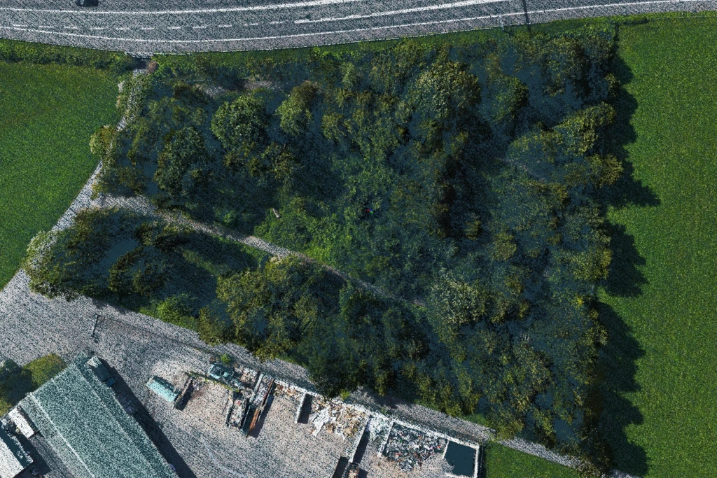
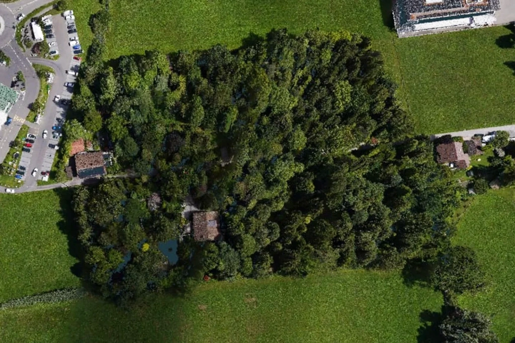
Figures 15–16. Survey of a forest belt
Digital Urban Improvement: From Data to Decisions
The survey in Interlaken clearly demonstrates how laser scanning data can form the basis for digital urban improvement and sustainable development. Based on a high-precision 3D model of the road junction and surrounding areas, specialists have gained a powerful tool for analysis and planning.
Video 1. Overview 3D model of the Interlaken city area
Based on the obtained data, specialists can perform:
- Analysis and Monitoring: сonducting precise measurements of route geometry, assessing the condition of the surface, drainage systems, and engineering structures.
- Control of Hard-to-Access Objects: monitoring bridge spans, retaining walls, and supports by creating their digital twins, without risks or costly access requirements.
- Comparative Analysis: the ability to objectively record any changes on the site over time.
LiDAR as the Foundation for Digital Transformation
TOPODRONE solutions prove that laser scanning is a strategic tool for building comprehensive and well-considered infrastructure. The combined application of LiDAR and photogrammetry technologies creates a universal digital archive for:
- Planning repairs and urban improvement works.
- Quality control of contractor work.
- Integration into BIM processes and GIS systems.
Successful application of the technologies in countries with the most stringent standards, such as Switzerland, confirms that modern UAV-based solutions have moved beyond the experimental stage and have become an efficient and practical tool for designing, constructing, and operating a safe and comfortable urban environment.