


.png)


INTRODUCING TOPODRONE POST PROCESSING 1.5.3.0

The TOPODRONE team has released the latest update of its post-processing software (TPP) – version 1.5.3.0, dated 11 November 2025. This release includes key improvements aimed at enhancing performance and making data processing more convenient. The main new features and fixes are listed below.
New Features
Point Cloud Colouring Utility (Insta360 Video): In the new version, has been added the utility that automatically colourises the point cloud using footage from an Insta360 camera. In the extended mode, the operator can manually adjust the temporal synchronization between the LiDAR and the camera, and compensate for any misalignment in the roll, pitch, and yaw axes. Additionally, the software now has the capability to generate geo-referenced panoramas from spherical (360°) video.
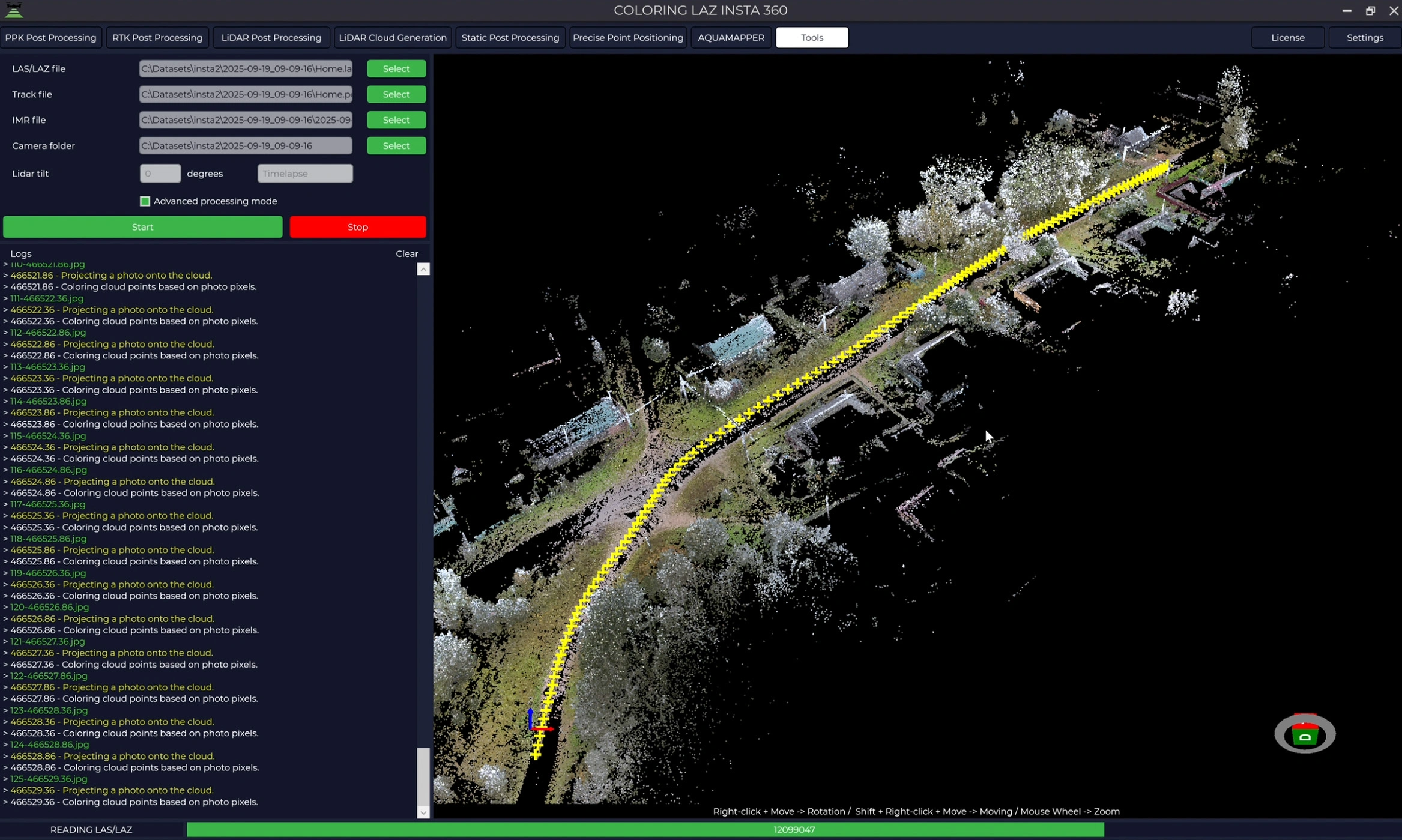
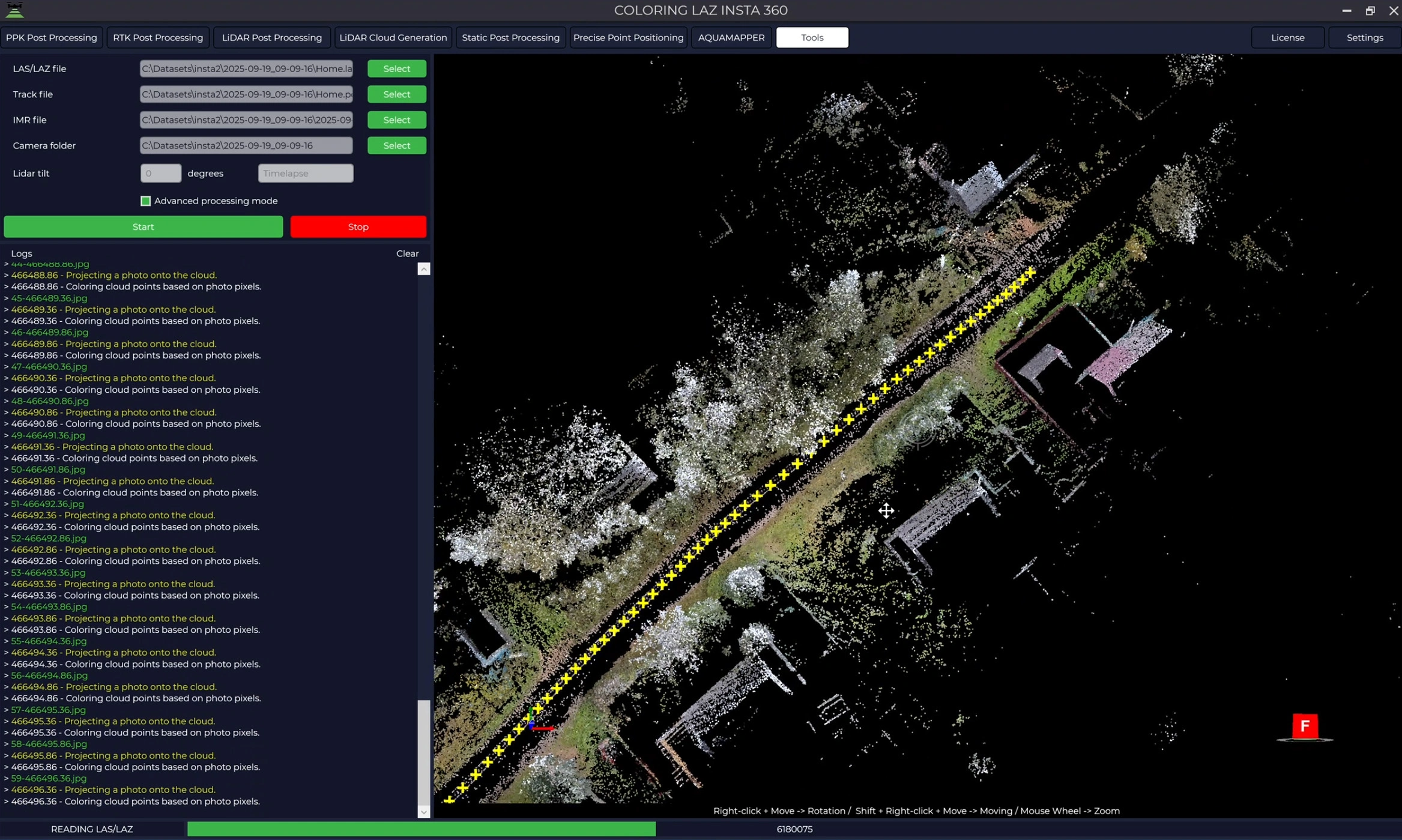
Images 1-2. Result of LAZ point-cloud colouring
Video 1. Colouring process of the INSTA360 LAZ point cloud in TPP
Streaming Mode: Point cloud generation, calibration angle calculation, colouring, and coordinate conversion to LAS/LAZ formats are now performed in a streaming mode, where the data is processed in parts rather than loaded entirely into memory. This allows users to work with projects of any size without limitations and ensures stability when processing large datasets.
Support for Q.Fly Water SWIR Camera: The software now includes support for the new Q.Fly Water infrared camera, which is designed for capturing water surfaces and specialised hydrological applications. This camera operates in NDMI, NDMIj, NIR, and SWIR spectral bands and can record video. (Support was previously added for the Q.Fly Explore, Q.Fly Explore Pro, and Q.Fly Solar cameras.)
Images 3. Q.Fly Water support in TPP
IMR Data Recovery Utility: A utility has been added to automatically fill small gaps in IMR/IMU logs with interpolated data. This enables the calculation of the LiDAR scanner’s trajectory in the event of brief GNSS data losses, for example due to signal jamming.
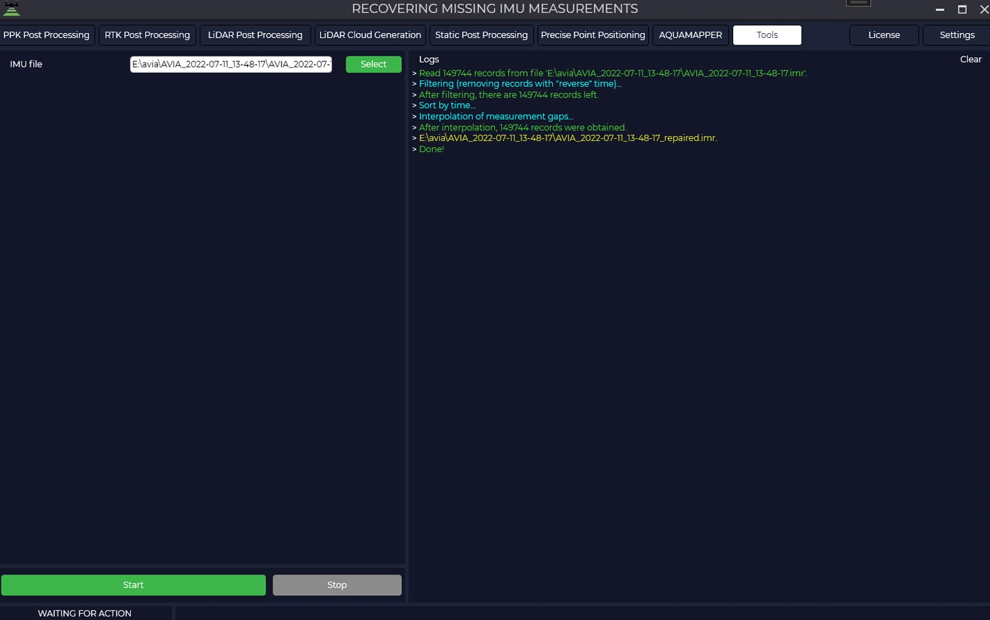
Images 4-5. IMU measurement gap restoration
Fixes
Takeoff Marker: Fixed an issue with incorrect initialization of the takeoff point coordinates, which was causing the point’s default location to be set at the North Pole or at the origin (0°, 0°).
Practical Benefits
Time-saving and convenience: Automatic colourised visualisation and the streaming mode eliminate the need for manual image registration and speed up data review. The update provides reliable and fast processing even for very large projects, enabling users to quickly analyse results and make decisions.
Improved accuracy and reliability: The new tools allow for detailed checks of data quality (for example, the colourised point cloud simplifies object identification) and fill in any data gaps. They also enable calculation of the LiDAR trajectory during brief GNSS data losses (for example, during signal jamming).
Integration with external systems: The generated colourised point clouds can be easily combined with data in CAD/GIS systems, simplifying further analysis and visualisation.
Reliability: The software has been rigorously tested on large datasets (tens of kilometres of flight paths), ensuring correct operation even in challenging conditions.
The update is now available to all users with an active TOPODRONE support plan.