DJI Mavic 2 Pro RTK/PPK for mining & volume calculation
 Today we want to continue the cycle of articles about real survey project carried out by DJI MAVIC 2 PRO PPK upgraded by the TOPODRONE team to the level of a professional survey tool. An additional survey grade GNSS receiver was installed on board and connected to the camera via Topodrone synchronization system. DJI MAVIC PRO PPK allows to convert photos to precise digital terrain models with an x,y,z accuracy of 3-5 cm, without using ground control points (GCP).
Below we present a report on UAV survey over open pit mine area.
Difficult open pit terrain, height difference of 50 meters and the steepness of the pit walls makes it almost impossible to use standard GNSS survey technology in the RTK mode, and using a total station makes allows to get results no earlier than a week after the start of field work.
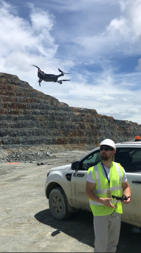
TOPODRONE SA specialists performed aerial surveying of the area using the smallest survey drone DJI MAVIC 2 PRO PPK additionally equipped with a high-precision dual-frequency GNSS receiver designed by Topodrone.
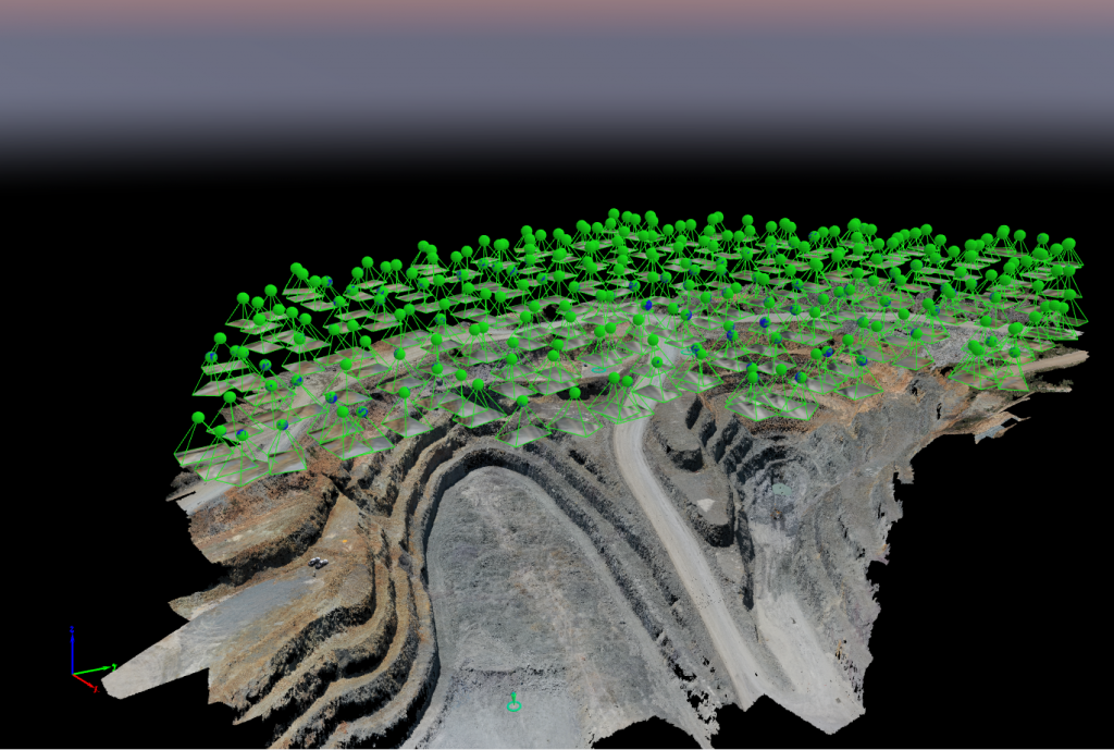
The flight time was no more than 20 minutes, aerial photography was carried out fully automatically, at 90 meters altitude. Flight routes were planned taking into account the double-grid technology, which allows to obtain more detailed textures of steep surfaces.
Based on the results of the field work, the following set of information was obtained:
1. Set of photos
2. Raw GNSS measurement data from the drone and the permanent base station in Rinex format
3. The coordinates of the measured ground control points that will be used to assess the accuracy of the model

Fig. Pix4D photogrammetric processing
As a results of the GNSS measurements post-processing in RTKLIB software, the high-precision coordinates of the image centers in the WGS 84 were calculated and converted to the local coordinate system in the LGO software.
PIX4D software was used for photogrammetric image processing. PIX4D photogrammetry software provides all messerly tools for precise images processing as well as images rectification, points clouds, DTM, DSM and TIN models generation.
Please ask Topodrone team download the report on the adjustment of the block of images or sample dataset.
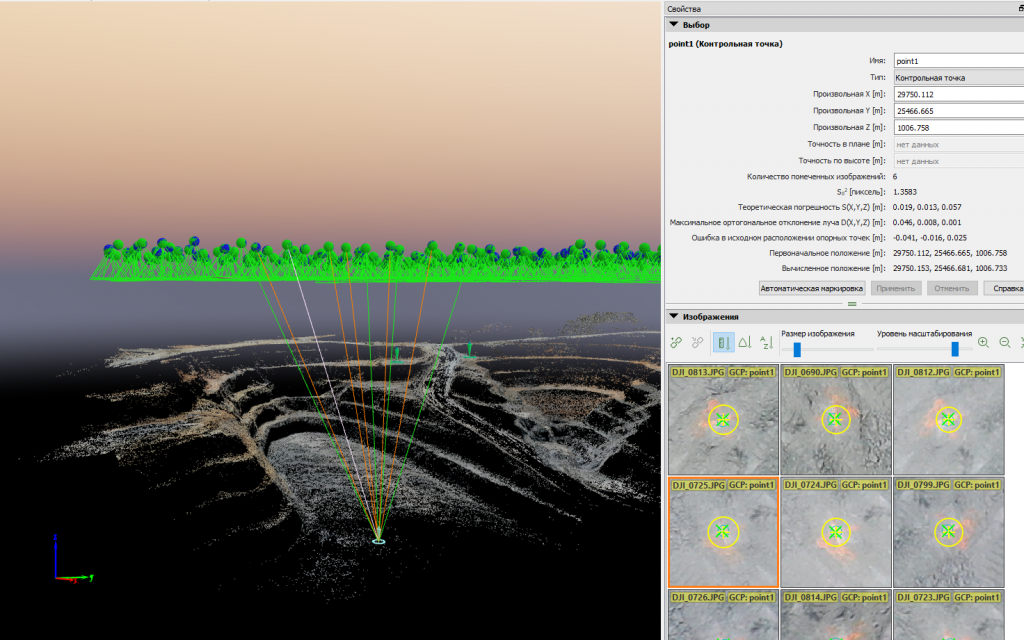
It should be noted that the coordinates of ground control points were loaded into the project to assess the accuracy of the work. Evaluation of the accuracy of determining the coordinates of control points is presented in Table 1.
|
CheckPointName |
ErrorX[m] |
ErrorY[m] |
ErrorZ[m] |
ProjectionError[pixel] |
Verified/Marked |
|
point1 |
-0.041 |
-0.016 |
0.025 |
1.387 |
6/6 |
|
point2 |
0.024 |
0.006 |
0.068 |
1.125 |
9/9 |
|
point3 |
0.007 |
0.015 |
0.029 |
0.881 |
11/11 |
|
Mean[m] |
-0.003168 |
0.001479 |
0.040371 |
||
|
Sigma[m] |
0.027635 |
0.0129 |
0.019447 |
||
|
RMSError[m] |
0.027816 |
0.012984 |
0.044811 |
Table 1. Report on the assessment of the accuracy of determining the coordinates of control points
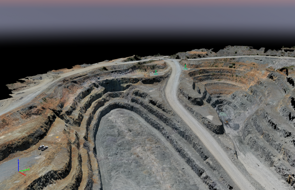
After the aerotriangulation stage, the process of generating a dense cloud of points, creating a TIN model and contour lines was launched.
As a result of the project we generated high precision dataset of points cloud, TIN model and orthophotomosaic over hard to reach open pit area. Thanks to the combination of affordable survey drone DJI MAVIC 2 RTK/PPK and advances PIX4D processing technology we substantially decreased field works and It took us just few hours to get accurate final result for volume calculation.
As you can see PIX4D software supports camera model of DJI MAVIC 2PRO and provides the great accuracy

Fig. Dense point cloud

Fig. Dense point cloud

Fig. Dense point cloud

Fig. Accuracy assessment by GCP

Fig. Accuracy assessment by GCP

Fig. Orthophoto combined with contours

Fig. Orthophoto combined with contour lines

Fig. DEM combined with contour lines
|
Start cooperation with an individual consultation on the selection of equipment and services.
|
Order service
|


.png)


