DJI Phantom 4 Pro RTK/PPK for high detailed building reconstruction
We would like to share survey project results of the high detailed 3D reconstruction of St. Seraphim of Sarov Church
To carry out this project, we have chosen UAV technology that can significantly reduce the time of work, provide measurement of hard-to-reach areas such as roofs, canopies, domes, etc., as well as make this type of work more affordable through the use of a cheaper set of equipment.

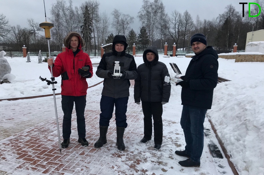
Pic.1.
For surveying we used modified DJI Phantom 4 Pro RTK/PPK with Reach M+ GNSS receiver on board and EMLID Reach RS+ as a base station.
Before capturing photos, we installed the Reach RS+ receiver on the point with well known coordinates.
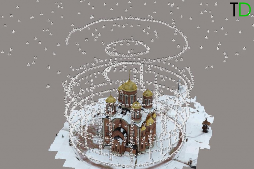
Then flights mission were prepared (the location of the routes is shown in Fig.2.), then we made photo survey by DJI PHANTOM 4 PRO. It should be noted that the survey was carried out completely in automatic mode and for its successful implementation, we needed only 5 batteries and 3 hours of field work.
During survey high-precision x, y, z coordinates of each photo location were measured. It allowed us to process the data in automatic mode and provided high accuracy of the model construction.

Pic.2. Aerial survey routs
You can read more about GNSS measurement post-processing technology, replacement of navigation coordinates with high-precision and photogrammetric processing in our blog, as well as get more advanced knowledge and practical skills that allow you to carry out such projects independently.
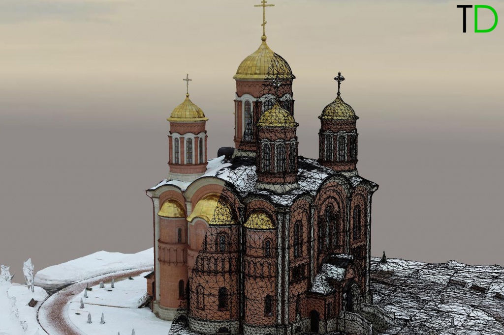
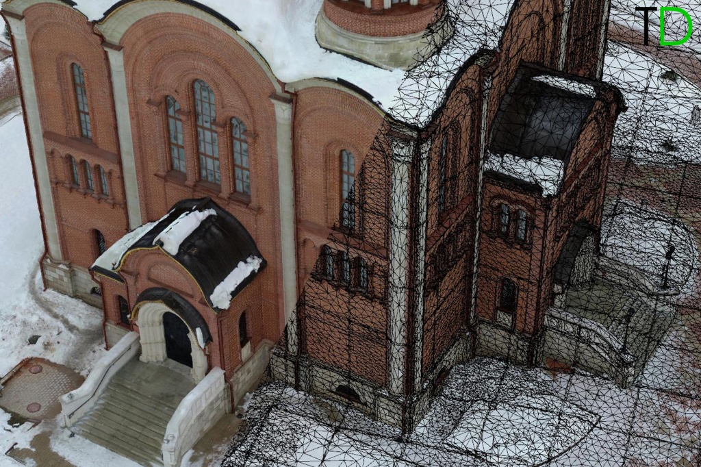
After photogrammetry processing a high-precision three-dimensional model of the temple was built.

Pic.3. 3D and TIN models of the Church of St. Seraphim of Sarov


Pic.5. 3D and TIN models of the Church of St. Seraphim of Sarov

Pic.6. 3D and TIN models of the Church of St. Seraphim of Sarov

Pic.7. 3D and TIN models of the Church of St. Seraphim of Sarov

Pic.8. 3D and TIN models of the Church of St. Seraphim of Sarov
Conclusions
The results of this project clearly show the effectiveness of the use of drones for the facade survey of architectural monuments, as well as highly detailed three-dimensional modeling of buildings and structures.
The solution developed by our company to upgrade the standard DJI Phantom 4 Pro to the level of a professional survey drone allows you to create a high-precision three-dimensional model of the building in hard-to-reach places for "standard" technologies, significantly reduces the time of field work, and also reduces the cost of financial investments for the purchase of equipment.
|
Start cooperation with an individual consultation on the selection of equipment and services.
|
Order service
|


.png)


