LIDAR SURVEY IN DEEP VEGETATION
We answer the question: "Is TOPODRONE LIDAR equipment penetrates deep vegetation and how accurate can be LIDAR survey in forest, bushes and canes areas?"
We receive a lot of questions:
- Is TOPODRONE LIDAR equipment penetrates deep vegetation?
- How accurate can be LIDAR survey in forest, bushes and canes areas?
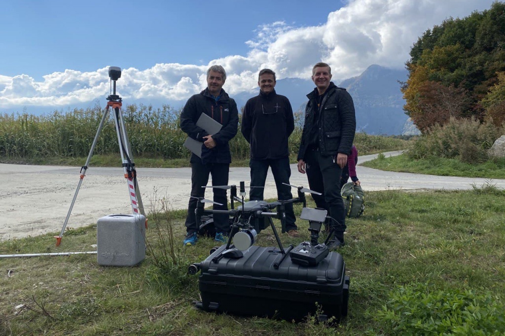
To answer these questions which are very important for all surveyors we would like to share some results from the recent training workshop for using TOPODRONE LIDAR 100 LITE onboard of DJI MATRICE 200 together with EMLID REACH RS2 for survey over deep vegetation and forest areas and to generate accurate 3D maps, orthophoto and terrain level rapidly.
All steps of field works and data processing were made together with professional surveyors from TENZOR VSR (Bulgaria) and Le Dronographe (Switzerland).
Two items of EMLID GNSS receivers were used in the field to establish a base station for UAV LIDAR and to measure some check points in open and covered by vegetation areas.
To tell the truth we were really impressed by the stability of fixed solution provided by this type of GNSS receivers even under trees and in deep vegetation.

Pic. 1. Using EMLID REACH RS2 for measuring check points in deep vegetation.
In order to get fast and accurate survey results and a terrain level we made aerial survey by TOPODRONE LIDAR 100 LITE installed on board of DJI MATRICE 200.
LIDAR flight mission was prepared in UGCS software. UGCS is a professional software which has all you need to create appropriate mission for LIDAR.

Pic. 2. UGCS APP at work.

Pic. 3. UGCS software.
The total flight time of DJI M200 with TOPODRONE LIDAR 100 LITE on board was 28 minutes which allows to survey up to 100 hectares per flight due to light weight of payload. The total weight of TOPODRONE LIDAR system is less than 1 kg, including GNSS receiver, IMU and LIDAR sensor.
After the flight we carried out GNSS and IMU data postprocessing to get precise trajectory as well as 3D points cloud was generated. In more details LIDAR data processing workflow is described in our previous article in BLOG.
It took us approximately one hour after flight to generate precise 3D points cloud and to extract terrain level automatically. The density of points cloud (more than 200 points per sq.m.) was totally enough to get very precise terrain model.
The accuracy of the terrain was proved by several ground check points measured by EMLID REACH RS2 GNSS receiver. As you can see at the following screenshots, a precise terrain can be extracted automatically even in hard to reach vegetation areas covered by canes and bushes.

Pic. 4. RGB LIDAR points cloud.

Pic. 5. LIDAR points cloud colorized by elevation.

Pic. 6. RGB LIDAR points cloud.

Pic. 7. LIDAR points cloud colorized by elevation.

Pic. 8. RGB LIDAR points cloud.

Pic. 9. LIDAR points cloud colorized by elevation, easy to recognize different lines of canes.

Pic. 10. Profile of LIDAR points cloud shows the position of each lines of canes and terrain level on the bottom.

Pic. 11. Profile of LIDAR points cloud shows the terrain level under trees and canes.

Pic. 12. Ground check points location.

Pic. 13. Ground check points location (red dots).

Pic. 14. Location of GCPs at profile.

Pic. 15. Location of GCPs and automatically classified terrain level.

Pic. 16. Automatically generated contour lines.

Pic. 17. 3D view of contour lines together with points cloud.

Pic. 18. 3D view of contour lines together with points cloud.
CONCLUSIONS
The quality control results of a classified relief surface in comparison with the measured check points confirmed the declared accuracy of measurements within 2-4 cm in XYZ.
At the same time the density of the point cloud and the intensity of TOPODRONE LIDAR 100 LITE are fully sufficient for carrying out survey in dense vegetation and forest areas and creating maps of a scale up to 1: 500.
Using TOPODRONE LIDAR 100 LITE installed on the drone leads to substantial time and cost savings during field work on the territory covered with forest, dense bush, field and agricultural vegetation, where it was previously possible to use only ground-based survey methods (RTK or totalstation).

Pic. 19. Quality control by comparing coordinates of GCPs and LIDAR points.

Pic. 20. Quality control by comparing coordinates of GCPs and LIDAR points.

Pic. 21. Quality control by comparing coordinates of GCPs and LIDAR points.
|
Start cooperation with an individual consultation on the selection of equipment and services.
|
Order service
|


.png)


