


.png)


DJI ZENMUSE L3 — NEXT-GENERATION AIRBORNE LASER SCANNER

Contents
- Key advantages of the Zenmuse L3
- Superior range and penetration
- High data accuracy
- Dual 100-MP cameras and photogrammetry
- Adaptive scanning modes
- Increased operational efficiency
- Intelligent integration and software
- Main technical specifications of the Zenmuse L3
- Applications
- Conclusion
- Ordering equipment from TOPODRONE
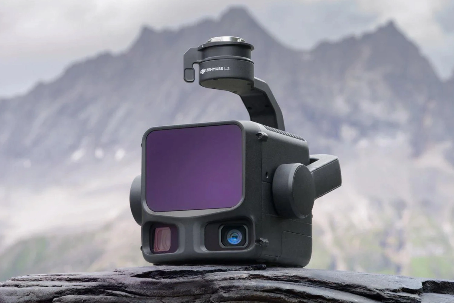
Image 1. DJI Zenmuse L3
5 November — DJI has introduced a new-generation LiDAR system, the Zenmuse L3 This airborne visual system substantially extends the capabilities of unmanned aerial surveying.
With a new sensor suite and cameras, the Zenmuse L3 can survey up to 100 km² in a single day when flown on a DJI Matrice 400, simultaneously collecting LiDAR and photogrammetric data. The combined FOV of the laser sensor and the cameras provides approximately 20% point-cloud overlap and 60% aerial-imagery overlap at the same time; as a result, additional flights are often unnecessary and survey productivity increases markedly.
Key advantages of the Zenmuse L3

Image 2. Industrial unmanned platform DJI Matrice 400 equipped with a Zenmuse L3 LiDAR sensor
Superior range and penetration
The Zenmuse L3 is a significant evolution over the previous Zenmuse L2 generation, delivering notable technical improvements and practical advantages in the field.
Comparison (selected parameters)
| Parameter | Zenmuse L3 | Zenmuse L2 | Practical significance |
|---|---|---|---|
| Detection range | Up to 950 m (10% reflectivity, 100 kHz), up to 2000 m (80% reflectivity, 100 kHz), up to 700 m (10% reflectivity, 350 kHz) | Up to 250 m (10% reflectivity, 100 klx), up to 450 m (50% reflectivity, 0 klx) | L3 enables substantially greater operating heights and area coverage, reducing the number of sorties and improving safety. |
| Point density (point-cloud rate) | Laser rates: 100,000 pts/s / 350,000 pts/s; single return — up to 240,000 pts/s; multiple returns — up to 1,200,000 pts/s | Single return — up to 240,000 pts/s | L3 produces denser point clouds, yielding more detailed object geometry and higher mapping fidelity. |
| Number of returns | Up to 16 returns | Up to 5 returns | L3 captures sub-canopy surface and complex structural detail more effectively, increasing data completeness. |
Practical field advantages:
- Improved penetration through vegetation and complex structures.
- Greater number of reflections beneath forest canopy.
- Clear detection of small objects (power lines, structural elements).
- Reduced noise level in the point cloud.
The L3 extends range and increases data density, reliably capturing small details beneath vegetation and in mixed lighting conditions — qualities that make it a highly suitable tool for accurate and safe airborne data acquisition.
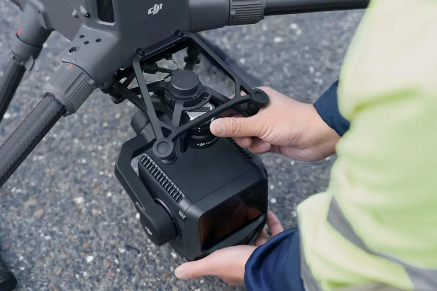
Image 3. Mounting the DJI Zenmuse L3 on the Matrice 400.
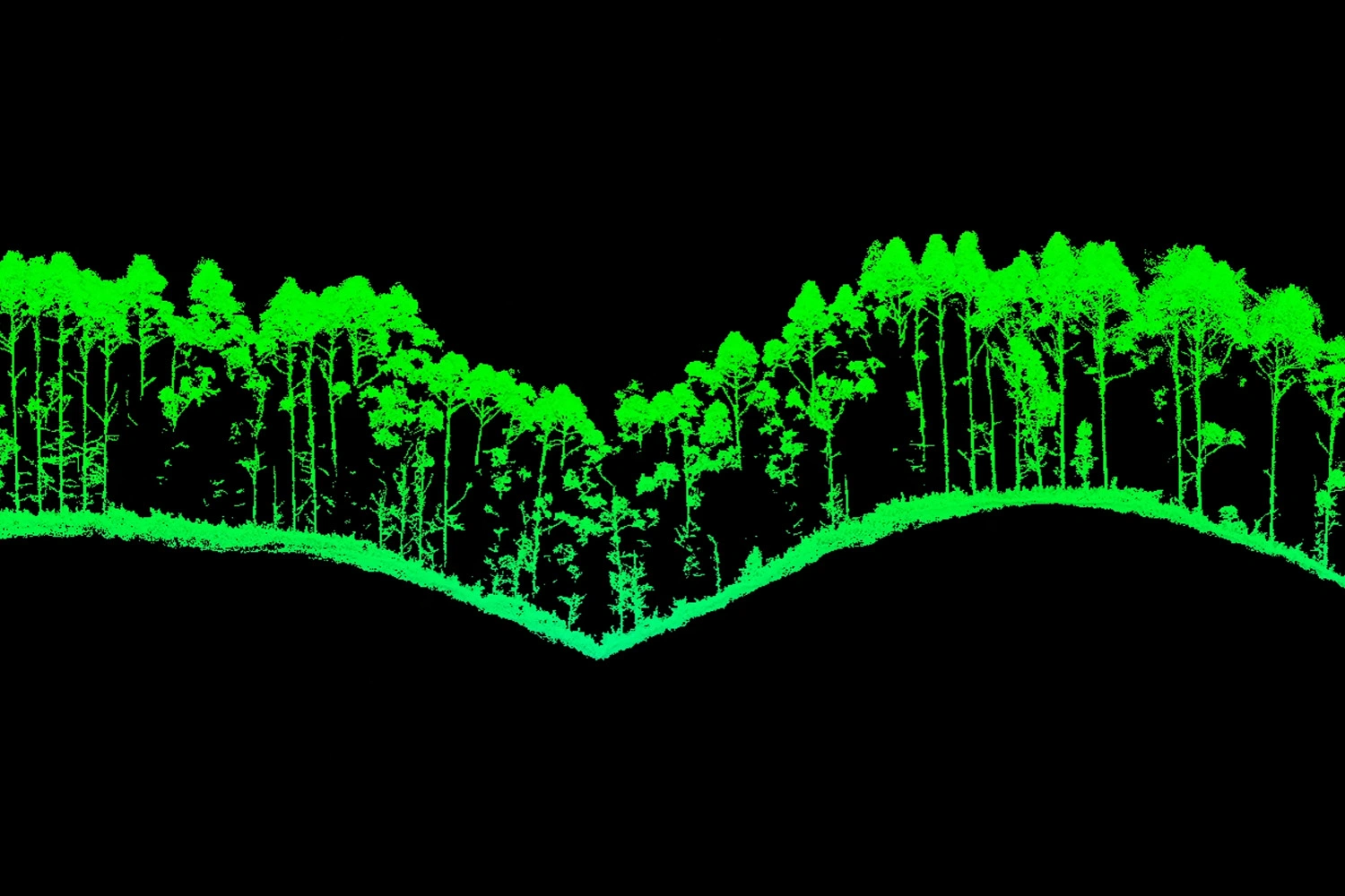
Images 4-5. Collecting data under the forest canopy.
High data accuracy
Compared with the previous Zenmuse L2, the new Zenmuse L3 offers improved measurement accuracy and stability. Where the L2 specified a vertical accuracy of ±4 cm and horizontal ±5 cm at roughly 150 m, the Zenmuse L3 delivers ±3.5 cm vertical and ±5 cm horizontal at the same altitude.
These results are achieved thanks to a new POS module (Position and Orientation System) with enhanced angular performance — 0.02° yaw and 0.01° pitch and roll.
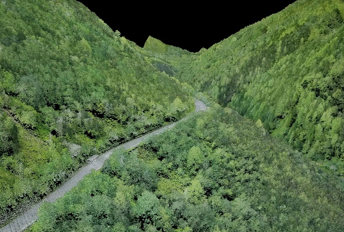
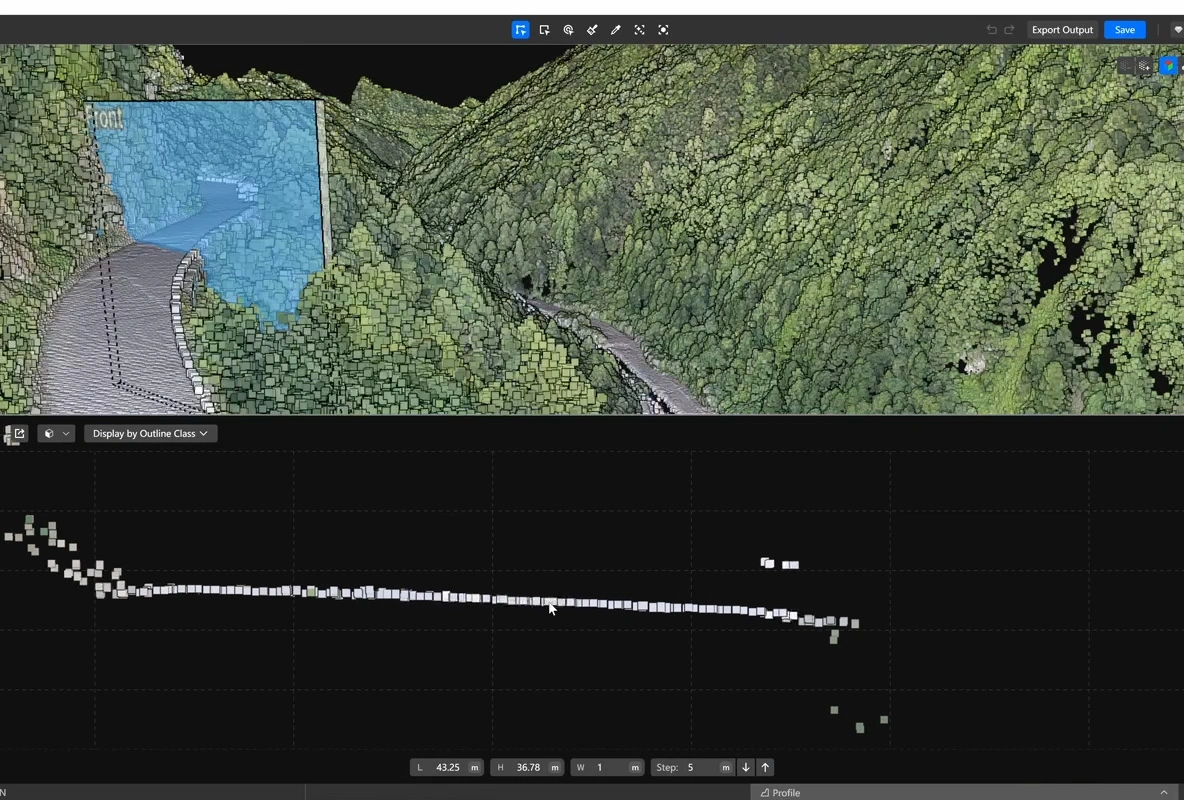
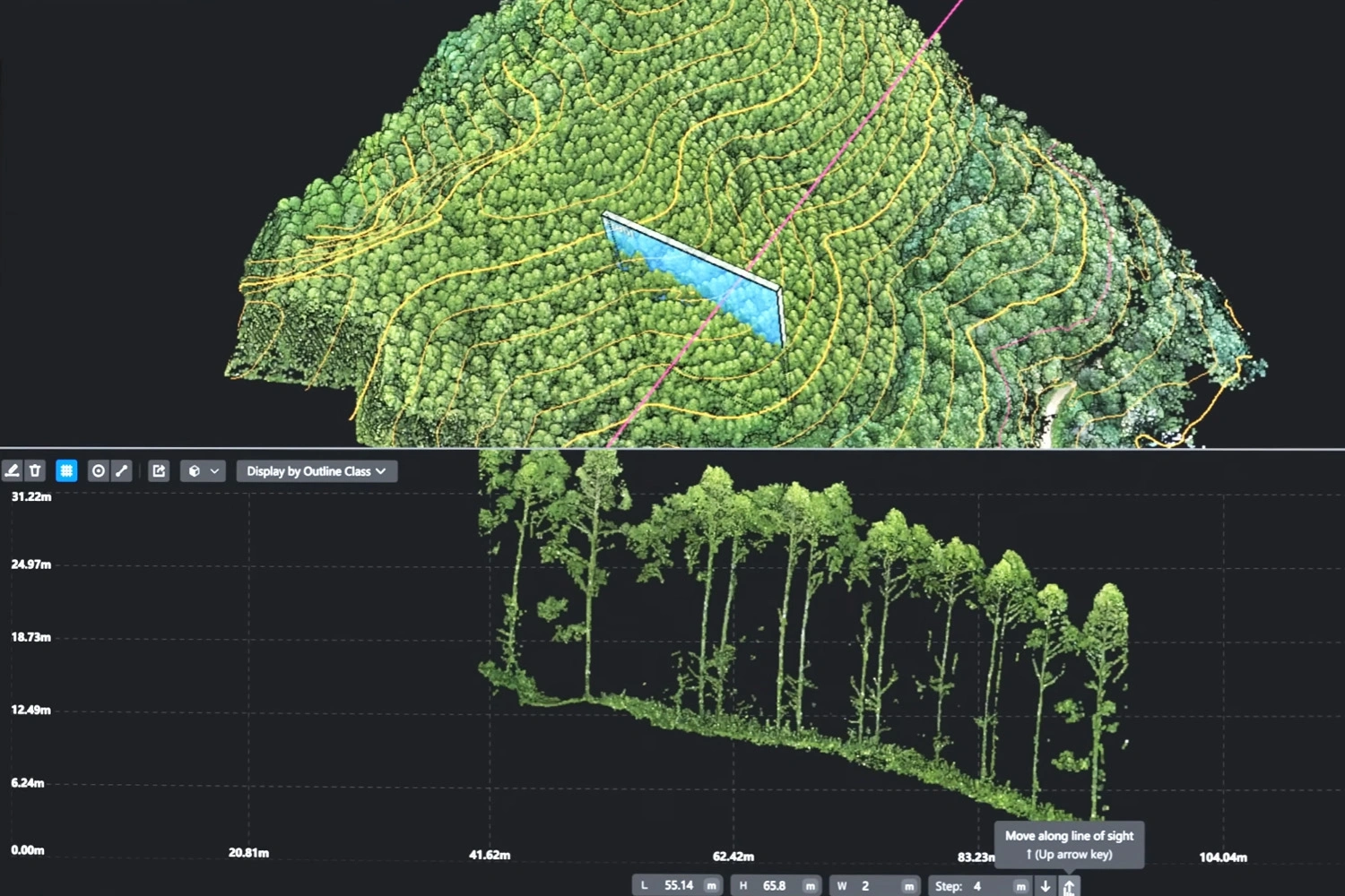
Images 6-7. Example of scanning a densely forested mountainous area using the Zenmuse L3.
Dual 100-MP cameras and photogrammetry
Previously, projects requiring simultaneous LiDAR and photogrammetry typically used a combination of Zenmuse L2 LiDAR and a Zenmuse P1 photogrammetric payload. The new Zenmuse L3 integrates both functionalities into a single module, enabling synchronous collection of LiDAR scans and aerial imagery in one flight.
The L3 is fitted with two 100-MP 4/3-format RGB cameras with mechanical shutters, which provide:
- A wide combined field of view — up to 107° horizontal (versus 84° for L2 and 63–84° for interchangeable P1 lenses).
- High spatial resolution — approximately 3 cm/pixel (GSD) at 300 m altitude.
- Parallel collection of photogrammetric imagery and laser scanning, even with only 20% point-cloud overlap.
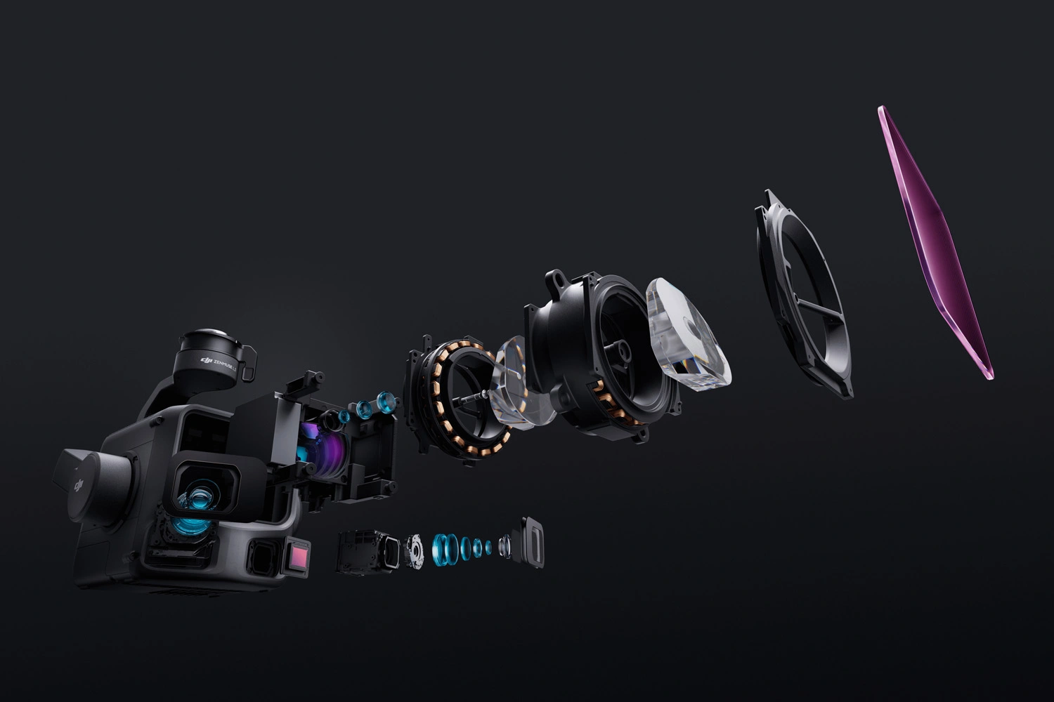
Image 8. Exploded view of the DJI Zenmuse L3
This sensor combination gives the operator georeferenced orthophotos, digital elevation models (DEMs) and coloured point clouds immediately after flight, without requiring a separate aerial-photography campaign.
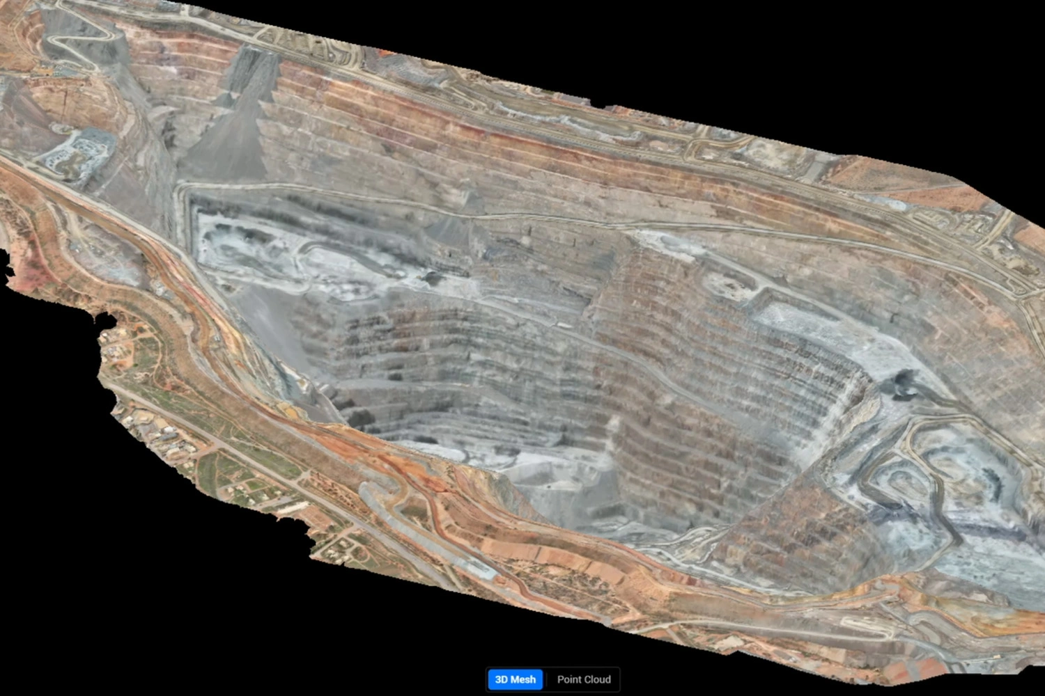
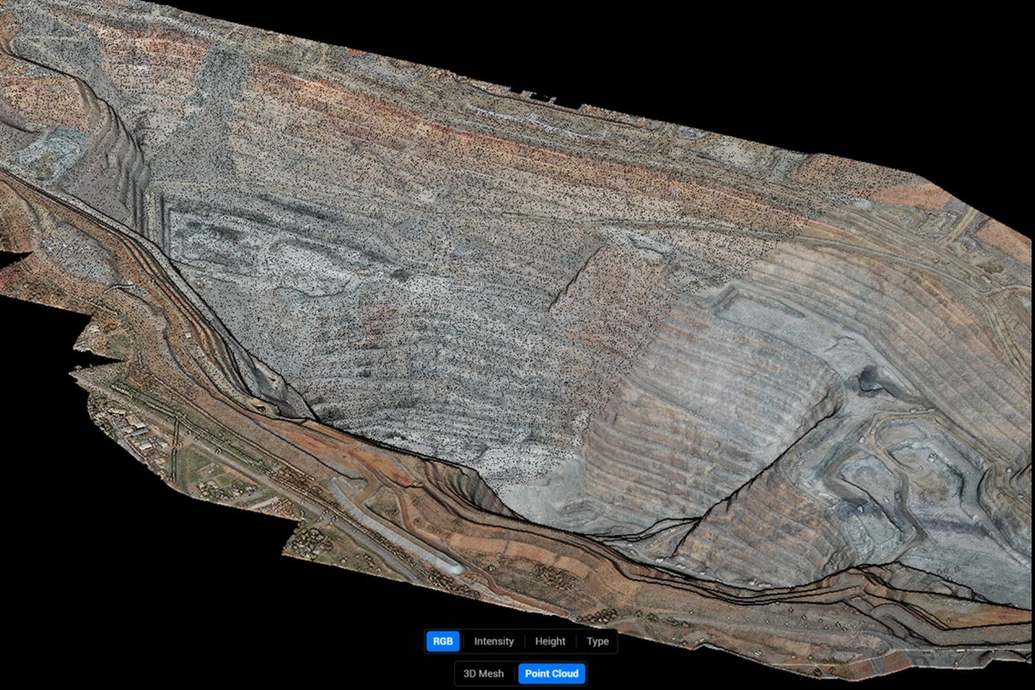
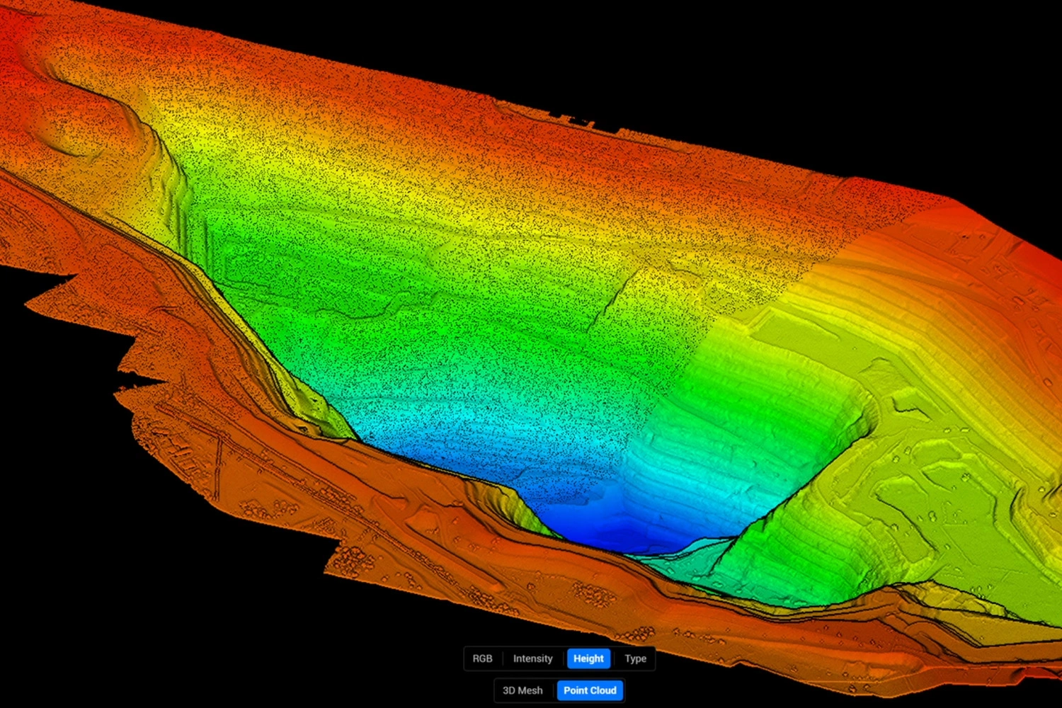
Images 9-11. Single-Pass Photogrammetry and LiDAR Survey of an Open-Pit Mine.
Adaptive scanning modes
The Zenmuse L3 offers enhanced scanning modes that optimize data quality for specific surveying tasks.
Scanning modes:
- Linear — provides uniform, sequential coverage; ideal for high-precision topographic surveys of flat terrain.
- Star (multi-angle) — acquires data from multiple view angles, increasing point-cloud density; suited to forests, complex terrain and urban areas where multi-angle coverage helps resolve occlusions and façades.
- Non-repetitive — enables scanning from varying angles along a route, broadening coverage and increasing efficiency for inspection of power lines and complex engineering structures.
These modes allow the L3 to adapt to survey conditions — from dense urban zones and woodlands to extended infrastructure corridors — striking an optimal balance between speed, accuracy and point-cloud density.
Increased operational efficiency
When paired with a DJI Matrice 400 aircraft, the Zenmuse L3 demonstrates outstanding mapping performance. At around 300 m altitude the system can cover up to 10 km² per sortie, allowing collection of up to 100 km² in a single day.
Relative to the L2, the L3 provides higher detail due to a reduced laser footprint, enabling crisp capture of small infrastructural features. This is particularly important for large-area and linear surveys — roads, power lines and pipelines — where minimising flight time while retaining data quality is critical.
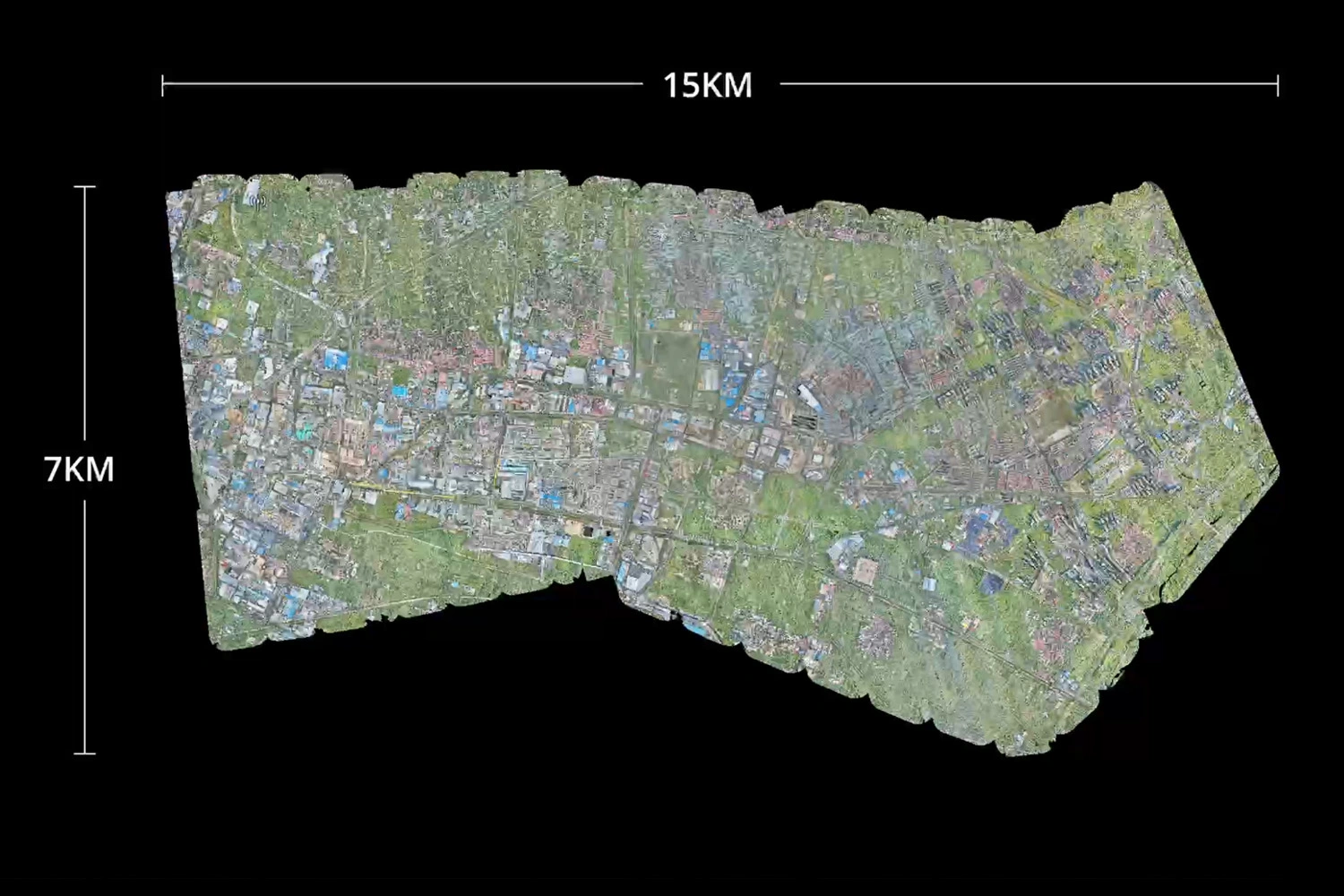
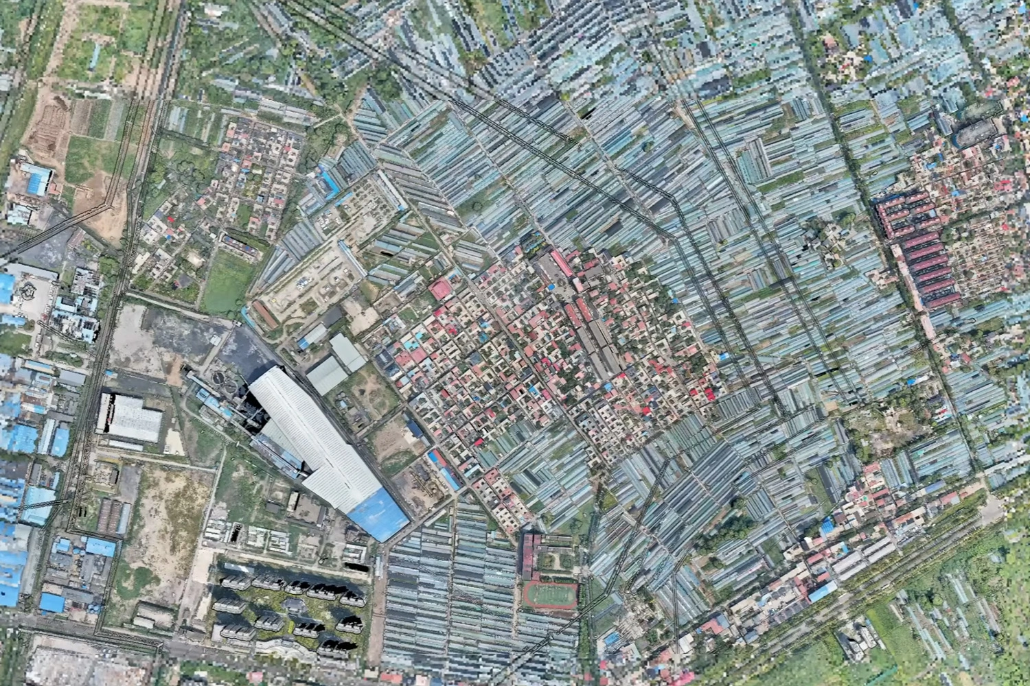
Images 12-13. Photogrammetric Survey Using the L3
Intelligent integration and software
The Zenmuse L3 is fully integrated into the DJI Enterprise ecosystem, supporting a continuous workflow from flight to ready-to-use GIS products.
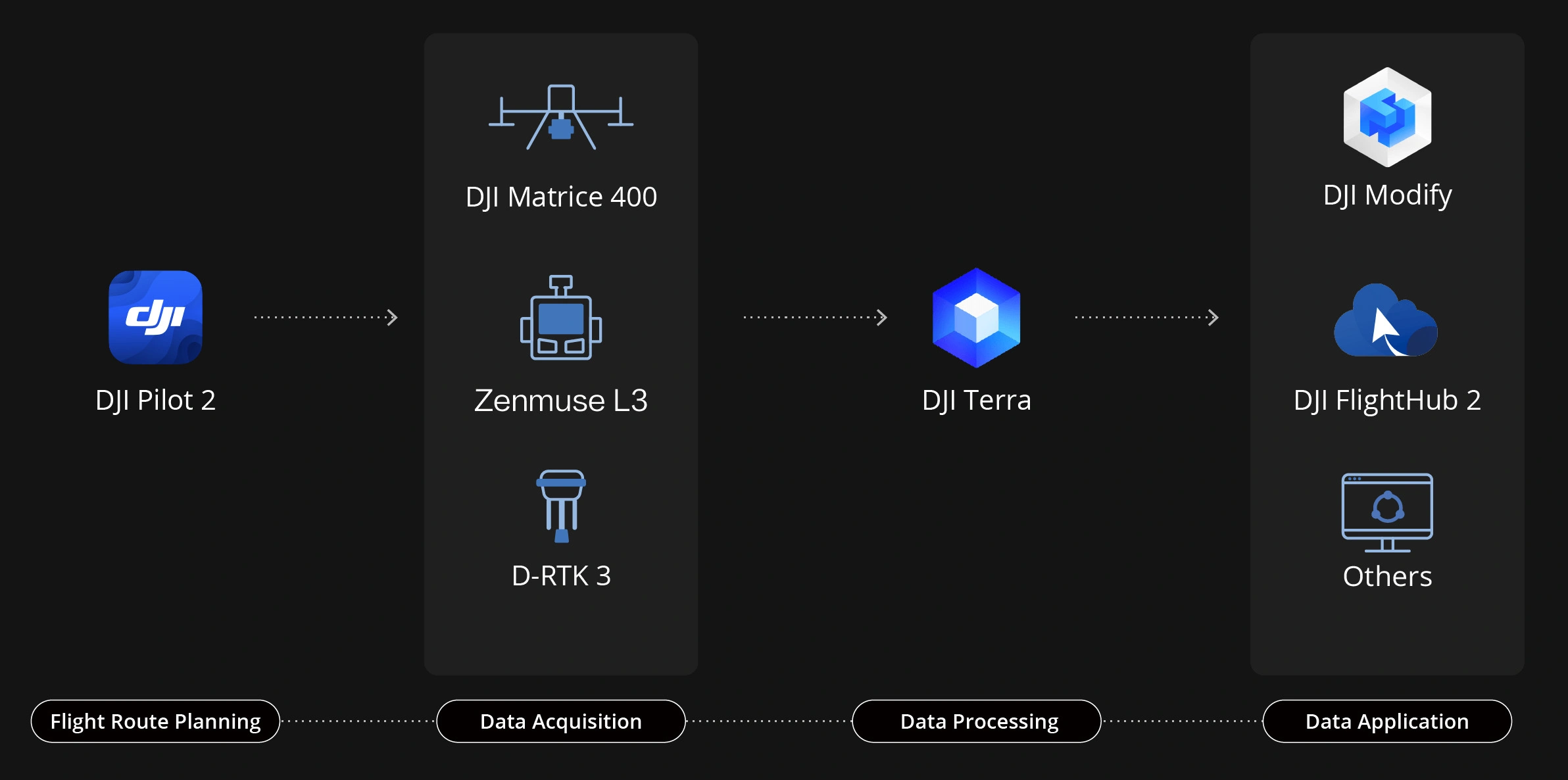
Image 14. The DJI Ecosystem
Mission and sensor control are performed via the DJI Pilot 2 application, where the operator defines flight routes and LiDAR/photogrammetry parameters and monitors acquisition in real time.
Post-processing is carried out in DJI Terra and DJI Modify — software solutions that automatically generate orthophotos, point clouds, digital terrain models (DTM) and 3D meshes (TIN).
PPK correction of navigation data, used in conjunction with D-RTK 3 base stations, provides high-precision positioning and enables operations without the need to deploy ground control points.
This integrated approach delivers key results after a single flight with no complex manual synchronisation or data merging, substantially reducing labour, minimising errors and making mapping fast, accurate and repeatable.
Main technical specifications of the Zenmuse L3
| Parameter | Value |
|---|---|
| System type | Airborne photogrammetric-LiDAR module with dual RGB camera |
| Compatible aircraft | DJI Matrice 400 RTK (requires the standard gimbal connector) |
| Mass | 1.60 kg (device only) |
| Dimensions (L × W × H) | 192 × 162 × 202 mm |
| Power consumption | 64 W (nominal) / 100 W (maximum) |
| Ingress protection | IP54 |
| Operating temperature | −20 °C to +50 °C |
| Storage temperature | −40 °C to +70 °C |
| Laser wavelength | 1535 nm |
| Laser safety class | Class 1 (IEC 60825-1:2014) |
| Detection range | 700 m at 10% reflectivity, 350 kHz / 950 m at 10% reflectivity, 100 kHz / 2000 m at 80% reflectivity, 100 kHz |
| Conductor (wire) detection range | 300 m at 100 klx for aluminium conductor Ø 21.6 mm / 100 m at 100 klx for black PVC-insulated conductor Ø 18.4 mm |
| Number of returns | Up to 16 (100 kHz, 350 kHz) / up to 8 (1000 kHz) / up to 4 (2000 kHz) |
| Pulse repetition frequency | 100 kHz, 350 kHz, 1000 kHz, 2000 kHz (depending on flight altitude) |
| Measurement accuracy | Vertical: 3 cm and Horizontal (planimetric): 4 cm at 120 m (RMSE) / Vertical: 5 cm and Horizontal: 7.5 cm at 300 m (RMSE) |
| Range accuracy | Absolute accuracy: ±10 mm / Repeatability: < 5 mm (1σ) |
| Point spacing (point cloud) | 1.2 cm at 120 m / 2 cm at 300 m (1σ) |
| RGB field of view | Up to 107° horizontal (combined twin-camera FOV) |
| GSD (RGB cameras) | 3 cm/pixel at 300 m |
| Cameras | 2 × 100 MP RGB cameras (4/3 CMOS) with mechanical shutter |
| Scanning modes | Linear, Star (multi-angle), Non-repetitive |
| Software | DJI Pilot 2, DJI Terra, DJI Modify |
| Maximum daily throughput | Up to 100 km² per day |
| POS orientation accuracy | Yaw: 0.02° / Pitch & Roll: 0.01° |
Applications
The Zenmuse L3 is aimed at professionals in surveying, infrastructure, forestry, power utilities and other sectors. Typical tasks include:
- Large-scale topographic mapping — thousands of hectares per day with minimal sorties.
- Urban and construction mapping — creation of 3D building models, roofs and facades.
- Forestry and ecology — assessment of forest parameters, biomass and terrain using the system’s strong penetrating capability.
- Infrastructure inspection — detailed scanning of power lines, pipelines and bridges; the narrow laser beam captures small elements (wires, rebar) at long ranges.
- Emergency response and heritage documentation — rapid 3D mapping of disaster areas or detailed 3D documentation of architectural monuments.
- Transport monitoring — surveys of roads, railways and coastal lines.
Conclusion
The DJI Zenmuse L3 represents a new generation of airborne laser scanners, combining long-range LiDAR, photogrammetry and high-precision navigation in a single solution. The system delivers record detection range, high detail and consistent accuracy, enabling data acquisition in minimal time.
Thanks to the combination of a new laser sensor and two 100 MP RGB cameras, the L3 generates dense, accurate and coloured point clouds without the need for additional flights. This makes it a powerful tool for engineers, surveyors and designers who prioritise speed, accuracy and data reliability.
The Zenmuse L3 sets a new standard for efficiency and quality in airborne laser scanning — creating detailed orthophotos and 3D models is now faster, easier and more accurate than ever before.
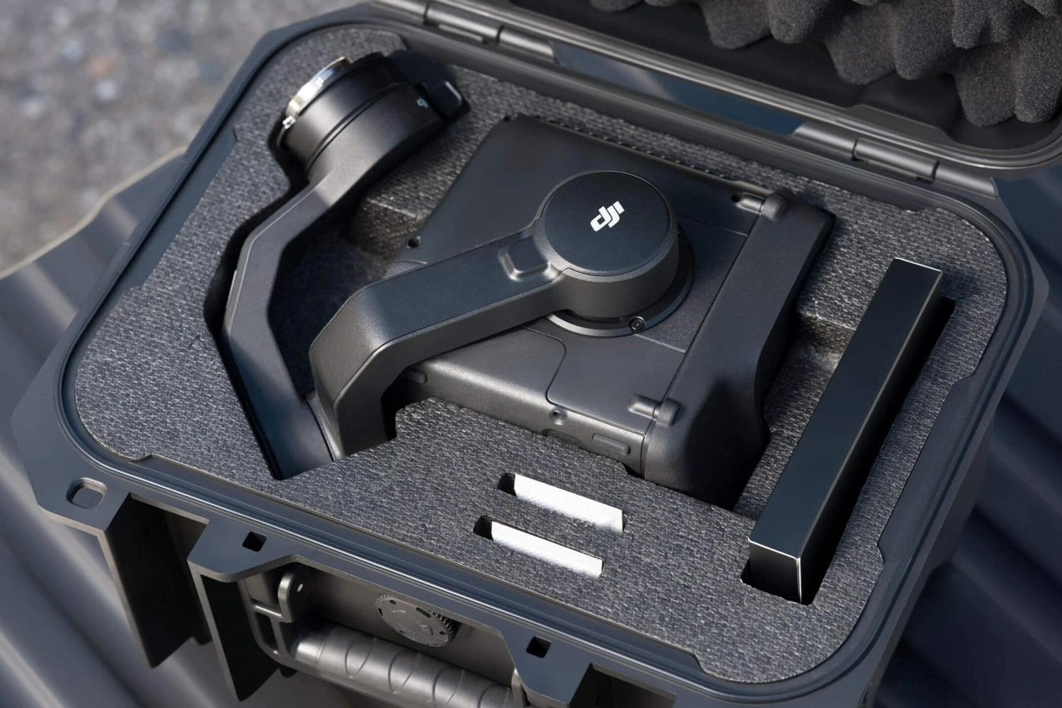
Image 15. DJI Zenmuse L3 LiDAR with Protective Case
Ordering equipment from TOPODRONE
TOPODRONE supplies original DJI equipment, performs pre-delivery testing and calibration, and guarantees stable, reliable system performance under real operating conditions.
Each LiDAR unit and drone undergoes compatibility testing, firmware updates and bespoke configuration to meet the client’s specific project requirements. TOPODRONE specialists ensure that all components operate correctly and, when necessary, carry out software restoration and optimisation.
At present, the DJI Zenmuse L3 and the industrial DJI Matrice 400 platform are available to order in our catalogue.