

Chailuri Fortress
Chailuri Fortress is an outstanding example of medieval defensive architecture, situated in the picturesque valley of Kakheti.
Built to protect trade routes and local settlements, the fortress retains all characteristic features of Georgian fortifications: massive stone walls, defensive towers, and a strategically advantageous location on an elevated site, providing extensive views of the surroundings and protection from potential attackers.
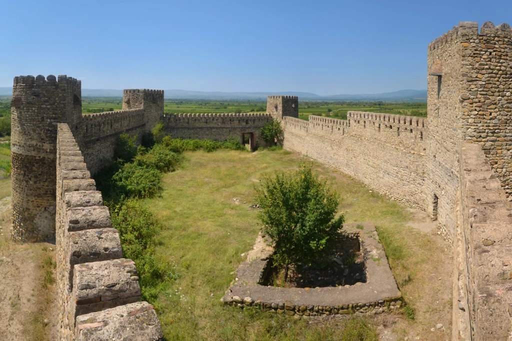
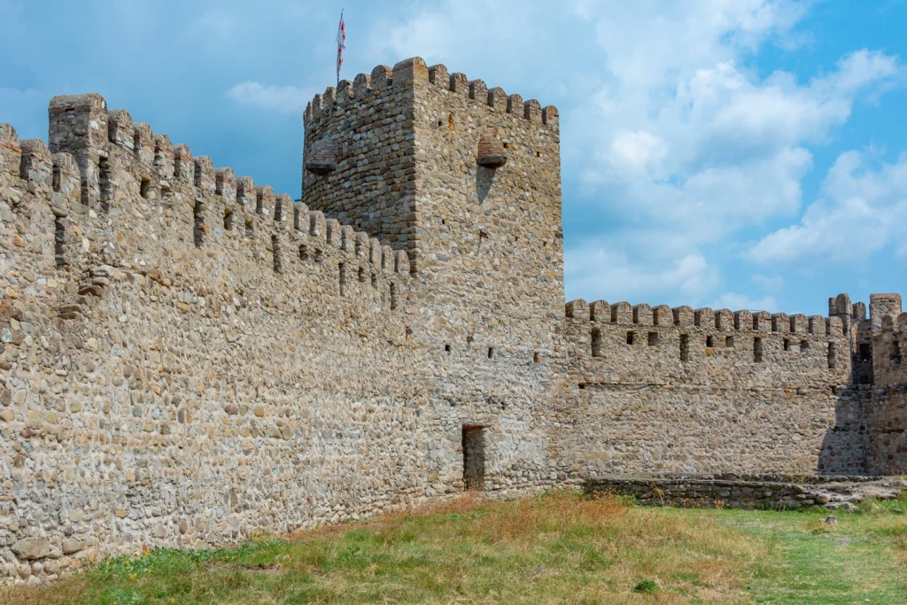
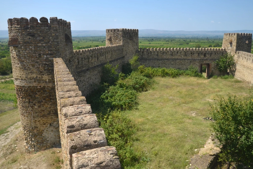
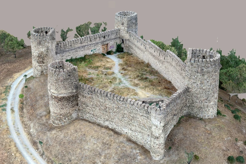
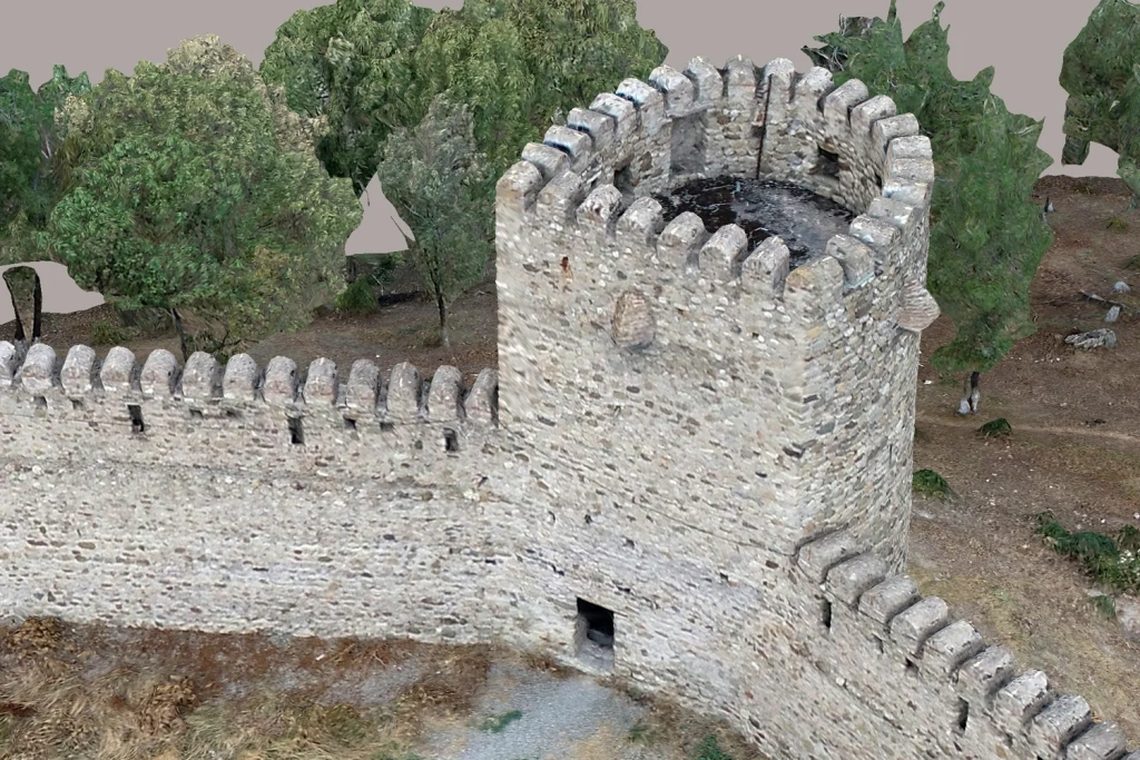
Images1-3. General Views of Chailluri Fortress
Assessment of the Landscape
The surrounding landscape is highly complex and diverse. The fortress rises atop a hill, surrounded by rugged terrain featuring alternating ravines, slopes, and natural terraces.
Historically, this natural combination of relief elements provided reliable defence and complicated enemy access. Today, the same features present significant challenges for geodetic surveying: variations in elevation, dense vegetation, and inaccessible areas create “blind spots” when using traditional surveying methods.
Under such conditions, drone-based photogrammetry becomes the optimal tool. It allows for the collection of detailed data on terrain, drainage, and vegetation, opening up new opportunities for:
- Landscape analysis
- Monitoring of erosion processes
- Planning conservation measures for historic sites
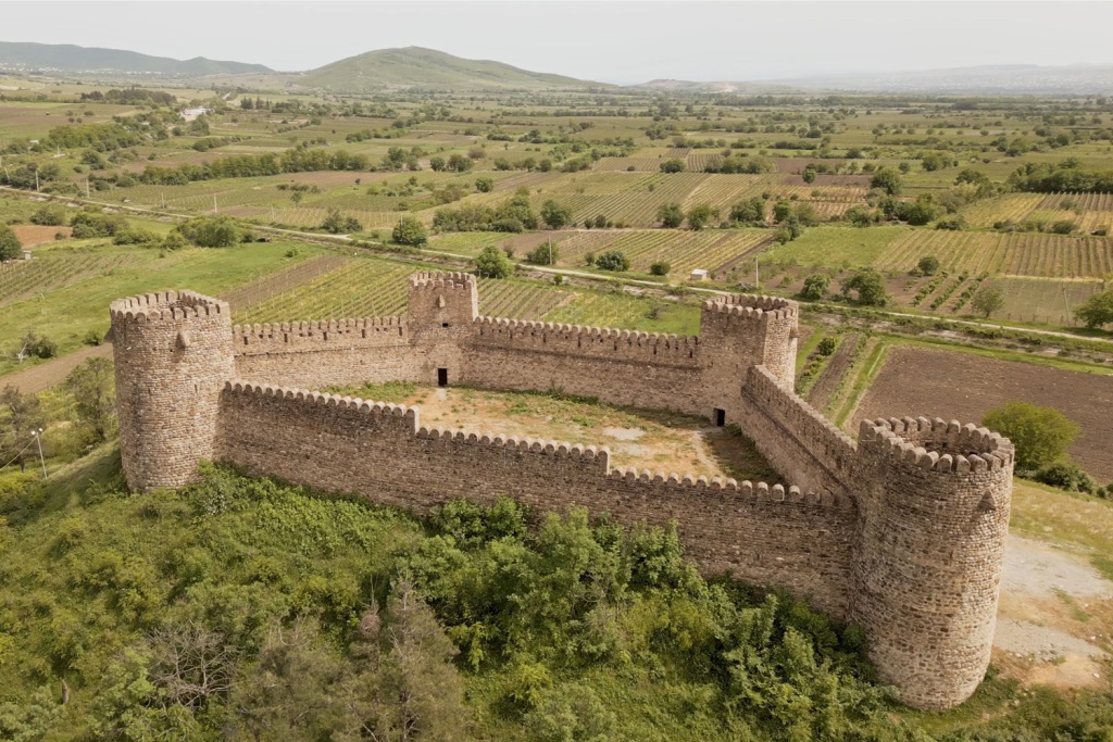
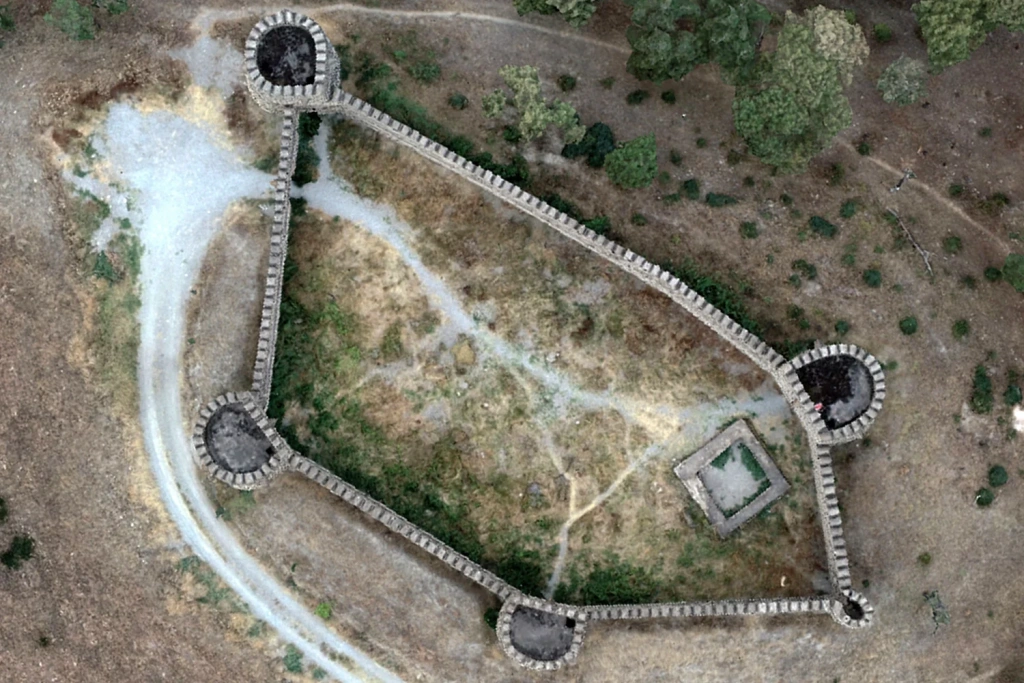
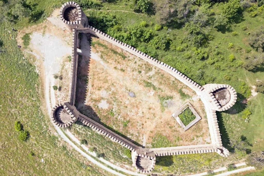
Image 4. Chailluri Fortress and the Surrounding Landscape
Soil Heterogeneity
Beneath Chailuri Fortress, a significant variety of soils can be found, directly affecting its stability:
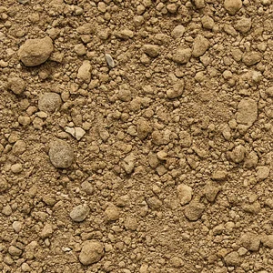
Loam – a mixture of clay and sand that retains moisture and can settle over time. Loam soils are dense and relatively stable, but excessive wetting may alter their properties.
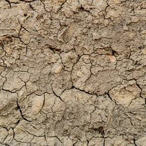
Alluvial deposits – sediments formed by rivers and temporary streams. Composed of sand, clay, and gravel, these soils remain loose, prone to erosion, and susceptible to subsidence.
This variation in the fortress’s foundation explains the uneven condition of its walls:
- Sections built on dense soils are relatively well preserved
- Areas on loose soils show signs of settlement, cracking, and partial masonry collapse
Fortress Foundation
The fortress rests on a typical medieval Georgian strip foundation made of rubble stone set in lime mortar, laid directly on natural soil.
This method provided reliability for the massive walls and enabled the construction of tall towers. However, in areas with variable soil composition, the strip foundation has experienced uneven settlement over time, leading to deformations and damage to certain structural elements.
Today, this necessitates not only continuous monitoring but also the use of technologies that objectively assess soil conditions and track their changes.
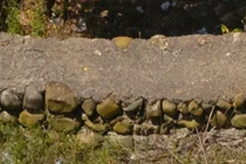
Image 5. Example of a Foundation Made of Rubble Stone and Mortar
From Historical Heritage to Modern Technology
The combination of complex terrain and heterogeneous soils makes modern monitoring technologies essential.
Chailuri Fortress is not only a valuable historical monument but also a unique research site, demonstrating how digital tools can help preserve architectural heritage.
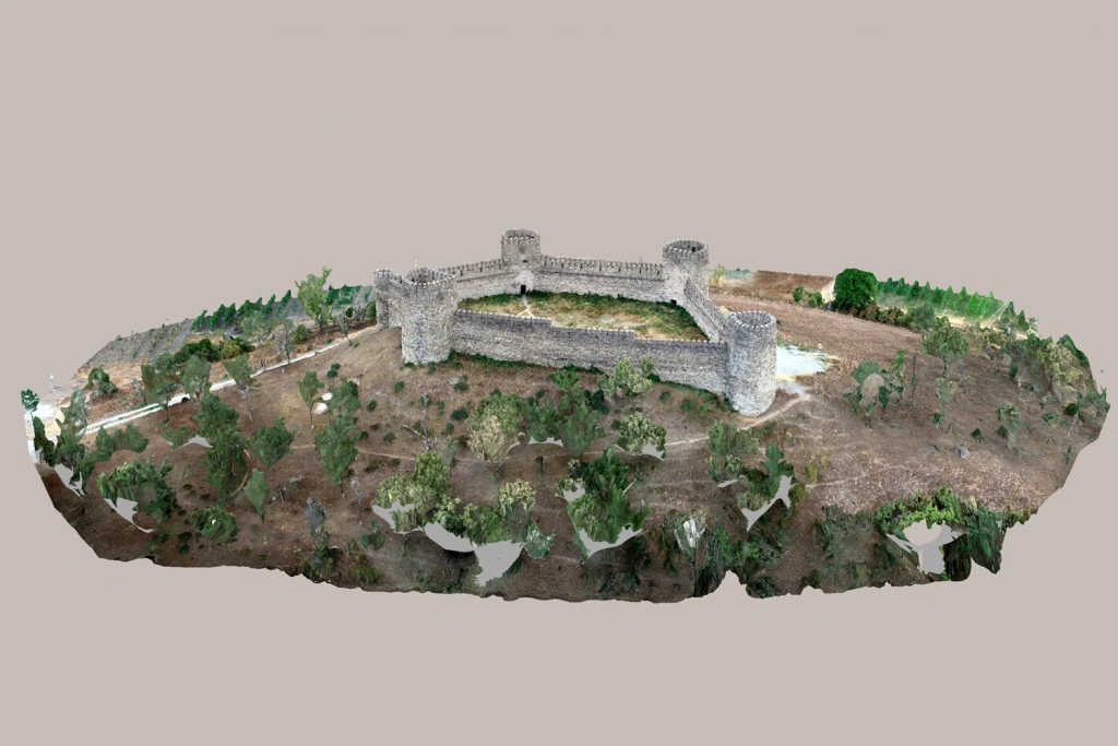
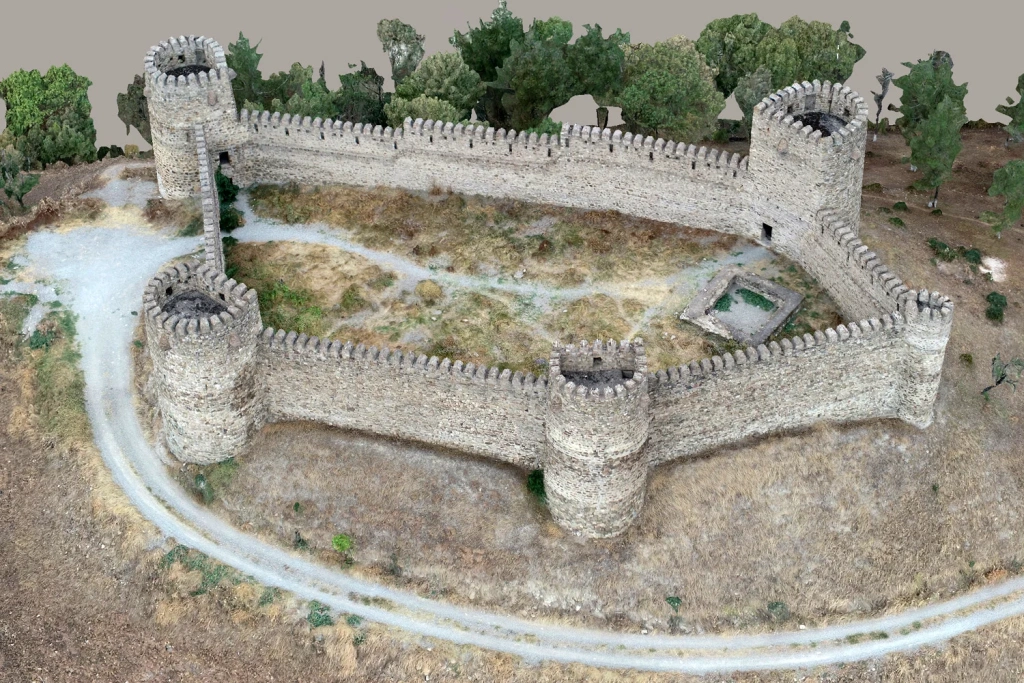
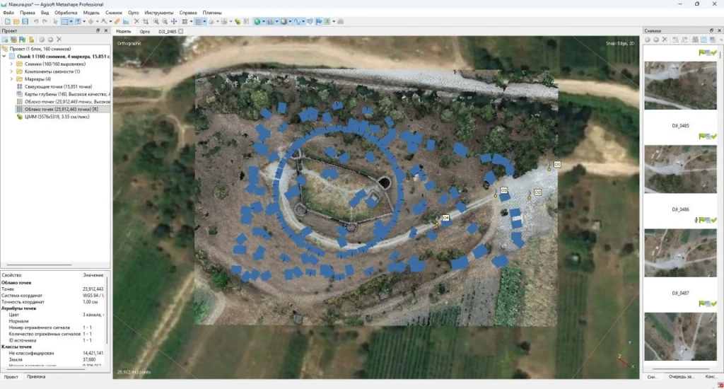
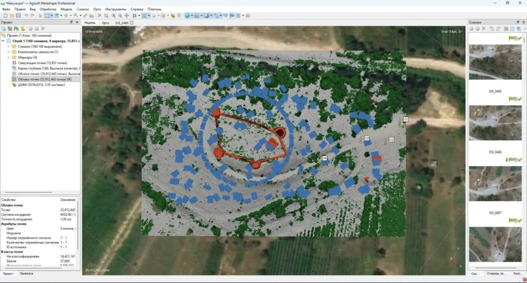
Images 6-7. Overview 3D Model of the Point Cloud of Chailluri Fortress
Modern TOPODRONE solutions enable a shift from traditional surveying to a comprehensive digital approach, converting the fortress and its surroundings into an accurate 3D model.
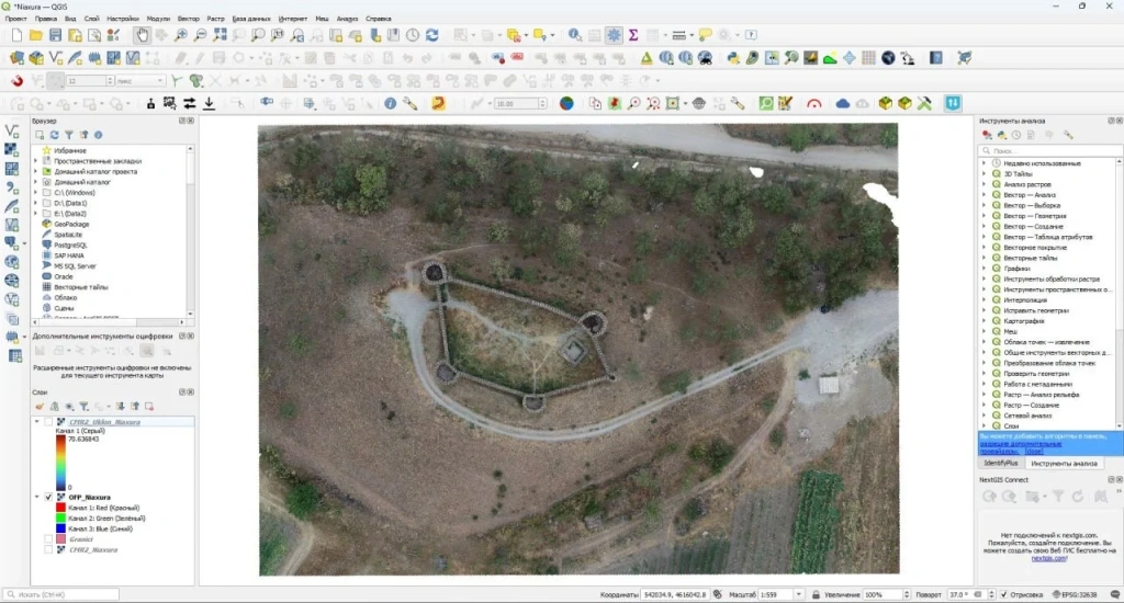
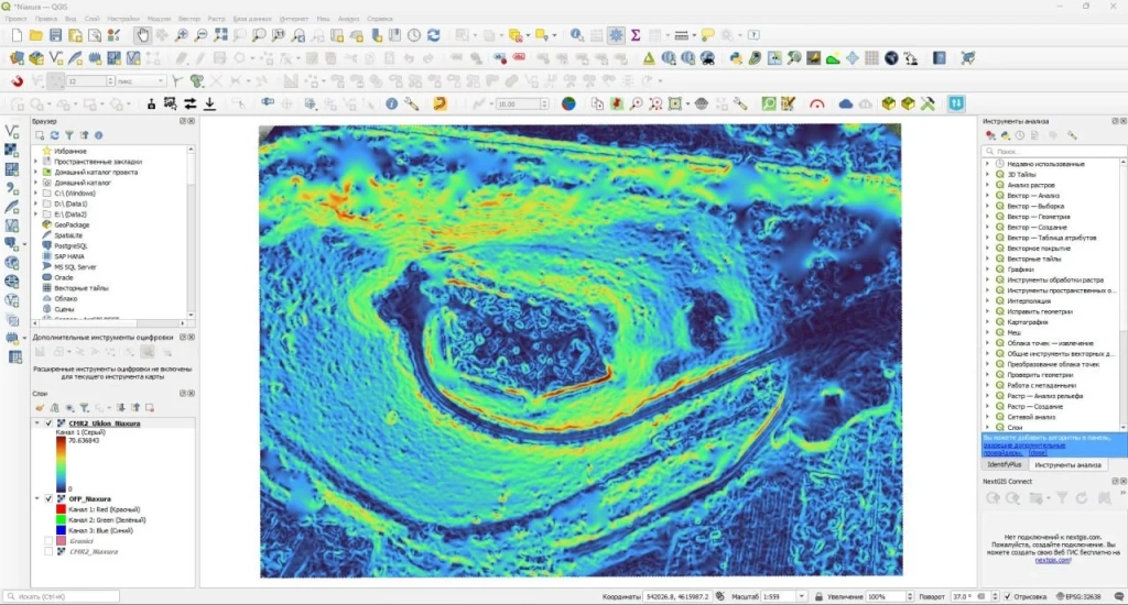
Images 8-9. Chailluri Fortress – Top View: Point Cloud on the Left, Drone Footage on the Right
This model serves as the basis for:
- Creating high-precision slope maps
- Analysing drainage directions and potential erosion zones
- Calculating volumes for embankments or cuttings when reinforcing slopes or designing drainage systems
- Monitoring soil changes over time — tracking settlement, subsidence, and erosion processes
Images 10-11. Chailluri Fortress – Overview 3D Point Cloud Model
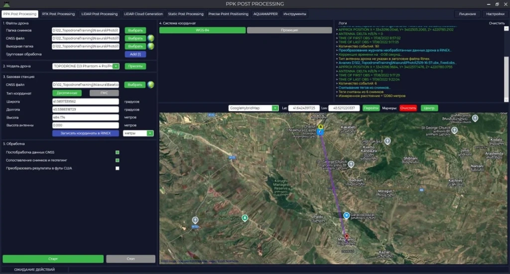
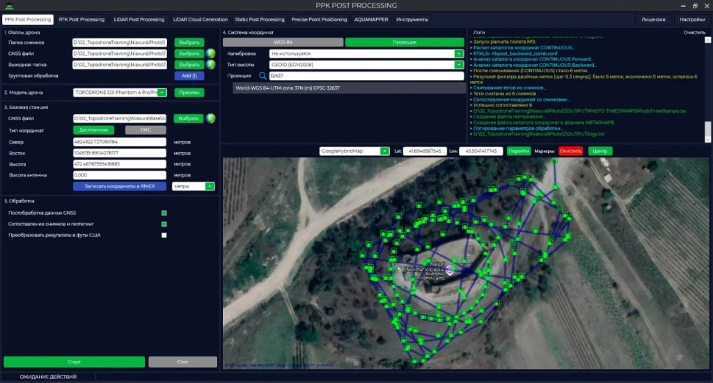
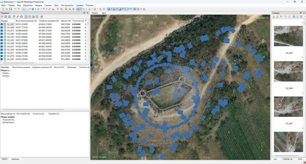
Survey Methodology of Chailuri Fortress Using PPK
Photogrammetric surveying of Chailuri Fortress and its surroundings was conducted under challenging terrain conditions with limited access for ground survey instruments. An industrial drone system was used:
- Drone platform: DJI Matrice 350 RTK
- Photogrammetric camera: TOPODRONE P24
- PPK module: TOPODRONE (L1/L2 GNSS)
Key Features of the Survey:
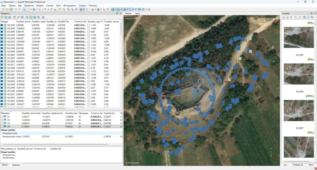
- The use of PPK with virtual RINEX via CORS provided high-accuracy georeferencing without the need for a ground base station.
- Georeferencing of images was achieved with 3–5 cm accuracy, ensuring metric reliability of the digital model.
- A multi-level flight scheme was applied:
- Vertical (nadir) images for capturing terrain, slopes, and adjacent areas
- Oblique images from multiple heights (~40 m and above) for detailed visualisation of walls, towers, and hard-to-access areas, eliminating “blind spots”
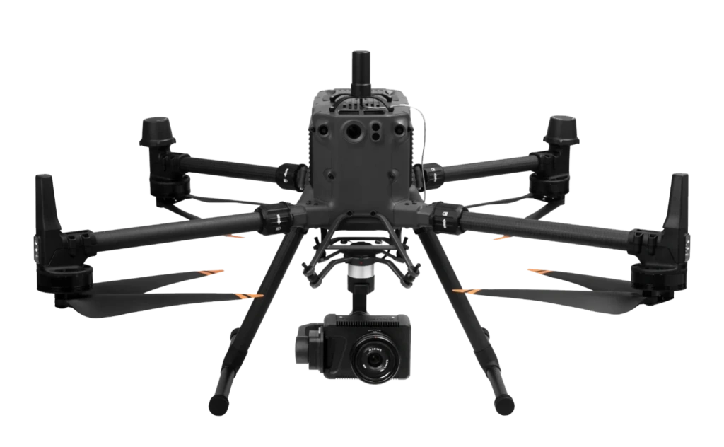
Image 12. Industrial UAV Photogrammetry System Based on DJI Matrice 350 + TOPODRONE P24 Camera + PPK
This comprehensive approach enabled the creation of an accurate 3D model of the fortress and its surroundings, forming the basis for terrain analysis, volume calculations, and monitoring soil changes while assessing the state of the historic site.
Data Processing Workflow
To transform drone-collected data into a metrically accurate digital model, the following sequence is applied:
1. Trajectory processing – flight data is post-processed in TOPODRONE Post Processing (TPP), calculating the high precision image centre coordinates.
2. Data import into Agisoft Metashape – images with calculated centres are imported for aerotriangulation, ensuring precise alignment.
3. Accuracy verification – the model is calibrated using control points (GCPs) to achieve centimetre-level precision.
4. Dense point cloud generation – a detailed 3D representation of the territory is created.
5. Point classification – points are classified as ground, vegetation, structures, and others.
6. Digital Terrain Model (DTM) and orthophoto creation – providing metrically accurate visualisation of the site.
7. Integration into QGIS – data is loaded into a GIS for slope analysis, volume calculations, and change monitoring over time.
Conclusions
The study of Chailuri Fortress demonstrates that the combination of complex terrain, heterogeneous soils, and an ancient strip foundation poses risks to its preservation. Traditional surveying methods are insufficient in such conditions, as they cannot capture detailed terrain features or monitor their dynamics.
Drone-based photogrammetry, combined with TOPODRONE software solutions, enables:
- Generation of a complete and accurate digital model of the site
- Identification of potential erosion and settlement zones
- Monitoring of foundation and masonry conditions
- Evidence-based planning of restoration and conservation measures
Digital technologies thus become a key tool for monitoring and preserving Chailuri — a unique monument of Georgian defensive architecture — bridging historical heritage with modern analytical methods.