TOPODRONE UAV survey for construction site monitoring and BIM
Today we would like to share with you our experience of using drones for building process monitoring and BIM modelling. A fair example would be a construction site located in Almaty city in Kazakhstan.
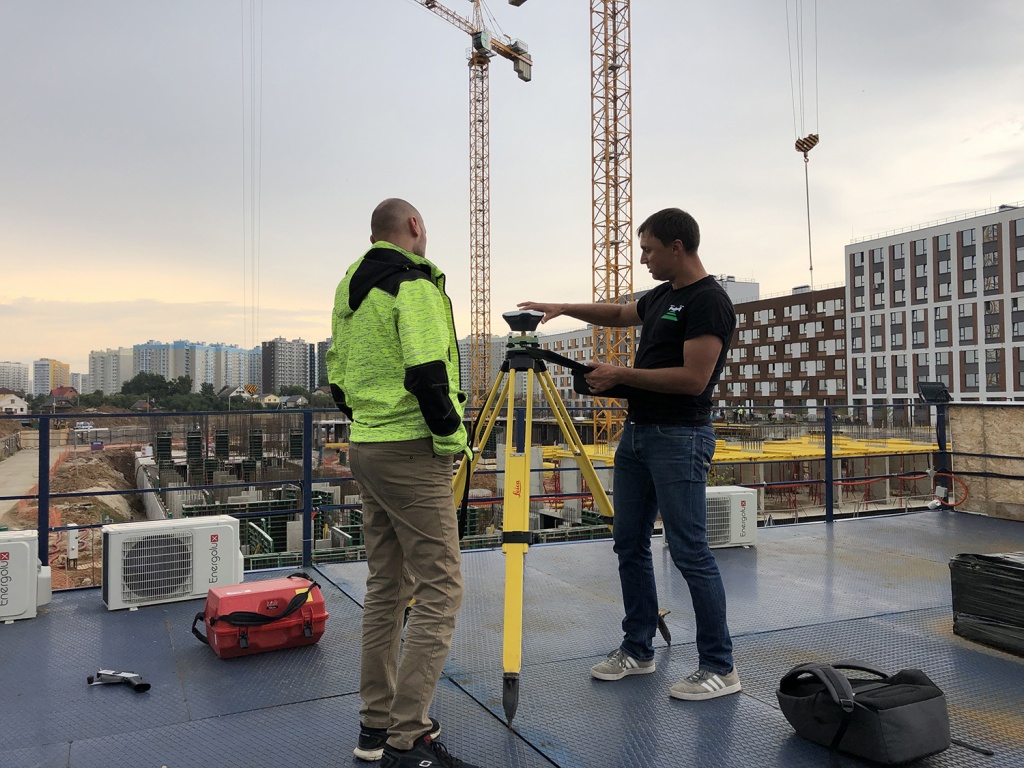
During the building and installation works, our partners in the Republic of Kazakhstan carried out a periodic monitoring of the developing area using TOPODRONE UAVs with a high-precision L1/L2 GNSS receiver and a high-resolution camera onboard.
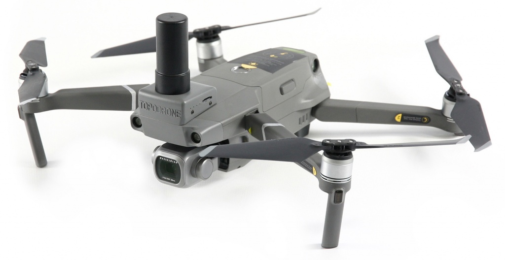
Pic. 1. Topodrone DJI Mavic 2 Pro L1/L2 RTK/PPK
They used the most advanced and affordable survey grade drones Topodrone DJI Phantom 4 Pro L1/L2 RTK/PPK and a best seller at the market - the most compact survey grade drone Topodrone DJI Mavic Pro L1/L2 RTK/PPK
Distinctive features of this equipment are the following:
1. User friendliness. Even unqualified worker after a 1-2 day training course will be able to execute aerial surveying on his own. Therefore, the everyday monitoring task becomes easy to fulfil and allows engaging local personnel without highly-paid professional pilots and surveyors, taking part.
2. High measurement accuracy. Due to the dual frequency survey grade GNSS receiver, the drone positioning and the survey timing is carried out with the accuracy of several centimeters. The flights can be taken up to 20-30 km away from the base station. Thus, there is no need to additionally purchase another GNSS receiver to be used as a base station.
3. Easy postprocessing. Due to the precise photo center coordinates, the photogrammetric processing is carried out in fully automatic mode. In order to control the modelling accuracy it is enough to use 2-3 ground checkpoints, placed in areas, providing long-term safety to them.
4. TOPODRONE survey grade drones allow getting comprehensive information about the status of the building process and the amount of the completed earthwork.
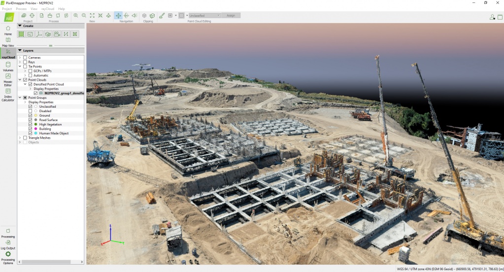
The results of photogrammetric processing of the survey data were used to create accurate digital 3D models and an orthomosaic with the Pix4Dmapper software. They were systematically integrated into a single BIM system of the object.
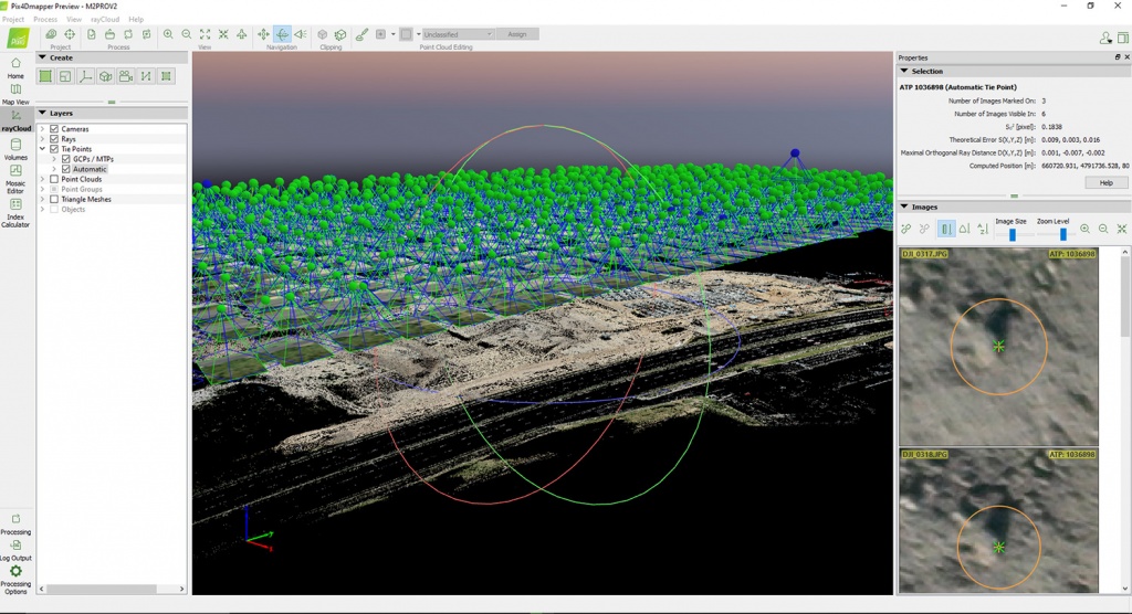
Pic. 2. Photogrammetric processing in Pix4Dmapper
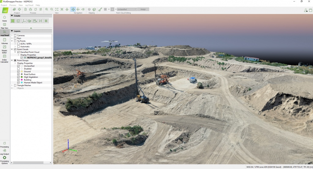
Pic. 3. Dense point cloud, representing machinery, buildings and facilities, flora
Pic. 4. Dense point cloud, representing machinery, buildings and facilities, fencing, flora and building materials in complete details (rebars, decking, etc.)
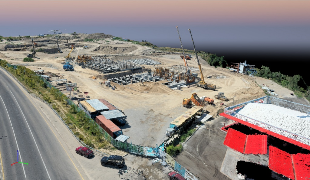
Pic. 5. Dense point cloud, representing machinery, buildings and facilities, fencing, flora and building materials in complete details (rebars, decking, etc.)
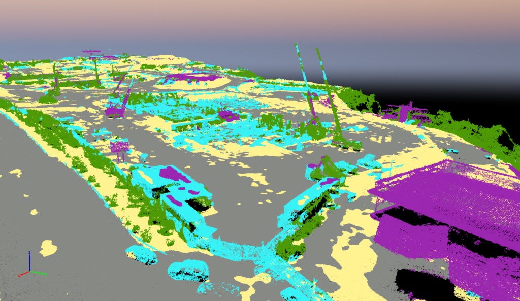
Pic. 6. Automatic dense point cloud classification. The objects are grouped into classes (buildings and structures, flora, roads, ground surface).
The Pix4Dbim software has been chosen as a program shell to the BIM model. It provides an easy access to the data through the web interface and allows to catalog the building process data (orthomosaics, digital terrain models, project drawings) by date, as well as it offers required tools for calculating the size of lines, spaces, volumes, creating profiles and analyzing the soil volume change through different dates.
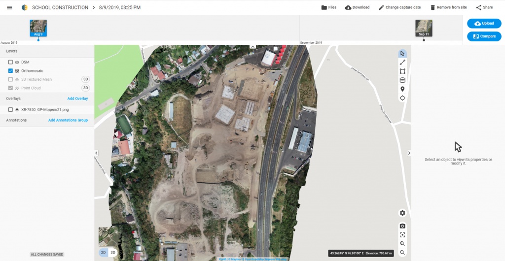
Pic. 7. Pix4Dbim interface represents an orthomosaic. The survey date is the 9th of August, 2019
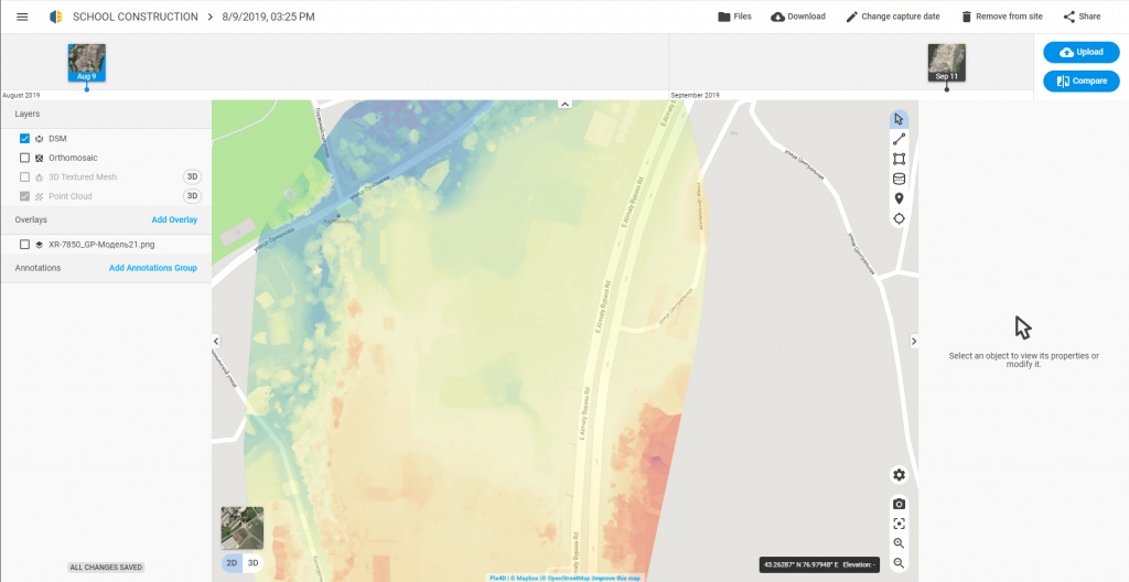
Pic. 8. Pix4Dbim interface represents a digital terrain model. The survey date is the 9th of August, 2019
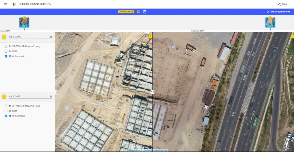
Pic. 9. Pix4Dbim interface, comparison of the survey data over the 9th of August and the 11th of September 2019, monitoring the status of the building and the changes.
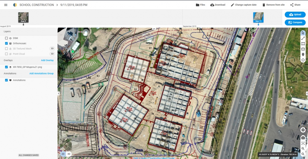
Pic. 10. Comparison of the survey materials and the project documentation.
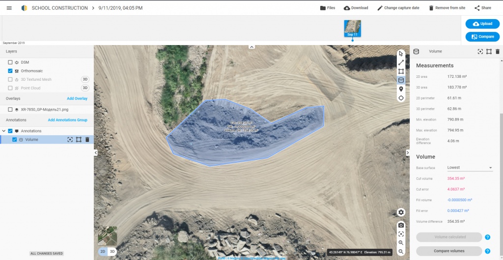
Pic. 11. Soil volume calculation

Tab. 12. The report on the volume difference change through time
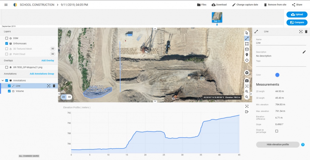
Pic. 13. Making a terrain profile
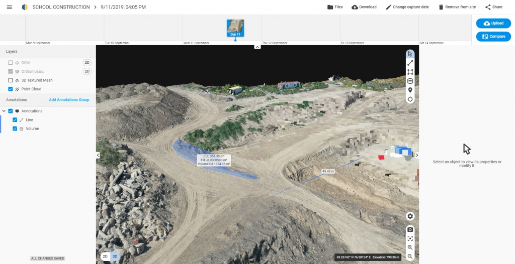
Pic. 14. The representation of the 3D developing area model in the Pix4Dbim web interface
Thus, BIM has become not only an engineering and design model, but also a continuously updated information system of the whole building process, that contains detailed data about every stage of the building and installation work and the amount of the ground works. The analysis of match between the executed works and the project plans has been undertaken. It should be noted that the access to the data has been implemented via the mobile phone app as well as via workplaces, allowing every participant of the building process to take speedier decisions, considering the survey info “from above” stored inside the BIM.
As the result of the following project implementation the employer has achieved:
— relevant and illustrative data about the building process;
— ability to control the building and installation work remotely;
— monitoring of compliance with the project concepts;
— prompt data about the amount of completed earth and installation works;
— data entry for the BIM system.
Conclusion
To sum up we would like to say that the joint use of TOPODRONE drones for gathering information about the status of the building and the interactive access and analysis Pix4Dbim system lead us to the future where the prompt creation of orthomosaics and 3D maps of a developing area will become an integral part of daily reports.
The use of accurate data instead of approximations will allow simplifying the logistics planning and money management, whereas the communication between the quality control department, the safety department etc. will be considerably faster and more efficient.
|
Start cooperation with an individual consultation on the selection of equipment and services.
|
Order service
|


.png)


